Listed 78 sub titles with search on: Main pages for wider area of: "KYKLADES Island complex GREECE" .
AI MICHALIS (Settlement) SYROS
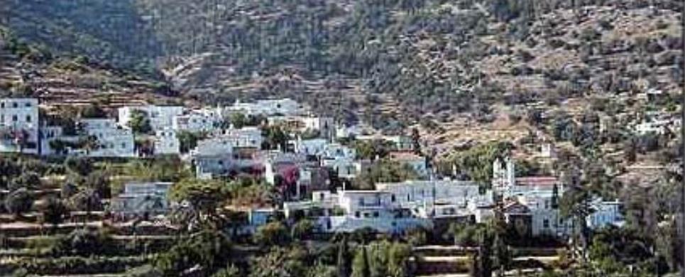
San Michalis is a small hamlet. Its inhabitants are mostly farmers who live there all through the summer, while, during winter, they only visit it occasionally to carry out certain jobs.


AMORGOS (Island) KYKLADES
Amorgos is a remarkably unspoiled island at the south-eastern edge
of the Cyclades group, where traditional customs are still inextricably interwoven
into a landscape as rich in beauty as in its history. Originally inhabited by
seafarers from Asia Minor in the 4th Century BC, the island now cradles a people
who enjoy a lifestyle that has been shaped by a varied and dramatic past. This
is a place that appears untouched by time, but where the inhabitants quietly preserve
one of the best kept secrets of the Aegean.
The length of the island is 33 kms and its width between 1,5 to 6
kms. There are three mountain peaks "Krikelos" (822m) to the north, "Profitis
Ilias" (699 metres) in the middle and "Korax" (607 metres) to the south-west.
The dramatic mountain scenery provides a fine backdrop to some excellent walking.
Meadows and areas for cultivation, can be found in the area of Aegiali
at the north, in Katapola
at the centre, and at Arkesini
the southern part of the island. There are two ports on the island: of Katapola,
and of Aegiali, where ferries, catamaran and hydrofoils call, connecting Amorgos
with the other islands and the main land.
...There are several beaches along the coast line. In Aegiali, the beach is long and sandy, and starts from the edge of the fishing village Ormos. "Levroso", "Psili Ammos" and "Hohlakas" are 15 min. walk from the port, and can also be reached by small boat on a regular schedule.
On the nearby small uninhabited island of Nikouria, there are two nice sandy beaches, where small boats cross people for swimming, from the bay of "Agios Pavlos".
...On the other steep side of Amorgos, bellow the Byzantyne Monastery
of Virgin Mary Chozoviotissa, the beach of Agia Anna, is famous for the clear
blue and turquoise waters. Going south, at the same side of the island, "Mourou
" beach is very popular to all for the clear waters, the dark thick sand and the
two caves where one can swim in. In Arkesini, "Kalotaritissa,"
"Kato Kambos" and "Paradisia"
beaches are some among others found at the South end of Amorgos. The island has
a population of about 1.800 which is found in the port of Katapola, in Chora,
the capital, up in the mountains overlooking the east coast, in the port of Aegiali,
in the three villages of Lagada,
Tholaria and Potamos
and in the small villages of South Amorgos: Vroutsi,
Arkesini, Kolofana.
AMORGOS (Village) AMORGOS
The Chora is - without doubt - one of the prettiest towns to be seen on the Cyclades. It stands nearly 400 metres above sea level with views of both the east and west coasts of Amorgos. Forty churches are dotted around the village and there are beautiful shaded squares and narrow lanes to wander around beneath the Venetian Castle. There are a few taverns in the village, which offer excellent food, and some cafes
ANAFI (Island) KYKLADES
Anafi is the at the southern side of the Assosciation, at the eastern
side of Santorini.
At the southern side of Anafi is located the small island called 'Anafopoula',
both visible from the eastern side of Santorini.
Anafi is one of the most beautiful islands in the Cyclades
as it has managed to keep its natural beauty untouched. Golden sandy beaches,
a dry climate and deep green waters make the island unique for all those who desire
a tranquil holiday in a clean natural environment, following a simple way of life
near the hospitable local people.
Although it is a small island, it has a rich history and mythology. It was first settled in the eighth century B.C. by Dorians. After A.D. 1207 it devolved to a succession of Frankish families, such as the Foscoli, the Gozzadini, the Crispi and the Posani. In 1537 the island was pillaged by Khayr ed-Din, the pirate also known as Barbarossa.
There are two stories to explain the origin of its name: One is related
to the myth of the Argonauts, according to which the Argonauts became endangered
by a terrible storm as they were returning from their expedition. Suddenly the
island appeared before them, and for this reason it was called Anafi ('appeared').
The other version is related to the lack of snakes on ('An-Ofis'= 'without snakes').
This text is cited Apr 2003 from the Development Association 21th Geographical Unit URL below, which contains image.
ANAFI (Village) KYKLADES
There is only one village on Anafi, which called Hora Anafis. It is built upon the ruins of a Venetian castle, with vaulted, dazzling white houses and narrow little stone-paved streets identical to those found in the Anafiotika area beneath the Athens Acropolis Anafi is two kilometres from the port of Nikolaos, to which it is connected by the only motorway of the island.
There are two other hamlets on the island, which are inhabit-ed during
the summer months only. These are the port of Ormos Ayios Nikolaos and the hamlet
of Kleisidi.
This text is cited Apr 2003 from the Development Association 21th Geographical Unit URL below, which contains images.
APOLLONIA (Small town) SIFNOS
Apollonia, also known as Stavri, has been the capital of Siphnos since
1836. It was the seat of the Siphnos Municipality (1836-1914) and of the Apollonia
District (1914-1998), and is presently the seat of the newly formed Siphnos Municipality
(1999).
The name Apollonia derives from Apollo, meaning a town dedicated to
the worship of the God Apollo. As for the derivation of its common name, Stavri,
which dates back to 1677, there are various possible interpretations: it could
derive from the male proper name Stavros; from Timios Stavros meaning Holy Cross
(there was a church of a holy cross in the vicinity); from its location literally
at the crossroads where all the main roads of the island meet; or from the crosswise
design of the town plan and houses.
Whatever the derivation of its common name, Apollonia is indeed situated
in the geographical center of the island and it is built amphitheatrically on
three hills. The island's commercial center, this is where you will find, among
other things, news agencies, travel offices, banks, stationary shops, as well
as the island's medical clinic, two pharmacies, the two police stations, the telecommunications
facilities sand gas stations. Apollonia has no shortage of restaurants, traditional
coffee houses, cafes, bars, and souvenir gift shops.
Visitors can stroll on Apollonia's stone-paved streets and lanes,
and enjoy the picturesque to local architecture, or have a drink or coffee at
the many coffee bars or sample the delicious local cuisine in one of the many
restaurants. To appreciate the local history and culture, a visit to the Folklore
Museum in Apollonia's central square is highly recommended.
Other sites of historical and cultural interest include the old schools
of Saint Artemios (1832-1988), the church of Saint Artemios (1629), which belongs
to the Simonopetry of Mount Athos, the Virgin Mary of Barou with the French frescoes
and wood curved temple the churches Saint Athanasios, Saint Sostis, the Transfiguration
of Christ, the Holy Cross and the Bearded Virgin ''Uraniofora'', the busts of
poet Rambaya in the square of the same name and that of Aristomenis Provelengios,
made by the famous Tinian sculptor Giannoulis Halepas, in the courtyard of the
Gymnasium.
South-west from Apollonia, on the highest peak of Mount Prophet Elias,
visitors can see the imposing monastery of the same name (1145-1890), where many
of the monks were iconographers; those who enjoy hiking will never forget the
panoramic view of the Aegean and the scenic way in which the island's many villages
punctuate the soft contours of the hills across from Mount Prophet Elias.
On the north slope of the same mountain, visitors can also see the
Monastery of Saint John tou Moungou (the Mute) (ca. 1650-1834), where Parthenios
Heretis, o monk well known for his intellectual and scholarly pursuits, lived
and worked.
ARNADOS (Village) TINOS
Arnados, with its marble paved square, traditional houses and narrow streets, lies at 9 km from "Chora" on the slopes of Kechrovounio. The church of Analipsiou tou Sotiros dominates the centre. Traditional cafes and taverns abound.
ARTEMONAS (Village) SIFNOS
Tel: +30 22840 32388
Fax: +30 22840 31234
According to the local lore, the village was allegedly the place where
Artemis, The well-wisher, namely the goddess who protected those disembarking
from the arriving ships, but also the one who brought about favorable resolutions
to various troubles, was worshipped. Though this lore made for good stories, it
is highly unlikely that is historically accurate, for in ancient time places were
Artemis was worshipped were called Artemissia. According to a scholar the name
Artemonas, or Artemon, relies on the same linguistic structure as that of Parthenonas,
or Parthenon, which itself derives etymologically from Parthena meaning virgin,
virginity being one of the attributions of Artemis.
Artemonas is the birthplace of Nikolaos Chrysogelos, already mentioned
above, and of Ioannis Gryparis, a highly esteemed Greek poet and philologist.
A municipality in its own right from 1914 until 1998, Artemonas is now part of
the single Municipality of Siphnos. One and a half kilometers north of Apollonia,
Artemonas is one of the most picturesque villages of Siphnos, thanks to the neoclassical
architecture of many of its houses and its beautiful gardens.
Of the many windmills that used to stand at the top of the hill, today
only two are in good condition. This spot is worth a visit for its panoramic view
not only for the other villages, including Kastro, but also of the nearby islands.
In Artemonas visitors can see the house where the poet Gryparis was born, the
churches of the Virgin Mary of Kohi, for its interesting architecture, the Virgin
Mary of Samos, an extension to which was added in1788 and where you will find
the icon of the Virgin Mary, The Nun, a rare iconic depiction of Mary without
the Holy Child and the Virgin Mary of Balis, whose feast day is celebrated on
November 21.
AZOLIMNOS (Settlement) ERMOUPOLI
Leaving the village of Manna,
turning left, one reaches the village of Azolimnos.
It is right on the sea, and summer visitors enjoy its small and picturesque
bay. It offers a wonderful beach with many taverns, attracting both local and
foreign visitors.
CHROUSSA (Village) SYROS
Tel: +30 22810 61480
Chroussa, along with Pagos,
is a village situated in the centre of the island, at 7 km from Hermoupolis. It
is a typical agricultural site, among orchards and greenhouses. These supply the
island with fresh fruits and vegetables.
Its farms are built in traditional style and are typical of this kind
of architecture on Syros. One also finds some surprisingly grand country houses
in neoclassical style, dating from the 19th century and screened from the road
by pine groves. Amazingly green gardens thrive in the shade of these trees.
The impressive catholic church of Faneromenis is situated on the hill.
During religious holidays, it attracts a great number of worshippers. Remains
of an ancient settlement are found on the site of "Agia Thekla".
DIO CHORIA (Village) TINOS
The village lies at 8 km from the "Chora", on a wonderful site with
a view to match and plenty of fresh water. It boasts numerous traditional cafes
and taverns. A rather bumpy road leads out of the village to Lihnaftia,
where visitors will find a wonderful sandy coast with many taverns.
EGIALI (Port) AMORGOS
Aegiali is an Amorgian small world consisted of its three traditional villages, Langada, Tholaria and Potamos climbing the slope of the highest mountain
on Amorgos, Krikellos (821). They are built above the deep valley and the harbor of Aegiali, which is a port with all the tourist services available. A beautiful sandy beach spans the gentle curve of the bay.
FALATADOS (Village) TINOS
This mountainous village is situated at a distance of 10 km from "Chora". The famous "rozaki" grapes for the production of raki are grown here. The marble church of Agios Ioannis and the beautiful traditional Cycladic square of Megalocharis draw numerous visitors.
FINIKAS (Village) SYROS
Tel: +30 22810 42219
Finikas lies very near to Possidonia, at 11 km from Hermoupolis. Visitors
arriving by sea can berth in its harbour and eat in taverns on the seafront.
Tourists flock to Finikas during the summer. Rest, relaxation and
delightful walks along its coast are guaranteed.
Hotels and rooms for rent abound. The Community even boasts an Agricultural
health centre, with sport facilities such as basketball grounds. Children can
enjoy themselves in a safe playground created especially for them.
FOLEGANDROS (Island) KYKLADES
Folegandros lies between Milos
(15 nautical miles) and Sikinos
(five nautical miles). It is 102 nautical miles from Piraeus,
has an area of 32 sq. kilometres and a coastline 40 km long. Its population is
about 600. A mountainous, rocky island, its highest mountain is Ayios Eleftherios
(455 metres) in the south of the island, whilst the mountain of Merovigli in the
north is 312 metres high.
The historian Aratos called the island Sidira ('iron') because of
its rocky surface. Greek mythology says that the island was inhabited by shepherds
who came from western Greece in search of pasturelands. Because most of the shepherds
were men, the island was named Polyandros ('many men'). From this derives the
sailors' habit of calling the island Polykandro.
It was later settled by Cretans led by Folegandros, son of Minos,
who gave his name to the island. The next to arrive were Dorians, the last of
the island's colonists before it came under Athenian domination in the fifth century
B.C. Artemis and Apollo were worshipped on the island in ancient Greek times.
During the Roman period the island was used as a place of exile.
Under Venetian rule the islanders built a castle around the main village,
on the side facing the sea, so as to protect themselves from corsairs. During
the period of Prankish rule the island belonged to the duchy of Naxos.
In 1617 the island was captured by the Turks, ending Prankish control of the Cyclades.
Under Turkish rule Folegandros paid a tribute and in 1715 it suffered great pillaging
by Kapudan Pasha. After a short period of Russian control (1770-1774), the Revolution
of 1821 liberated the island from Ufa Turks and united it with Greece.
The largest village on Folegandros is Hora.
It is built on the edge of a great rock, 200 metres above sea level. In Hora there
is also an imposing stronghold consisting of houses, which begins in the middle
of the village and ends at the edge of the precipice above the sea.
This text is cited Apr 2003 from the Development Association 21th Geographical Unit URL below, which contains images.
GALISSAS (Village) SYROS
Tel: +30 22810 42408
Galissa, at 9 km from Ermoupolis, is a well-known seaside resort,
boasting the largest beach of the island. It counts modern hotel complexes, rooms
for rent and a camping.
The village is situated on a picturesque site. Its sandy beaches are
crowded by numerous visitors and its pier is a fine place for delightful strolls
and sightseeing. If you are romantically inclined, you can walk to the country
church of Agios Stefanos, built on the rocks just above the sea. The small snow-white
chapel of Agias Pakous (or Ipakous) was built on the foundations of an even older
church.
Remains of an ancient settlement were found here.
GRAMVOUSSA (Small island) AMORGOS
Gramvousa. A small island with sandy beaches across from Kalotaritissa beach on South Amorgos. Good fishing and snorkeling area. Is used as a resting spot for immigrating birds.
HERAKLIA (Island) KYKLADES
Iraklia is the southern most island of the eastern small Cyclades.
Its small population is occupied with fishing, the cultivation of the earth, and
livestock. One road only links the two settlements of Ai Giorgi (St. George),
the port, and Panagia (our Lady), the town (Chora). The road and the footpath
that run through the middle of the island lead to the only sand beaches, the cave
of Ai Yhiannis (St. John), one of the most beautiful caves in Hellas, as well
as the Castro of Irakli (Hercoules).
This extract is cited May 2003 from the Iraklia
Association of Tourist Enterprises tourist pamphlet.
IOULIS (Small town) KEA
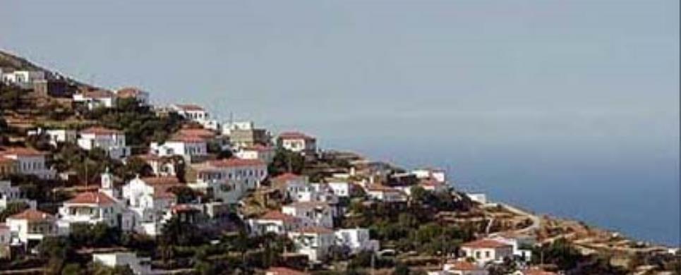
Ioulida is the largest town and the capital of the island. Only 5 km from the main port, it should be part of your itinerary. The inhabitants call it "Chora", but its correct name, used in its golden age, is Ioulis. It is a picturesque, typical Cycladic township with 600 inhabitants, a very interesting archeological museum, a prehistorical stone lion and a Venetian castle. Ioulis is well worth a visit. It is pleasant to stroll along its narrow streets.
KALOTARITISSA BAY (Bay) AMORGOS
Kalotaritissa. A long sheltered sandy beach on the southern part of Amorgos, where many fishing boats and fishermen can be seen.
KAPARIA (Village) ANDROS
Tel: +30 22820 61469
Kapparia owes the name to the plant caper (kappari in greek), which
you will find everywhere. The village is situated at the higher point of the fertile
Korthi valley and from
here originates the river Kapparianos, which flows even during the summer.
Sights are the dotted pigeon houses (peristeriones), the water-mills
and the adjacent to the main village Megalo
Chorio, with excellent architecture.
Moving to the other side of the mountain you will find the serene
beach of Plaka, with crystal
clear waters, while on the main road don't miss a stop at Agios Georgios in Farali.
KATAPOLA (Village) AMORGOS
Katapola itself is busy with a waterfront lined with cafes, taverns and mini-markets and a shelter for sailing boats. On the hill above Katapola, the excavations of the ancient city of Minoa, are of significant value. At the head of the bay lies Rahidi, with the large church of St George and the village that lies behind it. The most picturesque part of Katapola is the third section called Xilokeratidi, with its pretty narrow streets and a couple of taverns where you can sit in the shade of large trees and enjoy the view.
KATO PETALI (Village) SIFNOS
Petali is the name of two villages, Kato Petali (Petali Below) and,
because on its location on the hill above, Pano Petali (Petali Above). In the
local dialect, Petali means stony height, and is a commonplace name on the island.
Kato Petali is east of Apollonia,
built at the foot and on the gentle slopes of a hill. The building that stands
out on this village is that of the church of Zoodochou Pigis (1894). To raise
funds for its maintenance and restoration, the villagers sing the Virgin Mary's
Carols on January the 1st, the same melody as the Christmas carols accompanied
by local instruments. Of great interest is the stone-covered courtyard of this
church, with its traditional design patterns, as well as the architecture of the
houses, the object of a study by the German academic Friedrich Wagner and his
students. The old building that used to house the old primary school (1924-1994)
now houses the Music School of Siphnos.
East, of Kato Petali, you will find the old monastery of Saint John
the Chrysostomos (Saint John with the Golden Tongue), which was founded in 1650;
according to local tradition, this was where the first Greek school on Siphnos
was located, and where, too, the School of the Holy Sepulcher, known as the Helleno-museum,
was housed before it was moved to the School building of Saint Artemios. South
of the village, in the middle of an olive grove, you will find the beautiful church
of the Virgin Mary of Koukia (1614), also known as Myrtidiotissa.
This text is cited August 2004 from the Municipality of Sifnos URL below, which contains images
KEA (Island) KYKLADES
This exceptionally picturesque island lies close to the south-east
coast of Attica.
The mountain masses, which are encountered in most of the Cyclades,
are broken up by small valleys sparsely planted with vines and fruit-trees and
run right down to the sea, opening out into pretty little bays. On the western
side of the island is Agios Nikolaos
bay, and deep within it the port of Korissia,
which is considered to be one of the safest natural harbours in the Mediterranean.
Ferry-boats call at Korissia
- also known as Livadi - which stands on the site of the city of Korissia,
which in ancient times, with Ioulis,
Karthea and Poiessa,
was one of the island's four independent city-states.
The island's capital, Hora
or Ioulida (6 km. from Korissia),
has maintained its Cycladic idiom intact. Built in the shape of an amphitheatre,
it presents the visitor with an impressive vista of two-storey houses and tiled
roofs, steep cobbled alleyways and splendid churches with elaborately carved wooden
icon screens. At the highest point of the village, on the site of the ancient
acropolis, is a quarter known as Kastro which commands a breathtaking view of
the nearby islands off the coast of Attica.
Not far from here is the famous "Lion of Kea" (6th century BC), hewn
out of the slate.
The Archaeological
Museum in Hora contains interesting finds dating from the Cycladic period.
The interior of the island is dotted with miniature chapels, windmills and monasteries,
including that of Our Lady Kastriani, Kea's patron Saint. Easilly accessible from
Athens, Kea offers those who
are seeking a restful holiday clean, uncrowded beaches at Pisses,
Korissia, Koundouros,
Otzia bay and Poles bay.Here
they can enjoy delicious fresh fish at picturesque little tavernas.
This text is cited Apr 2003 from the University of Patras' XENIOS DIAS website URL below, which contains images.
KINI (Settlement) SYROS
Leaving Galissa,
a short cut leads to Danakos
and to Kini, a lovely fishing
village where a special kind of magic is created, each evening, by the glowing
colours of the sunset. It is, without a doubt, your best choice for family vacations.
The view on the village is spectacular. Sunlight sparkles off the
white houses dotted along the bay, where small fishing boats float on the calm
and deep blue surface of the sea, with the hills of Pano Meria as a perfect backdrop.
The beaches of Kini and Lotos,
as well as that of the bay of Delfini
are among the most pristine on the island, with plenty of taverns and hotels nearby.
This text is cited Apr 2003 from the University of Patras' XENIOS DIAS website URL below, which contains image.
KOCHYLOS (Village) ANDROS
Tel: +30 22820 61046
Hanging on the mountain, Kochylou, a real artist's painting, awaits
you to visit the neighbouring Kastro Faneromenis (Faneromeni Castle) and to refresh
you with a magnificent view of the Aegean
Sea.
Take a delightful walk in the twisting stonepaths of the village,
making a necesary stop for a rest at the coffee-shops. The village area has picturesque
springs and beaches, such as Melissa and Lavantara with its caves and access from
the sea and isolated Bouros with access from Ormos,on foot. It is worthwhile to
walk towards Ormos through
the well-maintained path, finding out in this way that the village is not so mountainous
as it seems.
KORISSIA (Village) KEA
As the ship turns to starboard, the small township of Livadi slowly unfolds itself, with its pier, anchorage and blindingly white houses with their red tiled roofs huddling at the foot of the hill. Upon disembarking, the visitor will only get a fleeting impression of a port backdropped by hills. He will then discover that most of the scenic beauty of the island is hidden among those hills: charming sites, including Agia Triada and Agios Savvas are well worth a visit. Today, Livadi offers every comfort to visitors, from hotels, rooms to let, restaurants, coffee-shops, bars, souvenir shops and modern supermarkets.
Fishing boats and yachts make a pretty picture at the port's small quay. At the northern end of the port, one finds the parish church of Agia Triada. Its name day is celebrated in an exceptional manner throughout Livadi and the surrounding countryside. Traditionally, cows were kept, mainly for the daily consumption of fresh milk. No cheese was produced.
KORTHI (Village) ANDROS
Tel: +30 22820 61354
Korthi is a vast area in the south part of the Municipality, which
includes many villages. Many places are worthwhile seeing.
Aidonia
is a picturesque village, with a nice old spring, the castle-houses (pirgospita)
and Alinou Monastery. You will never forget the festivities (panigiri) in Kournous
high above Aidonia, on August 29th.
Visit the traditional village Amonakliou
and medieval Mousionas,
Agia Triada in Korhi, which was the first school in Andros established before
the War of Greek Independence and it has remarkable relics. In Piso
Meria you can see the water-mills in Bouro. Have a rest at the scenic square
in Korthi and move on to the byzantine churches of Agios Ioannis Theologos and
Agios Nikolaos.
If you feel adventurous you can go to Steno area, where you will compensate
with the view and the isolated sandy beaches you will find.
Don't forget to take a look at Moni
Tromarchion and to be present in one of the festivities taking place there
in easter and mid-August, and also in Agios Ioannis in Kremmydes at the end of
September, where you will go by a fishing-boat.
KYPEROUSSA (Settlement) SYROS
Kiperousa is a small rural community. Its inhabitants are mainly farmers who live there all through the summer, while only paying it an occasional visit in winter to carry out certain jobs.
LAGKADA (Village) AMORGOS
Langada is located at the end of the valley in an idyllic location among steep rocky peaks and deep valleys. It is quite easy to reach the port from here on foot or by a car. There are exciting sights to be discovered while hiking or walking on the numerous trails of the area. The gorge of Araklos, the historical church of Agia Triada, the old church of Panagia Epanohoriani, the half-ruined settlement of Stroumbos and the exceptional beauty of the natural landscape can be admired.
Within one hour's walk from Langada one can see the unique Byzantine monument of Theologos, a monastery of early Byzantine years. A bit further, the historical little chapel of Stavros is situated. In most of these locations traditional festivals take place every year, in memory of the patron saints, and many people from the island participate in the celebrations.
LEFKES (Village) PAROS
Tel: +30 22840 41990, 41617
Fax: +30 22840 41990
LIVADI (Settlement) FOLEGANDROS
Livadaki is the only part of the island which is not rocky, with a
spacious, clean beach. Most of the island's produce, such as figs, olives, tomatoes,
vegetables, etc., comes from this region and from Ano Meria.
This text is cited Apr 2003 from the Development Association 21th Geographical Unit URL below, which contains images.
LYGERO (Settlement) SYROS
Ligero is one of the island's many hamlets, where the inhabitants are mostly farmers. It is typical for this type of agricultural community that is is inhabited throughout the entire summer, but only occasionally in winter, for the necessary chores.
MANA (Village) SYROS
Tel: +30 22810 88601
A Mediterranean village, 3 km from Hermoupolis, among green valleys
and farmland, spreading to the beach of Azolimnos. The village is surrounded by
greenhouses, producing fresh vegetables. Parts of arable fields are divided by
cane-plantations.
You pass by it on your way to the Airport.
MARPISSA (Village) PAROS
Tel: +30 22840 41217
Fax: +30 22840 41744
MAVRI RACHI (Settlement) SYROS
Mavri Rahi is a small hamlet. Its inhabitants mostly consist of farmers who are there all through the summer but only rarely in winter.
MEGAS GYALOS (Village) SYROS
This is a resort with quite a few hotels, rooms for rent and the attraction
of a beautiful coast with a crystal-clear, turquoise sea.
The small pier is dominated by the picturesque chapel of Agios
Antonios.
MINOA (Ancient city) AMORGOS
The Ancient site of Minoa, at Moundoulia Hill, above the port of Katapola,
was one of the most important centers of human life and activity on the island
throughout prehistoric times. Enormous excavation project reveals evidence that
the whole site of ancient Minoa was constantly populated at a high cultural level
from the 10th century B.C. to the 4th century A.D. The defensive wall from the
Geometric period with its extensions and bastions which surrounded the acropolis
can be made out. The long 4th century B.C. Gymnasium building dominates the archaeological
site. The foundation of a sanctuary from the Geometric period have been preserved
at the peak of the acropolis. The Hellenistic temple on the far left, surrounded
by smaller buildings of worship is impressive with the body of a statue standing
alone in the middle. A characteristic building on the south side of the Gymnasium
site is the lavatory which has been preserved almost intact with its duct cut
into the rock..
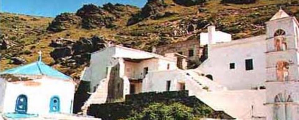
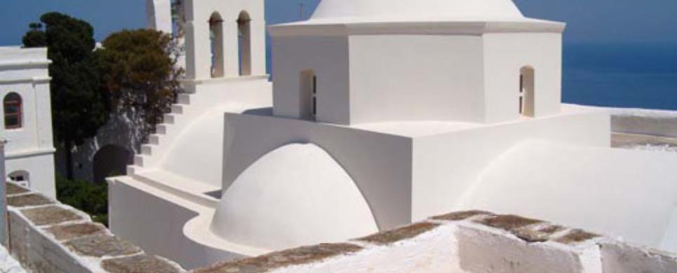
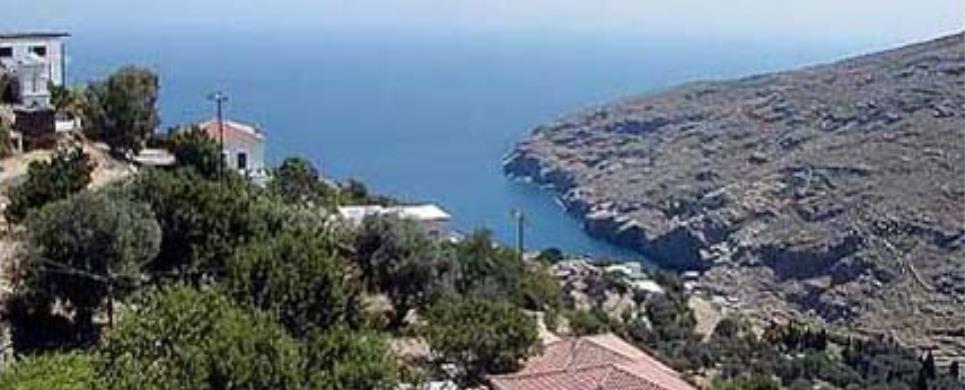
MONASTERY CHOZOVIOTISSA (Monastery) AMORGOS
Tel: +30 22850 71274
The Byzantine Monastery of Panagia Chozoviotissa is located on a steep cliff, 300 m. above sea level,
which overhangs the southeastern coast of the capital (Chora) of Amorgos.
The position, inaccessible and imposing, is visible only from the sea.
The name of the monastery is a corruption of the name Choziva or Koziva, a location in the Holy Land,
where the Orthodox monastic tradition flourished since the early Christian times. In the oral tradition of Amorgos survived
the narrative of the miraculous advent of the icon of Panagia on the island during the period of Iconoclasm. The monastery
heirlooms include two icons bearing the inscription ΧΩΖΗΒΙΤΙCΑΣ (CHOZIVITISSA). In fact, the co-study of Byzantine historical
sources, of the events of this turbulent era in the eastern Mediterranean and in Palestine, and of later ecclesiastical documents
(codices and patriarchal sigillia) suggests that the first building on site dates to the 9th century AD, when the icon first came on the island,
thus supporting the oral tradition.
Decisive evidence regarding the foundation history of the monastery provides the inscription preserved on a silver hexapterygon
(metal disk with a representation of the six-winged Serapheim) of 1652, according to which the monastery was rebuilt (or fundamentally renovated)
by the Byzantine emperor Alexios A’ Komninos (1081-1118), whose decree of 1088, giving stauropegic rights to the monastery, is also known to us
from literary ecclesiastical sources.
Hence a Middle- and Late Byzantine monument, the monastery comprises a building complex, fully incorporated to its surrounding environment.
The steep uneven land imposed a multi-level plan evolved in eight floors, so that the monument seems like a white expansion of the rock. At the centre of the
complex lies the small vaulted church, which is surrounded by the numerous monks cells, along with a series of auxiliary spaces (kitchen, bakery, storerooms,
wine press), cisterns and wells. Staircases, built or carved in the rock, lead from one level to another. In terms of layout, building technique and architectural
form the complex is a typical example of the popular island architecture of Greece, preserving additionally important elements of the past, such as the Byzantine
arches or the pointed arches of the Venetian period (1296-1537).
An exhibition of the monastery heirlooms was organized in 1978 and is open since then to the public. Among the most important exhibits of the
collection are:
- Codices in pergamene (10th- 15th centuries) or paper (13th-19th centuries), sigillia and printed Evangelia.
- Important specimens of ecclesiastical gold-embroidery decorated with precious stones. Also metal components of clerical vestments created by several workshops
of silver craft. In their majority the exhibits date to the 18th and 19th centuries.
- Valuable ecclesiastical objects and vessels, such as icons, crosses, chalices, candle stands, oil candles etc.
MONI AGIOU NIKOLAOU (Monastery) ANDROS
Tel: +30 22820 22190
MONI KIMISSEOS THEOTOKOU KECHROVOUNIO (Monastery) TINOS
Tel: +30 22830 41218
MONI PANACHRADOU (Monastery) ANDROS
Tel: +30 22820 51090
MONI TAXIARCHON (Monastery) SERIFOS
Tel: +30 22810 51027
In the northeast part of Serifos, near the village of Galini, about
1 kilometer from Panagia
is the Monastery of the Taxiarches, dedicated to the patrons of the island, the
Archangels Michael and Gabriel. Founded around 1600, it is built like a fortress.
The church contains a few of the frescoes that once decorated it, a marble and
wood iconostasis, some memorable icons (the one of the archangels having been
brought from Cyprus), a marble floor and an elegant dome. The monastery also has
a superb collection of ecclesiastical treasures, including a holy codex. It is
situated conveniently near the beach of Platys
Yialos.
This extract is cited May 2003 from the Municipality
of Serifos tourist pamphlet.
MONI ZOODOCHOU PIGIS (Monastery) ANDROS
Tel: +30 22820 72459
MYTAKAS (Settlement) SYROS
Mitakas is a tiny rural community. Its farms are inhabited only during the summer. During the winter, the farmers return to the village occasionally to carry out the necessary tasks of the season.
NAXOS (Island) KYKLADES
Naxos, the largest and most fertile of the Cycladic islands, lies
almost at the centre of the Aegean. Meadows running down to vast beaches, cliffs
rising steeply out of the sea, rocky mountains side-by- side with fertile valleys,
abundant springs and streams; these are just some of the features of a natural
environment noted for its variety. The coastline of Naxos is abrupt on the south
side and more sheltered to the west, with numerous inlets and sandy beaches. The
island is first heard of in mythology and is then mentioned throughout every period
in history, though it was at the peak of its glory during the period of the Cycladic
civilisation.
Naxos or Chora covers a naturally amphitheatrical site on a hillside
to he north-west side of the island and is one of the most attractive towns in
the Cyclades. As the visitor walks from the harbour high up to the Venetian castle,
he will be struck by the beauty of the narrow lanes winding between old stone
houses. Interesting monuments from various periods are to be found all over the
town. They include fine Byzantine churches, the castle itself (with its tower
and battlements), and traces of Mycenean constructions in the part known as Grota.
The Archeological Museum of Naxos has some noteworthy exhibits. Traces of Greek
antiquity are to be seen everywhere. Each part of the island has something of
interest. For instance, near the pretty coastal village of Apolonas - on the north
side of the island - is a half-finished outsize "kouros" (statue of a youth),
dating from the 6th century BC, still lying in the marble quarry where it was
abandoned. Another such statue can be seen at Melanes. An interesting archaeological
museam is to be found at Apirathos, a village where a number of strange customs
and habits have survived. Among churches of interest are those of Our Lady "Protothroni"
at Tragea and Our Lady "Filotitissa" in the village of Filoti.
There are good swimming beaches at Agios Prokopios, Mikri Vigla Kastraki,
Alikos, Pirgaki, Agiassos (on the west side), Apolonas, Psili Amos, Panormos,
Pahia Amos and elsewhere The superb beaches of Naxos, its attractive villages
and its wealth of monuments draw thousands of visitors to the island each year.
The good tourist amenities in Hora make it easy to tour the charms of the island.
This text is cited Mar 2003 from the University of Patras' XENIOS DIAS website URL below, which contains images.
NIKOURIA (Island) AMORGOS
Nikouria. A small uninhabited island in front of Aegialis Bay, famous for its coin production in antiquity and later used as a refuge for lepers,. Today, visitors enjoy its beautiful sandy beaches.
There are regular crossings in the summer by caique. It is ideal location for snorkeling.
ORMOS KORTHIOU (Village) ANDROS
Ormos is the administrative and economic center of the Municipality.
It is situated in the interior of a big bay and it has a port and adequate transport
services with the rest of the island. In the nearby area there are many sights
to excite the visitor's interest. In a short distance you will see pigeon-houses
(peristeriones) and the rare type of horizontal wind-mills (tavlomylos).
Walking in the scenic old paths you will visit villages with exceptional
architecture, like Chones, Rogo and Alamania, you will see old oilpresses, water-mills,
threshing floors and you will quench your thirst in cool springs like Stiva. Visit
the country churches Agios Fanourios and Agia Sofia, located at the two ends of
Ormos. Interesting walk is by Potamos (river), which is the most cultivated agricultural
area. The beaches of the area are Mylos, Vintzi, Agia Ekaterini, Bouros and of
course Grias Pidima. If you have a boat you can enjoy the numerous isolated beaches
and take a look at the caves in Melissa and the steep cliffs in Kavos Orginou.
Finally don't forget to visit the Folk Museum and to attend some of
the numerous happenings, such as the Carnaval, Korthiana in August (cultural festivities)
and many enteirtaining festivals (panigiria) related to the churches of the area.
Το κείμενο παρατίθεται τον Μάρτιο 2005 από την ακόλουθη ιστοσελίδα, με φωτογραφίες, του Δήμου Κορθίου
PAGOS (Village) SYROS
Tel: +30 22810 42192
Pagos is 7 km from Hermoupolis and, like Chroussa,
situated in the middle of the island. It is a farming village, set among orchards
and greenhouses, which supply the island with fresh fruits and vegetables.
One can see some fine examples of agricultural architecture, both
of the traditional Syriot type and of the neoclassical country house style which
was typical of the 19th century.
PALEOKASTRO (Village) ANDROS
Tel: +30 22820 61496
Paleokastro consists of many villages, each one with its own style
and architecture.
Piskopeio
with the lovely house architecture, the wind and water mills, the scenic springs
and the old Elementary School.
Lardia
with the flowery gardens and the breath-taking view of Ormos and the open sea.
Gianniseo, high up on the mountain, with Agridiotissa church dominating
in the area and the old Elementary School.
Exo Vouni
in a pure mountainous environment. Mesa
Vouni with the therapeutic spring Petrenia, the water-mills, the tiny monastery
Agios Antonios, the Elementary School and the impressive geological formations,
Lefkopodes, with signs of palaeolithic settlement. Don't forget to be there on
August 23rd for the traditional Wine Festival.
Leaving Vouni,
go to the remarkable Panachrantou
Monastery, where you will admire the impressive interior and you will rest
under the thick shadow in the yard, having a rare view of the central part of
the island with Chora.
PARADISSIA (Beach) AMORGOS
Paradissia. It is located below the beautiful church of Agia Paraskevi, where the big festival of the 26th July takes place in Kolofana,It is a small sandy beach where the remains of an early-Christian basilica has been splashed by the waves for centuries.
PARAKOPI (Village) SYROS
Parakopi is a farming village with greenhouses, vinyards and orchards.
PERISSA (Beach) SANTORINI
At the southern part of the island the famous 5km long black sandy
beach is spread. There, you will be able to enjoy the sea, the sun and the available
sea sports. Moreover, you can taste traditional dishes or fresh fish in the restaurants
and fish taverns along the beach or just enjoy the music in the beach bars with
a cold frappe.
In Perissa there are shops, where you can purchase souvenirs and gifts,
restaurants and bars.
You might find interesting visiting the archeological places that
are still being excavated, or to follow the path that leads to the top of “Mesa
Vouno” mountain, where the city of “Archea Thira”
is located and shows the situation that existed thousand of years ago.
This text is cited March 2004 from the Southern
Santorini Tourism Trade Association tourist pamphlet.
PLATY VOUNI (Settlement) SYROS
Plati Vouni is a hamlet where, typical for the island's rural community, the farmers are present only throughout the summer, while becoming seasonal workers during winter.
POSSIDONIA (Village) SYROS
Possidonia lies at 12 km from Hermoupolis. Some people still call
it Dellagratsia, after the name of the church of Santa Maria Della Grazia.
It is considered to be one of the most beautiful villages of the island.
Possidonia was the favourite place of the island's wealthy class who built their
country retreats in and around the village. Thus, we see quite a number of neoclassical
mansions, some of which are open to visitors. Visitors to Possidonia
will admire the catholic church of Agios Petros and the orthodox church of Agios
Ioannis.
On the way to the sea, one comes upon the beautiful sandy beach of
Angathopon and, a litlle
further on, the deserted beach of Komitos. One should also enjoy a swim in the
pure sea of Ambela.
PYRGOS (Settlement) TINOS
This largest village of Tinos, houses the of council of Panormos in its centre. It is one of the most beautiful traditional villages of Greece.
RIVA (Port) KYKLADES
In the 13th century, the ships of the Venetian sea conqueror Markos Sanoudos landed on Riva, who annexed the islands Thira and Thirassia for the Aegean Principality of Naxos. The little church of Saint Irene (latin Santa Irini), that can be seen high on top above the port of Riva, gave its name not only to the settlement but to the whole island of Santorini.
SERIFOS (Island) KYKLADES
This Cycladic island lies between Kythnos
and Sifnos, 73 nautical miles
from the port of Piraeus, with
which it is linked by daily ferries. It covers an area of 73sq. km., and is hilly
with rocky terrain, the highest peak being Tourlos (alt. 585 m). In the tiny valleys
tucked amongst its stony slopes, the islanders manage to cultivate a few fruits
trees, early vegetables, citrus friut and vines. Its subsoil is rich in iron ore,
which has been exploited since antiquity. Its coastline, measuring some 82 kilometres,
punctuated with superb sandy coves and bays in some places, steep cliffs and tumbled
rocks in others. The climate of Serifos is healthy, with mild winters and cool
summers thanks to the «meltemi», the prevailing northerly wind which blows through
all the Cyclades. The residents
are chiefly employed in fishing, shipping and, more recently, in the growing tourism
industry.
This extract is cited May 2003 from the Municipality
of Serifos touristic pamphlet.
SERIFOS (Village) SERIFOS
The capital of the island is called Serifos of Hora. It is built on
a steep, rocky hillside overlooking the port, Livadi. The Hora of Serifos is a
typically Cycladic settlement, composed of dazzling white cube-like houses with
flat roofs, narrow alleyways with whitewashed steps, bridged at intervals by terraces
and arches. The dense, compact arrangement of the buildings has its roots in the
Frankish occupation, during which time Serifos had to defend itself against pirate
attacks. For greater security, the inhabitants crowed within the fortification
walls, while on the highest spot a stong castle was erected. The capital consists
of two neighbourhounds, Pano (Upper) Hora, the older section, and Kato (Lower)
Hora. Walking down from the fortress, one comes to Pano Piazza, the old business
center with the Town Hall - a Neoclassical building dating finds from the area
- and the cathedral of St. Athanasios, which contains a superb carved iconostasis
(18th c.)
This extract is cited May 2003 from the Municipality
of Serifos touristic pamphlet.
SIKINOS (Island) KYKLADES
Sikinos is one of the smaller Cycladic
islands. This does not however lessen the interest of the island, nor its unique
charm. It is in the southern part of the archipelago between los
and Folegandros. It has an area
of 41 square kilometres and a population of some 300 inhabitants. The island is
long and narrow. The southeast section is flat, while in the northwest there is
a precipice which rises some 300 metres above the sea. Its highest mountain is
Troulos (552 metres) which is located in the centre of the island. The land on
Sikinos is stony although one section of it is covered in olive trees, from which
comes the island's exceptional olive oil. Another of the island's excellent products
is thyme honey.
The most important hamlets on Sikinos are Horio and Kastro, which
are only a few hundred metres apart. A large number of the houses in both hamlets
are uninhabited today as a result of the continuous population decline. Indeed,
in the last few years the residents have been living in Kastro, having abandoned
Horio. They are both very pretty villages with whitewashed stone houses and narrow
picturesque little roads. There is little greenery here and water is drawn from
cisterns and from a small aqueduct.
A 3.5- kilometre road connects the two main settlements of the island
with the bay of Ano Pronias, also known as Alopronia, where in the past few decades
a summer resort has developed. The island's harbour is here, and a pier has been
built for boats as well as a small jetty for fishing boats. Nearby beaches are
Ayios Georgios, Dialiskari, Ayios Pantelimon, and the unique Mavri Spilia (Black
Cave).
Kastro is famed for its authentic Cycladic-style architecture and
the church of Pantanassa, which is the metropolis of the island. To the northwest
of Kastro is the picturesque church of Ayios Vasilios and the Ayioi Anaryiroi.
The monastery of Chrisopiyi is one of the sites most worth seeing. It resembles
a fortress and was used as a refuge by the residents against pirate raids. This
monastery was built in 1690 and celebrates its feast day on the first Friday after
Orthodox Easter. In the middle of the monastery precinct is the church of Zoodohos
Piyis ("Fount of Life"). Southwest of Hora is Episkopi, an area of archaeological
interest in which there is a rectangular church with two marble Done columns to
the left and right of the entrance. The prevailing view is that this was the site
of the ancient temple of Pythian Apollo which was then converted into a church
during the Christian period.
This text is cited Feb 2003 from the Development Association 21th Geographical Unit URL below, which contains images.
SIRINGA (Settlement) SYROS
Sirigas is a small village with reputed springs and a wonderful view.
SYNETI (Village) ANDROS
Tel: +30 22820 22954
Syneti, one with Dipotamata, has to show the visitor an impressive
natural environment and an unexpected tranquility, by the end of the gorge.
The coffee-shops of the village, the Elementary School and the scenic
stonepaths, add the final touch to a unique landscape.
The beaches in the area, unique too, are the isolated Lidi in the
north and Syneti beach, with the impressive stalactites by the sea and the underwater
springs.
In Syneti it is worth visiting the Cultural Museum "Cultural
Heritage of Syneti".
SYROS (Island) KYKLADES
Syros is an island of the Cycladic Archipelago, of which it is also
its administrative centre. Thus its capital, Ermoupolis
(or Hermoupolis), is also the capital of the entire archipelago. Its land
is mountainous and barren, with some fertile small valleys. Its coasts are lined
with beautiful sandy beaches and rocky inlets, lapped by the crystal waters of
the Aegean Sea. One of the
attractions of the island is its very interesting neoclassical architecture, which
makes it different from the other Cycladic
Islands.
Syros was inhabited from Prehistoric times and archeological finds
testify that it was an important centre of the Cycladic civilisation. The island
was first colonised by the Phoenicians, who gave it the name Syros, which means
"rocky". Later the Ionians founded two important cities, one on the
site of today’s capital and the other on the site of the village of Posseidonia.
During the Persian Wars it was an ally of the Persians and later of Athens.
Syros was conquered in turn by Macedonia,
Egypt and Rome.
In Byzantine times, it became a possession of France
and later of Venice. Under
the rule of these two powers, Catholicism took such a strong hold of the region
that Syros was to become the only island of the Aegean
Sea with exclusively Catholic inhabitants.
In 1537, it fell into the hands of the Turks, but the continuous support
of France made their domination
more tolerable. With the beginning of the War of Independence in 1821, inhabitants
from the islands of Chios,
Psara and Smyrni
took refuge here. They brought the art of modern shipbuilding to the island. From
this historic moment, Syros turned into an important commercial and seafaring
center of the Aegean Sea.
Today’s capital, Ermoupolis,
was constructed at that time.The Orthodox religion of these immigrants started
to spread throughout the island. Syros began to lose its importance only when
the port of Piraeus became
the principal port of Greece.
This text is cited Apr 2003 from the University of Patras' XENIOS DIAS website URL below, which contains images.
THOLARIA (Village) AMORGOS
Tholaria, with its extremely hospitable people is built close to the location of the ancient city of Aegiali (Vigla). The village celebrates on the 1st of July the name day St. Anargiri. The good location of the village allows easy access to many beaches and the port. The crystal clear sea of Aegiali offers unforgettable moments. Besides the main sandy beach, locarions suitable for swimming are Levrosos, Psili amos and Hochlakas, where the tranquility of the location brings peace and relaxation to visitors.
TINOS (Island) KYKLADES
Tinos is an island of the Cycladic Archipelago. It is one of the most
interesting places of Greece,
with great natural beauty and interesting folk lore. It is an important religious
center, with hundreds of churches and country chapels scattered over the island.
It is the most important place of worship in Greece,
with the Sanctuary of Evanghelistria, which houses the miracle-working icon of
the Virgin Mary.
The island was inhabited from Prehistoric times. During the classical
period, Tinos had commercial relations with the other islands and the rest of
Greece. Particularly important
to the island was the worship of Poseidon, god of the sea. In the 2nd Century
BC, Tinos was under the domination of Rome.
In 1204, the Cyclades Islands
came into the hands of the Venetians and Tinos remained under Venetian rule until
1715. It then became a unique Christian oasis among the Cyclades
which were all occupied by the Turks. In 1822, a miracle-working icon of the Virgin
Mary, dated to early Christian times, was found on Tinos. On that very spot, the
Sanctuary of Panaghia Evanghelistria was built to house this icon. Tinos then
became a religious centre for the whole of Greece.
Every year, on the 15th of August, a very important religious celebration takes
place and pilgrims from everywhere come to honour the icon of the Virgin Mary.
Features of Tinos:
Tinos is the one of the largest island of the Cycladic Archipelago,
after Andros and Naxos,
with an area of 197 km2 and a coastline of 114 km. The capital is also called
Tinos. The highest mountain
of the island is Mount Tsiknias, frequently battered by powerful north winds.
According to mythology, Aeolus, king of the winds, lived on that mountain. On
Tinos there are some fertile valleys (Livada,
Potamia and Agapi)
as well as several extremely arid areas, such as the surroundings of the village
of Volax, with rounded granite
rocks strewn over the barren earth.
Tinos has important mineral wealth (deposits of chrome, lead, iron,
manganese, etc.). The island also produces white and green marble, unique in the
world. It was used in the construction of Buckingham Palace and in the Louvre.
The Tinians have always been farmers and hanged the aspect of their island at
the cost of their unceasing labour. The barren earth turned into fields and the
construction of stone walls created arable plots of land for increased agricultural
production. Today, of course, tourism is an important source of wealth for its
inhabitants.
The Caves of Tinos:
Tinos has several interesting caves:
1. The Cave of Gastrion, in Kionia.
2. Mygospilia or Kammeni Cave, a few km north-west of the village of Aetofolia.
3. The cave of Drakolakkos, 4 km west of the village of Platia.
4. The Cave of Voulismeni, 1 km south of Faneromeni.
5. The Cave of Kithara, 3 km north of Voulismeni Cave
6. The Cave of Fournakion, between Cape Papargiros and Cape Axachopos.
7. The Cave of Spilias, between Cape Fero Krimno and Cape Diasphae.
8. The Caves of Krouftes, north of Falatados.
9. The Cave of Mourounia, in the northwestern part of the island.
10. The Cave of Koufangeli, west of the harbour of Panormos.
11. The Cave of Panormos and Kamara, on the northwestern side of the bay of Panormos.
This text is cited Apr 2003 from the University of Patras' XENIOS DIAS website URL below, which contains images.
TINOS (Small town) KYKLADES
The town of Tinos is called "chora" by its citizens and is a small
insular township that began to develop during the period of theTurkish occupation.
Upon arriving at the port of Tinos, visitors see two roads. Both of them lead
to the cathedral of the Panagia. The one to the left, leoforos tis Megalocharis,
is new; the one to the right is the older Evangelistrias street. The Town Hall,
the telephone communications building and the Archeological Museum are situated
on leoforos Megalocharis. Numerous shops are concentrated on Evangelistrias street.
Except for the church of the Panagia, we find many other beautiful churches in
the town: the Catholic church of Agios Nikolaos, the church of Kimiseos tis Theotokou
(Malamatenia), the church of Taxiarhon, of Trion Ierarchon and of Agios Ioannis.
The church of Agios Antoniosis is situated on the way to the port and to Kionia,
very near to the old quarter of Palada. This quarter is accurately named for its
numerous townhouses (palatia) on the waterfront, while another version has it
that its name derives from "palantzes" - scales used for weighing goods. The Orthodox
church of Agios Nikolaos is very near to Palada.
VARI (Small town) SYROS
Tel: +30 22810 61222
The sheltered bay of Vari lies at 6 km from Hermoupolis. Vari is a
traditional farming village, while the tourist industry is highly developed on
the beaches of Megas Ialos, Achladi, Vari, Fabrika, and Santorini.
After a refreshing swim, one can sample delicious traditional snacks
and fresh fish in typical local taverns. Remains of an ancient settlement were
found on the site of "Koskonas" .
VOLAX (Settlement) TINOS
This is the most traditional village of Tinos. It is located at a height of 280 m, 3 km from the northern region of Exobourgo. As it is built on different levels, it has a character all of its own. The village owes its name to a few white houses hewn into the surrounding rocks. There is also a small beautiful theatre carved out of the hill with a capacity of 400 persons, where, during the summer, cultural activities are organised.

Receive our daily Newsletter with all the latest updates on the Greek Travel industry.
Subscribe now!
