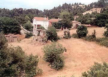
Small agricultural and cattle-raising colony, situated near the road
Rovies-Istiaia
(through Voutas) and at a distance
of about 12 km northerly of Rovies, in fully green pine-trees forests bringing
in mind landscapes found in N. Europe. The geomorphology, the name, the surrounding
toponymies, ruins of old colonies and other historical signs, give proof of a
significant course of the village through the ages (specially in the middle ages).
This text is cited May 2003 from the Municipality of Elymnies tourist
pamphlet.
Photo gallery
Map & Distances
Distances:
145,5 Kilometers South-southeast (SSE) the prefectural capital CHALKIDA
Town, EVIA
,
GREECE
Altitude:
400 meters
Longitude:
23o 14' 30.32" E
Latitude:
38o 52' 08.26" N
Hotels, local businesses, destinations & directions
Greece’s First Private Civilian Airport to Go Up Near Kavala
A new private civilian airport in northern Greece will handle private and business flights, organize air shows, and host professional pilot training facilities....
Athens Airport Passenger Traffic Spikes by 16.3% in April
Athens International Airport (AIA) continues its upward trend in passenger traffic, confirming market estimates of handling approximately 30 million passengers this year....