Listed 93 sub titles with search on: Sights Gorges & Ravines for wider area of: "GREECE Country EUROPE" .
ACHELOOS (River) ETOLOAKARNANIA
The Acheloos gorge is between Raptopoulo and Vrouvianon (in Evrytania), with the Temblas bridge, built in 1904.
AGIA IRINI (Settlement) ANATOLIKO SELINO
The gorge is 8km long and 45-500 metres deep, in a forested area with
steep mountain cliffs, and is easy to walk. In 1866, 1,000 women and children
escaped from the Turks through this gorge.


AGIOS ATHANASSIOS (Village) DIRFYS
The gorge of Agali is located 1000 m. away from the village of St.
Athanassios, at the foot of Dirfi.
It has a unique wild beauty of craggy and variously coloured rocks and green clad
slopes. During spring there is crystal clear water flowing through the ravine
that formulates small cascades. Its visitor can see the brooks that violently
pass through the craggy rocks and can also see the cave Voidokleftra, which was
the dwelling of humans during the Neolithic age.
This text is cited May 2003 from the Prefecture
of Evia tourist pamphlet (1999).
AGIOS IOANNIS (Village) IERAPETRA
AKROTIRI (Municipality) CHANIA
Among the 115 caves and 5 small gorges of the promontory the small
verdant gorge of Katholikou or Avlaki Agiou ("The saint's way") distinguishes
itself in its wild beauty. After reaching the well-known Convent of Gouvernetou,
situated at an altitude of 260m. and a distance of 16 km from Chania,
you start walking northwards on a pathway and, after 10 minutes, you meet the
Cave of Panagia Akroudiotissas, as well as the chapel of the Virgin Mary and the
sanctuary of Artemis. After walking for 10 minutes downwards, you can see the
monastery of Saint John the Hermit, who lived during the 14th century in the 151
m long and very nice cave that is situated in the vicinity of the chapel.
A little further downwards, after walking over an unusually big bridge,
you enter the gorge. You then walk on the streambed for about half an hour and
reach the coast. You can see is very clean for swimming. You can see a Venetian
well, a construction where the monks of Katholikos used to keep their small craft,
and the stone portion that was cut off for the building of the Convent.
This text is cited April 2003 from the Prefectural
Committee for the Promotion of Chania pamphlet.
ANO LOUTRO (Settlement) XYLOKASTRO
Pages of commercial websites
ANOPOLI (Village) SFAKIA
It is another of the densely wooded worth visiting gorge of Sfakia
with high precipices.
From the mountain village of Anopoli you can start walking on the
rural-mountain road leading to the White
Mountains, while reaching an altitude of 2000 m near their highest summit.
After walking for one hour and a half, a small ramification leads rightwards to
the Byzantine chapel of the Rood that contains remarkable murals. You can drive
up there too.
It takes about 3 hours to walk up to the exit of the gorge, where
there is an asphalt road leading from Chora
Sfakion to Anopoli. A few meters downwards , there is a very clean beach called
Iliggas, where you can enjoy swimming in the Lybian
Sea.
If you can't make the above crossing, you can have a global view of
the gorge by walking as much as you wish toward the inside of the gorge from its
exit on.
This text is cited April 2003 from the Prefectural
Committee for Tourism Promotion of Chania pamphlet.
ARADENA (Settlement) SFAKIA
The impressive gorge of Aradena starts from the Lefka Ori north of
the village of Aradena, and ends up in the sea, south of Aradena. You may walk
down through the Aradena Gorge and exit near Marmara on the south coast. There
is a path from Aradena that allows you to descend into the gorge. The walk may
take 3 to 4 hours as it is 7km from the Aradena entrance to the sea. You should
not attempt the walk without ample water, boots, and arrangements to be picked
up at the walk's end. A path at the bottom goes to Marmara beach, Finikas, Loutro,
and Hora Sfakion. The coastal path is narrow and quite dangerous in places between
Loutro and Hora Sfakion. Alternatively, you can walk to Loutro and take the boat
to Hora Sfakion.
This text is cited Nov 2002 from the Crete TOURnet URL below, which contains images.
ARVI (Village) VIANNO
Above the village is a very pronounced mountain cut that forms the
gorge of Arvi.
ASFENDOS (Village) SFAKIA
In the east of Sfakia
there is the gorge of Asfendou, which has its entrance in the almost deserted
mountain village of Sfakia called Asfendou (at an altitude of 770 m and a distance
of 8 km from Imbros)
You reach the gorge by coming from the area of Ambelos - Tentas -
Seli and after walking for 3 hours, you meet the old village of Agios
Giorgos (former Kolokasia) situated at an altitude of 260 m. The 1700 m long
rural road will lead you from there to the main road of Chora
Sfakion - Fragokastello
and to the new village of Agios
Nektarios, 73 km distant from Chania
and 7 km from Chora Sfakion.
This text is cited April 2003 from the Prefectural
Committee for Tourism Promotion of Chania pamphlet.
CHANIA (Prefecture) CRETE
Chania is a blessed and privileged place with a mild climate during
the whole year, countless beauties and all kinds of attractions.
Apart from its five hundred villages, the area counts more than 100
very clean beaches on the northern and southern coasts, a hundred mountain tops
and about 1500 caves, as well as countless monuments and gorges of incomparable
wilderness and beauty in Europe. More than sixty small and bigger gorges, easy
or difficult of access, are situated in the Prefecture of Chania, and that is
why the city is often called “the Locus of Gorges”.
These gorges, with their wild beauty and unpolluted environment stir
strong emotions of awe and wonderment. The passage of one of these gorges offers
unforgettable experiences and certainly makes you wish to cross another gorge
during a next visit in Chania.
Apart from its wilderness and beauty, Chania presents a number of
other interests also: legends about dragons and fairies, about good and bad spirits
that dwell in the gorges. There are limpid water sources or picturesque Byzantine
churches in such places where famous oracles or pantheons formerly took place.
There are heroic stories about the rebels who, from the gorges, drove
the Roman, Arab, Venetian, Turkish or Nazi invaders out of the Cretan land. Tragic
stories as well, about battles and about thousands of women and children who found
refuge from the aggressors in these gorges, and many other stories.
If you look more attentively, you will distinguish the vestiges of
the people who used to live in the gorges: sheepcotes, water mills and hydro-saws,
lime or coal furnaces, guardhouses erected for defense against the various incursions,
and many other things.
These gorges were mainly formed on carbonic rock beds, i.e. limestone,
marbles and dolomites, as a result of a deep fissure in the earth’s crust and
the corrosive activity of the waters of the rivers. They were formed about 14
million years ago, at the end of the Miocene period of the Cainozoic century.
(Text: Antonis Plymakis)
This text (extract) is cited February 2004 from the Chania
Prefecture Tourism Committee tourist pamphlet.
DAFNI (Settlement) FILIATES
Starting off from Igoumenitsa towards Filiates, we turn right towards Keramitsa. Going up the road that leads from Daphni (known as "Tzouma") to Kokkino Lithari, one meets on his right, the old path-cobbled road (it was built during the years of the Turkish domination so as to connect Ioannina with the port of Sagiada), which goes up like a snake on the steep slopes of Laggari mountain, above the stream of Potamia. Many parts of the cobbled road are well preserved and the walls which protect it from the cliffs and the "screes" are quite impressive, reaching up to a height of four meters and, in some parts, they are double. The view from the path into the gorge is fantastic, with the stream down below and the high rocks of Laggari above. The course "a pleasant mountain walk" does not take more than two hours.


EPANO ARCHANES (Small town) HERAKLIO
South to the Archanes settlement, rich in flora and fauna.
IMBROS (Village) SFAKIA
The Imbros Gorge starts just south of the village. During World War
II, twelve thousand soldiers evacuated the island walking through the gorge to
the south coast of Crete under aeroplane fire. There they were taken by the Royal
Navy to Egypt. The Imbros Gorge is very narrow in certain parts, with impressive
walls. There is unique flora all year round. It is 11km long, takes 4 to 4 1/2
hours to walk and ends in the village of Komitades.
This text is cited Nov 2002 from the Crete TOURnet URL below, which contains images.
KALI LIMENES (Port) MIRES
The gorge of Agiofarago starts from the road from Odigitria Monastery
to Kali Limenes on the south coast of Iraklion and ends at the sea, west of Kali
Limenes. There is a dirt track (going west) 500 metres after the riverbed on the
road to Kali Limenes from the Odigitria Monastery. Follow the dirt track to the
end and a footpath continues along the river, through the canyon, and past the
monastery church to the sea. It is an easy, pleasant walk through the gorge, which
has 100 metre high walls.
This text is cited Feb 2003 from the Crete TOURnet URL below, which contains images.
KALIKRATIS (Settlement) SFAKIA
It is situated eastwards the Asfendou
gorge, starting from the mountain village of Kalikratis in Sfakia at an altitude
of 750 m (14 km distant from Imbros)
and you need three hours in order to cross it.
The gorge ends in the village of Kapsodasos
at an altitude of 120 m and at a distance of 8 km from Chora
Sfakion.
This text is cited April 2003 from the Prefectural
Committee for Tourism Promotion of Chania pamphlet.
KANEVOS (Settlement) RETHYMNO
The Gorge of Kotsifou begins at the village of Kannevos and ends at the village of Plakias. Just 10 m wide at the entrance, the beginning of this gorge is very narrow, however, eventually the gorge widens out to 600m. It is 1,800m long in total and its almost perpendicular walls reach a height of 600 m. A small chapel built into a rocky cavity is situated in the gorge.
KATOCHORI (Village) KERAMIES
This gorge is well known as the gorge of Katechori or Stylos as well
and it is one of the few gorges in Chania that does not have a north-south direction.
It is a very beautiful and verdant gorge, with many species of the
Cretan flora and with a lot of steeps. Its crossing is easy, since it is situated
near the city of Chania and
is accessed from the village of Katechori in the Province
of Keramia (at an altitude of 300 m and a distance of 21 km from Chania).
The passage takes three to four hours and ends in the village of Faraggi
(meaning "gorge") (at an altitude of 40 m and a distance of 17 km from Chania),
at a short distance from the Chania -Stylos
main road.
This text (extract) is cited April 2003 from the Prefectural
Committee for Tourism Promotion of Chania pamphlet.
KIRKI (Village) ALEXANDROUPOLI
KOXARE (Village) RETHYMNO
The Gorge of Kourtaliotis with its imposing precipices reaching to a height of 600 m starts shortly after the village of Koxare and ends at the Lagoon of Preveli. This magnificent gorge is worth visiting. Approximately half way through the gorge and on the left-hand side of the road from Koxare to Asomatos are steps, which lead down to the bottom of the gorge and to the chapel of Aghios Nikolaos. The river Megalos Potamos runs through the gorge, which at this point is called river Kourtaliotis.
Kourtaliotiko Faragi is 23km directly south of Rethimnon on the Rethimnon - Armeni - Kourtaliotiko Faragi road. The mountains of Kouroupa (984m) and Xiro Oros (904m) form the Kourtaliotiko Gorge. The gorge begins in the village of Koxare and follows the Kourtaliotiko River, as does the road. About half-way through the gorge there are parking places and steps leading down to the river-bed and the church of Agios Nikolaos. At the end of the gorge is an area that resembles a tropical lagoon, Palm Beach. The gorge is narrow and ruggedly beautiful; the river that flows through it forms five big pools and then a waterfall. Throughout the gorge a wide variety of wildlife is visible.
This text is cited Dec 2002 from the Crete TOURnet URL below, which contains image.
NEA EPIDAVROS (Small town) ARGOLIS
In New Epidavros there is one of the most beautiful gorges of all Argolida, Vothila Gorge as it is called, a green paradise surrounded from two rocky mountains.
OMALOS (Plateau) CHANIA
It is one of the most remarkable gorges of Sfakia where a few couples
of wild goats still live (the seldom Cretan Chamois).
Its passage starts from the village of Agios
Ioannis in Sfakia (at an altitude of 780 m and a distance of 92 km from Chania).
You need around 1 hour in order to reach the location of Kormokopos, where there
are caves with water, before starting descending the gorge (up to that point,
you need a guide). The gorge ends in the very beautiful piny sand beach of the
Libyan Sea, after another
2 hours' walk. From the beach to Agia
Roumeli, you have to walk one more hour. The above crossing covers half the
gorge. If you wish to cross all of Elygia, you need an experienced guide and at
least 2 days at you disposal. You start from the plateau of Omalos and walk via
the refuge of Kallergi and the summit of Melinataou (at an altitude of 2133 m)
before reaching the location "Potamos" in the White
Mountains. After a vertical descent of 10 m you reach the bottom of the gorge
and walk on up to the coast of the Libyan Sea.
The Omalos-Potami trek takes 6 hours and another 6 hours from there
to the coast.
This text is cited April 2003 from the Prefectural
Committee for Tourism Promotion of Chania pamphlet.
This gorge is one of the biggest and most difficult of access in Chania,
which requires a guide to be crossed, and at least one and a half days available.
The first afternoon you can climb up (via the plateau of Omalos at an altitude
of 1200 m) the mountain of Grigkilos, very precipitous mountain with alpine configuration.
You pass under a natural arch at an altitude of 1400 m from the frozen water source
of Linoseli. In order to approach the summit, where you spend the night outdoors
or in the ruined sheepfold of Tzatzimou, you need to walk for 2,30 hours at an
altitude of 2080 m.
The myth says that it is on this summit that Cratagenous Jupiter had
his throne, and westwards, on the nearby more regular peaks, he had his harness
racing. At the source of Linoseli there was a famous ancient oracle as well.
From Gigilo up to the coast, you have to walk for about six hours.
If there is no boat waiting for you there, you will walk for another three hours
(right-and upward from the old village), before reaching the very beautiful littoral
village of Sougia in Selino
(70 km distant from Chania)
There is a wide diversity of fauna and flora species in the gorge,
which is the dwelling place of the Cretan Chamois as well.
You will find a cistern, a goat sheepfold and the chapel of Saint
Nicholas there also.
This text is cited April 2003 from the Prefectural
Committee for Tourism Promotion of Chania pamphlet.
PALEKASTRO (Small town) ITANOS
Fantastic canyon situated 5km away from Palekastro, with about 2,5-3 km length.
Its path is a special experience which gonna fill with enthusiasm the nature lovers
thanks to its impressive and wild beauty. After a walk of about 1.30 hour the
gorge winds up at a virgin and unspoiled beach, ideal for swimming, fishing and
resting.
PATSOS (Village) SYVRITO
The gorge of Patsos is easy to walk through. Both the gorge and the cave, which hosts the Church of Aghios Antonios, have been improved by the Forest authority and are an excellent destination for short tours and a picnic.
PEFKI (Village) MAKRYS GIALOS
PERVOLAKIA (Village) MYTHIMNA
POROS (Small town) KEFALLONIA
The ravine of Poros is one of the most beautiful geological phenomena of Kefalonia. It is an 80 meter deep precipice, with steep slopes. This wild and imposing landscape is connected to a strange legend, that claims that the hollows in the rocks are the footprints of the huge supernatural feet of the hero Hercules
PRASSES (Village) MOUSSOURI
A small but very beautiful and wild gorge with significant altitude
differences from the entrance to the exit, due to which the walk in the gorge
is sideling enough and takes place among small or bigger rocks and under very
impressive precipitous escarpments.
You reach the beginning of the gorge via the asphalt road leading
from the crossroads of Petra Seli to the plateau of Omalos
(Chania-Sougia
route) and about 1 km from the entrance to the detour of Omalos. On the nearby
dirt road, there is a 1-km long pathway leading to Platanos
after 15 minutes, a densely wooded area with plane trees and ferns and full of
water sources. You thus enter the main portion of the gorge and exit the gorge
after walking for two hours on the rural road leading from the village of Prasse
in Kydonia (31 km distant from
Chania, at an altitude of 480m) to the village of Skidia rightwards. You need
another 40 minutes' walk before reaching Prasse if you do not have any vehicle
at your disposal.
This text is cited April 2003 from the Prefectural
Committee for Tourism Promotion of Chania pamphlet.
PRASSIES (Village) RETHYMNO
The Prassano Gorge, which starts south of the village of Prasses, offers you a three-hours-walk. Its impressive rock faces and a few rather difficult points of access make this tour particularly interesting.
RINTOMO (Settlement) AVIA
The Ridomo Gorge is one of nature’s wonders of exceptional beauty
with wonderful geological and morphological formations and a great diversity of
fauna and flora. It is ideal for recreation, physical exercise and walking and
is of particular aesthetic and tourist importance.
The gorge is situated at the beginning of the Messinian part of Mani,
at 15 km from Kalamata, originates at the mouth of the Sadova stream and stretches
up to the Prophet Elias top of the Taygetos mountain at a distance of 21 km. It
was first mentioned by Pausanias (160 BC), who crossed this gorge that was the
natural boundary between the Messinians and the Spartans, and refers to it as
the Choerios Nape (=gorge of the pigs).
The inhabitants of the area used it as a way of communication with
the Taygetos and Lakonia and, therefore, many cultural elements have survived
to this day, such as the well preserved, stone paved footpaths of Sotirianika
- Altomyra - Pigadia - Vorio and Sotirianika - Tubia, as well as the arched bridges
at Koskaraga and Tubia.
The itinerary, is characterized by particularly beautiful geological
formations, rocky slopes, rare formations, areas of layers with typical chromatographic
areas and slopes with caves the stalactites of which are visible from the stream
bed.
The most impressive part of the gorge is the point where its bed becomes
very narrow, an area 100m long, about 2m wide and 60m high, at the footpath leading
from Kedro (Gaitses) to Pigadia. The double, stone bridge linking the vertical,
solid slopes of the aforementioned especially beautiful formation is a traditional
art monument of great significance.
Having a narrow bridge of the gorge at the Kalamata-Kabos road and
at a length of 12km, as a reference point, the gorge splits into two streams,
the Ridomo stream and the Kareas stream. This is the location of the «Panagia
Kapsodematousa» Monastery (=Blessed Virgin Mary who burnt the haystacks), celebrated
on July 2nd with a traditional feast. Similarly, on the opposite side and on the
Ridomo stream, one finds the Aghia Marina church, celebrated by the stock breeders
of the area on July 17.
Moving up along the gorge, towards the alpine zone of the Taygetos
mountain, from Kitries to the mouth of the Sadova river, in the Mediterranean
zone there are lentisks, a type of chickpea plants, bushy oaks, white beamstrees,
sage leafed pear trees, different types of arbutus etc., while in the semi-mountainous
area there are hornbeams, commences and cedars and in the mountainous area there
are oak trees, fir trees, maple trees, hawthorns and wild plum trees.
This text is cited March 2003 from the Messenia Prefecture Tourism Promotion Commission URL below, which contains images.
SAMARIA (National Park) CHANIA
The Samaria Gorge is the longest in Europe, with a total length of
18km. The width of the gorge is 150 metres at its widest to 3 metres at its narrowest.
Its status as a national park protects its rare flora and fauna. The walk through
the gorge takes between 6 and 8 hours. The path runs downhill but requires strong,
comfortable footwear and some degree of physical fitness.
The gorge begins at Xiloskalo (Wooden Stairs) which, as the name suggests, is
a wooden staircase descending steeply to the river bed through an impressive forest
of trees and exceptional views. At the bottom, near the small church of Agios
Nikolaos, one can relax for a few minutes and enjoy the view. The path then follows
the river bed. Here the mountains tower more than 2,000 metres above sea level.
The highlight of the walk is the Sidheres Portes or Iron Gates. Here the walls
of the gorge are only 3 metres apart and tower to 600 metres on either side.
You can glimpse the blue sea in the distance.
Agia Roumeli lies at the end of the gorge. From here boats take you to Hora
Sfakion where buses transport visitors back to Chania.
This text is cited Nov 2002 from the Crete TOURnet URL below, which contains images.
The gorge of Samaria is the biggest, most imposing and beautiful gorge
in Chania and in Europe, and
that is why it is internationally renown and mostly visited, since more than 300.000
people have the opportunity to cross it each year. It has a wonderful landscape
with rare geo-morphological formations. It is a unique biotope with particular
richness in fauna and flora. It has a rich mythology as well, that goes back to
pre-historical years and a tumultuous history during the difficult years of Crete.
It was proclaimed National Park of the White
Mountains of Crete in 1962,
date at which two or three Sfakian families still lived in the village of Samaria,
in the middle of the gorge, who were mainly busy with cattle-breeding and woodcutting.
The surface covered at the time was 48.500 sq.m., whereas the expansion
of the Park is promoted today on 250.000sq.m. that will include the remarkable
portion of the White Mountains.
The gorge was awarded the following prizes:
•1971: National Diploma of Nature Protection.
•1973: was proclaimed a place of special natural beauty.
•1979: First Order European Diploma of Protection of the Natural Environment
awarded by the Council of Europe, renewable every 5 years. The same diploma was
indeed awarded anew in 1984, 1989, 1994 and 1999.
The length of the passage to the limits of the park is 12.800km and
the distance to the coast of Agia
Roumeli is then another 3.200km.
The gorge can usually be visited from the beginning of May till the
end of October, unless there are bad weather conditions. There are guardhouses
of the State’s Service of the Park (Forest Inspection Service) at the beginning
of the gorge (in the village of Samaria) and at its end. A doctor is also available
to serve the visitors of the gorge, as well as a helicopter airport in Agia
Roumeli.
The gorge has a lot of narrow passes that are called “gates”,
but the narrowest pass, the “Iron Gate”, is 3m wide and 300 to 700m
high from both sides. There are a lot of spots where you can walk over the river
of the gorge on small wooden bridges.
(Text: Antonis Plymakis)
This text (extract) is cited February 2004 from the Chania
Prefecture Tourism Committee tourist pamphlet.
SASSALOS (Village) MYTHIMNA
It is another gorge of Kissamos, wonderful to the nature lovers and
mountaineers, located in an intact natural environment.
It starts from the village of Sasalos in Kissamos
at an altitude of 340 m (57 km from Chania),
where you come to via the Chania-Nopigia-Koleni-Rokka-Sfakopigadi-Malathyro-Sasalo
route.
After walking for maximum 4 hours in the main portion of the gorge,
you reach the village of Malathyro (at an altitude of 315m and a distance of 48
km from Chania). If you walk for one more hour you can also reach the village
of Voulgaro in Kissamos, 7
km distant from the town of Kissamos.
This text is cited April 2003 from the Prefectural
Committee for Tourism Promotion of Chania pamphlet.
SELINARI (Settlement) NEAPOLI
The gorge of Selinari is the place where the builder of the church
of Agios Georgios, Nikolaos, lived and died. The church of Agios Georgios is considered
to be miraculous and travellers stop by to pray.
SELINO (Province) CHANIA
On the western side of the White
Mountains, in the province of Selino, another gorge opens up, unique in beauties
and flora. The gorge has a lot of vertical passes and bears its name after the
small village situated in the vicinity of its entrance, at a distance of 46km
from Chania.
The gorge is 7,50km long and its crossing takes 3 hours. At the end,
there is a beautiful traditional tourist kiosk.
(Text: Antonis Plymakis)
This text (extract) is cited February 2004 from the Chania
Prefecture Tourism Committee tourist pamphlet.
SFAKIA (Province) CHANIA
Probably the most interesting gorge in flora is the Sfakian Gorge
or Lagko (it is famous as the Gorge or Bartholomew)
You can visit it in two ways:
a) From the Porolagko situated southwards at a distance of 2 km from
Chora Sfakion on the asphalt road to Chania. Up to the end of the gorge, the distance
is 6,5 km and the walking on the watercourse is very smooth and lasts 3,5 hours
including the return. At the end of the passage northwards, on a small elevation,
there is an old sheepfold. You will also meet the little chapel of Apostle Paul
that was built by the Sfakians in 1407.
b) From the village of Imbros in Sfakia you walk for two hours before
reaching the very beautiful cattlemen village called Kali Lakki that has been
abandoned for years now. After walking for about half an hour from there, you
meet the aforementioned chapel of Apostle Paul, and then walk on for another two
hours before meeting the way out to the asphalt road.
This text is cited April 2003 from the Prefectural
Committee for Tourism Promotion of Chania.
pamphlet.
This gorge is the wildest and most difficult of access in Crete. You
need an experienced guide in order to walk through it. At certain points, you
absolutely need a climbing rope for safety reasons and around two days available
in order to be comfortably acquainted with the gorge.
The last portion of the gorge and the coast are called Domata. The
most beautiful and cleanest coast in Crete is situated there, with a sea of wonderful
colours, covered by a very thin and shiny boil and the pine trees of the gorge
reaching out to the coast.
If there is no boat to transport you to Sougia
or Agia Roumeli, you will go on
eastwards with your hard walking for another 3 hours.
This text is cited April 2003 from the Prefectural
Committee for Tourism Promotion of Chania pamphlet.
SIRIKARI (Village) CHANIA
It is a beautiful gorge in Kissamos
that starts from the village of Mesa Sirikari (at an altitude of 500 m and a distance
of 50 km from Chania) on the
Chania - Kalergiana Kissamou
- Kalathenes - Sirikari route.
It ends in Polyrrinia Kissamou
(at an altitude of 400 m), six km distant from the town of Kissamos.
It is wooded with chestnut tress at the beginning, and then with plane
trees, cardoons, wild olive trees, hollies, locusts, lentisks etc., and with aromatic
herbs like the sage burning bush.
Half way you meet the source of "Gra Vrissi" which is full legends,
some of which refer to the "demons" and "goblins" of the gorge. Its crossing requires
3 to 3,30 hours and is fairly easy. At the exit you will find the ruins of the
famous ancient city of Polyrrinias.
This text is cited April 2003 from the Prefectural
Committee for Tourism Promotion of Chania pamphlet.
SKINIAS (Village) KEFALLONIA
STEMNITSA (Village) TRIKOLONES
STYLOS (Village) ARMENI
This gorge is well known as the gorge of Katechori or Stilos as well
and it is one of the few gorges in Chania
that does not have a north-south direction.
It is a very beautiful and verdant gorge, with many species of the
Cretan flora and with a lot of steeps. Its crossing is easy, since it is situated
near the city of Chania and
is accessed from the village of Katechori in the Province
of Keramia (at an altitude of 300m and a distance of 21km from Chania).
The passage takes three to four hours and ends in the village Faraggi
(meaning “gorge”) (at an altitude of 40m and a distance of 17km from
Chania), at a short distance
from the Chania-Stylos main
road.
(Text: Antonis Plymakis)
This text (extract) is cited February 2004 from the Chania
Prefecture Tourism Committee tourist pamphlet.
SYNETI (Village) ANDROS
Dipotamata is a river-basin of extreme natural beauty, with a length
of about 7 kilometers, in the south-east side of the island, between Syneti, Paleokastro
and Kochylou.
Water these days is less, but even in drought times it doesn't stop. The natural
environment is unspoiled, since the traffic has stopped since the last 35 years.
As a consequence the vegetation is very thick (oleanders, mulberry-trees, fig-trees,
oak-trees, bushes, reeds, rushes, blackberries, mint, osiers, ivies). The whole
area is a shelter for a variety of animals, such as weasels, badgers, hares, snakes
and birds (partridges mainly).
The gorge is crossed by a wide slated cobbled road (the only road
connecting Korthi
with Chora till 1950).
In the intersecting point with the river, there is an arch-shaped bridge and occasionally
small fountains. There are also other narrow step-like paths connecting the other
villages of the area with the fields and the water mills. In good condition there
are also (apart from the paths, the stone-walls, the water-mills and their auxiliary
constructions) sheep-cotes, stables, lodgings, barns, threshing floors and country
churches. But the most important structures of the area are the water-mills.
The reason that in Dipotamata was built a large number of water-mills,
was the particularly favourable conditions for establishing and operating them:
plenty of running water, good access through the paths, protected environment,
small distance from villages, etc. Today can be seen (in good condition, in ruins
or in traces) 22 water-mills in all the gorge. Most of them are in very good shape.
In a few of them there are neighbouring or adjacent auxiliary buildings, such
as a room for the miller to spend the night, sheep-cote, stable or store room.
Hydraulic works of big importance and extent for the time and its technological
level were supplying and often netting the water-mills. In narrow places of the
gorge there were dams, which were forming lakes, to collect water for watering
purposes and the functioning of the water-mills. From there, canals were guiding
the water in the millpond and eventually into the hole of the machinery of the
mill. The remaining water and water coming out of the mill (having rotated its
wheel) was guided to the canal of the next water-mill.
This text is cited March 2005 from the Municipality of Korthi URL below, which contains images.
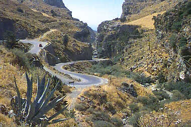
THERISSO (Village) CHANIA
It is the nearest gorge to the city
of Chania and the only gorge that a visitor can drive through by car of other
transportation means, since it is crossed by a carriageway leading to the gorge
from Chania via the suburb
of the city of Perivolia. The
main portion of thegorge is 6 km long. The imposing precipitous rocky slopes and
the very luxuriant flora have no cause to be jealous of the bigger gorges of Chania.
The gorge, even if visited by car, and the beauty of the village of
Therisso, built at the foot of the White
Mountains at an altitude of 580 m and only 15 km distant from Chania,
will remain unforgettable to the visitor.
The great politician and later Prime Minister of Greece,
born in Chania at the beginning
of the previous century, actualized the Cretan Revolution from the village of
Therisso in order to unite the island
of Crete and the rest of Greece,
after four hundred years of slavery under the Turks.
(text: Antonis Plymakis)
This text (extract) is cited February 2004 from the Chania
Prefecture Tourism Committee tourist pamphlet.
The road to the village of Therisos goes through the gorge, which
is 6km long. A tree lined river follows the gorge, with steep walls on either
side. The area is very pleasant for walking.
THYAMIS (River) EPIRUS
The river has its sources in the prefecture of Ioannina
and empties into the Ionian
sea. (it rises near Parakalamos
and its mouth is by Sagiada).
Gormos, Smolitsas, Tyria, Zaloggitikos, Kousovitikos and Kalpakiotikos are its
tributaries. Its ancient name was Thymiatis, and for quite some time it used to
separate the Kestrini
from the Thesprodida.
It used to be navigable, at least until the ancient Gitani,
which is situated near Ragio,
at the point where Kalamas receives the waters of the river Kalpakiotikos.
Up to the Middle Ages, the small ships used to go up the river up
to the skala of Zorgianos, below Sideri.
In the middle era, its ancient name was forgotten (so much so that many travelers
of the previous century identified it with Acheron),
and its place was taken up by Kalamas, due to the canes which grew in the swampy
mouth at "Parakalamos". Kalamas, a large waterway from the ancient times,
gathered by its banks important towns, such as Lygia,
Gitani, Fanoti, Osdina,
Raveni, etc. The Mycenean
findings which were found along the river bed, prove the importance which the
river had in trading during those faraway years, a trade which was continued later
on in the archaic years by the Ellines settlers from Peloponnisos. During the
Hellenistic times, the multitude of seals which were found in Gitani, confirm
the development of trade through the river, while the powerful venetian castle
at the "skala of Zorgianos" shows the continuance of trade up to the
Ottoman domination. (It was then that, possibly due to the change of the mouth
of the river, that Kalamas seized to be used as the main road and paths and wagon
roads were traced by its banks. New statio -towns, - such as Filiati
- appeared, while bridges for crossing it were built.) Kalamas is today a challenge
for the visitor, who has to choose between the routs in the wild nature of the
river with exceptional fauna and flora, the visits to the archeological sites
and the stroll in traditional villages with folklore museums.
Places of natural beauty: Delta of Kalamas. It has recently
been pronounced a protected area due to its important marsh, in which rare birds
nest. At the skala of Sagiada an information center operates as well as a museum
for the nature, not only of Kalamas, but also of the passes of Kalamas.
The Passes of Kalamas. A protected area between Vrosyna
and Pente Ekklisies.
Rare bird species and extremely rare types of flowers are in the gorge.
Theogefyro (God's bridge). A natural bridge from huge
rocks, which was used as a natural bridge for many centuries. It is situated by
the village Lithino.
Stone stairways that lead below the Theogefyro to the river.
Katarraktes (waterfalls). Two exceptionally beautiful
waterfalls are found in a luxuriant vegetation of plane-trees. They caused a sensation
to the travelers of the previous century who visited it, beginning with Lord Byron.
They are found near the village Katarraktis
(Glyziani) of the Prefecture of Ioannina.
This text is cited January 2004 from the Thesprotia Prefecture Tourism Promotional Committee URL below, which contains images.
TOPOLIA (Village) MYTHIMNA
Beside the road from Topolia to Koutsomatado is the tree-lined gorge
of Topolia with 300 metre high walls.
This text is cited Oct 2002 from the Crete TOURnet URL below, which contains image.
VANGOS (Village) MEGALOPOLI
The trip on the funicular railway resembles a journey in a dream.
Once the train has left the tranquil, peaceful landscape of Diakofto,
it delves into the deep gorge of the Vouraikos river that runs down from Helmos.Before
long the little train is clutching the rails with its "teeth".
The higher you go the better you appreciate nature' s silent work.
Enormous rocks, boulders gnawed by time, trees hanging from the mountain slopes
call forth awe and admiration.
The first stop - pause for breath - is at Trekilia for a quick cup
of coffee; then on to the village of Zahlorou at an altitude of 642 m.
This traditional village possesses a rare natural beauty.
The town of Kalavrita,
the third stop on the funicular, is spread out on the slopes of Helmos at an altitude
of 750 meters.
Numerous tall plane trees offer their welcoming shade. They line the
streets like an arcade.
The charming houses, streets, trees all make you feel right at home.
The town exudes tranquillity. Just outside town a Venetian fortress, "the
castle of Orea", stands atop a bluff.
This text is cited December 2004 from the West Greece Region General Secretariat URL below, which contains image.
VRASKAS (Settlement) SFAKIA
In the east of Sfakia,
apart from the Gorge of Imbros
there is also a parallel series of very small but interesting craggy gorges directed
eastwards. One of them is the gorge of Kapni.
It is a very wild gorge, difficult of access, with a very precipitous
ground slope. Its entrance is situated on the southern side of the mountains of
Akones and at the fourth km of the asphalt road from Imbros to Asfendou
in Sfakia, at an altitude of 900 m. It ends up in the border of the village
of Vraskas at an altitude of 190 m, and you need 3,30 hours in order to cross
it.
This text is cited April 2003 from the Prefectural
Committee for Tourism Promotion of Chania pamphlet.

Receive our daily Newsletter with all the latest updates on the Greek Travel industry.
Subscribe now!

