| Longitude: | 21o 39' 30.84" E |
| Latitude: | 38o 08' 37.4" N |
| Area: | 37,2 km2 |

| Postal Code: | 25002 |
| Year | Population |
|---|---|
| 1991 | 4274 |

Occupancy levels at Athens hotels in Q1 increased to 63.5% with average room rate at 98.47 euros....
Thu, 25 Apr 2024
Read more...
After the Covid-19 pandemic, all the more travelers are interested in nature, outdoors and sports tourism products, according to data by Mabrian....
Thu, 25 Apr 2024
Read more...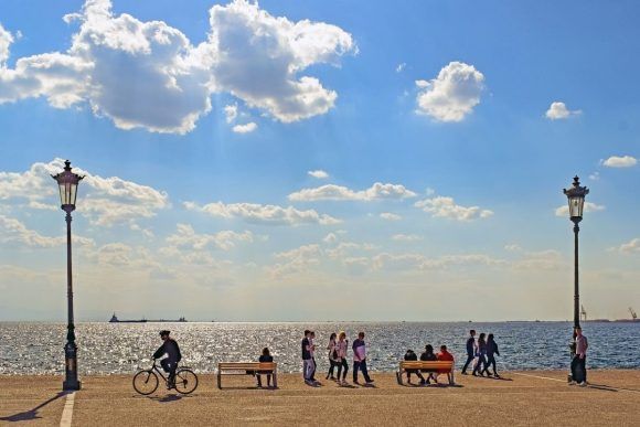
International arrivals to Greece rose by 18.7% in the first three months of the year reflecting a growing demand and extended season....
Thu, 25 Apr 2024
Read more...
More than 100 Greek hotels are on Tripadvisor's "Best of the Best" lists for 2024 that are based on reviews of real travelers....
Wed, 24 Apr 2024
Read more...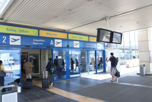
Passenger traffic at all 39 airports in Greece during January-March increased by 14.4% compared to the same period last year....
Wed, 24 Apr 2024
Read more...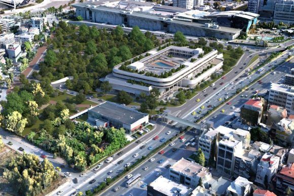
Details on Project VORIA, a 250-million-euro tourism investment in Marousi, Athens, have been released....
Wed, 24 Apr 2024
Read more...
Receive our daily Newsletter with all the latest updates on the Greek Travel industry.
Subscribe now!


