http://www.gtp.gr
May 25, 2013 Language selection
Map Search | Hierarchical Search | Special Search

Destinations Guide

You are here GREECE NORTH SPORADES ALONISSOS

ALONISSOS (PAI), Port, NORTH SPORADES

URL for linking to this page: http://www.gtp.gr/AlonissosPort

Geographical Data

Type of location: Beach, Village, Bay
Other Names: PATITIRI (Official name), ALONNISOS (Bibliography)
Postal Code: 37005
Tel +30 24240
Altitude: 20 meters
Longitude: 23o 52' 02.38" E
Latitude: 39o 08' 36.99" N

Map

Population Census

Year Population
1991 1846

Geographical Boundaries

  ALONISSOS (Port) belongs to ALONISSOS (Island)
ALONISSOS (Island) belongs to ALONISSOS (Municipality (Kapodistrias plan))
ALONISSOS (Municipality (Kapodistrias plan)) belongs to NORTH SPORADES (Island complex)
NORTH SPORADES (Island complex) belongs to MAGNESSIA (Prefecture)
MAGNESSIA (Prefecture) belongs to THESSALIA (Region)
THESSALIA (Region) belongs to GREECE (Country)
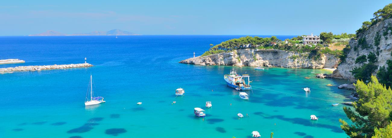
  Arriving on Alonissos with the ferry or the hydrofoil, one disembarks in Patitiri. Patitiri was chosen to be the main Port because is a natural harbour.
  It took its name from the old wine pressures (Patitiria) that used to exists, from when Alonissos was a red wine produser island.
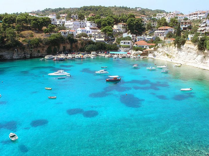
  Patitiri became the main town of the island accomodating the facilities of life, today. Someone can find lots of places to stay and taste our delicious sea food snacks.
  Further to the North we meet the next two fishing villages, Rousoum - Yialo and Votsi, 
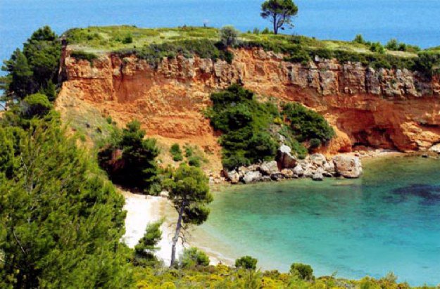
located at two charming bays, one after the other. Continuing to the North, one finds many wonderfull beaches to swim such as: Milia, Chrisi Milia, Tzortzi - Yialo, Lefto - Yialo e.t.c.
  The visitor can reach the beaches either by land or by sea, using cars or small taxi - boats which do these tours.
  Leaving Patitiri and taking the main road, leading West, after 3 km. you come to the old village of Alonissos. For those who love walking, there is the old donkey path, which takes you from the port to the old Alonissos within 30min.
This text is cited Mar 2003 from the Municipality of Alonissos URL below, which contains image.
http://www.alonissos.gr/en/articles.asp?p=20002-9 (1 img.) English Greek
Distances: 
  27 Nautical miles West (W) the capital of the island SKIATHOS, Small town, NORTH SPORADES, GREECE
4 Kilometers the capital of the island ALONISSOS, Village, NORTH SPORADES, GREECE
Located at/in/on: 
  Southeast (SE) coastline of: ALONISSOS, Island, NORTH SPORADES, GREECE
Search the above location for: 
  Travel and travel-related companies and organizations:
  62 companies/organizations found
  Accommodation:
  51 hotels found
  Areas and places of interest within the above area:
  15 areas and places of interest found
  Domestic sea schedules:
  Domestic sea schedules for the above location  
   Information of the location:
If you want to see them individually choose one from the list below or click here to see them all (7) members only
     Festivals and fairs (1)
     Local excursions (1)
     Useful Information (2)
     Professional associations: (1)
     Selected tourism enterprises (1)
  Total area information:
  15 information found
Photo Album 
IKOS Beach (Kokkinokastro)
MILIA Beach
Results:  4 from 9 More photos...


Destinations
Travel Directory
Accommodation
Beginning with
Destinations |  Accommodation | Companies |  Ferry Schedules | Home