http://www.gtp.gr
May 24, 2013 Language selection
Map Search | Hierarchical Search | Special Search

Destinations Guide

You are here GREECE DODEKANISSOS SYMI

SYMI, Island, DODEKANISSOS

URL for linking to this page: http://www.gtp.gr/Symi

Geographical Data

Type of location: Homeric island, Homer's Catalogue of Ships - Hellenes, Homeric name
Other Names: AEGLE, ELCOUSA, METAPONTIS (Ancient)
Postal Code: 85600
Tel +30 22460
Altitude: 610 meters
Longitude: 27o 50' 11" E
Latitude: 36o 35' 39.36" N
Area: 58,1 km2

Map

Population Census

Year Population
1991 2332

Geographical Boundaries

  SYMI (Island) belongs to SYMI (Municipality (Kapodistrias plan))
SYMI (Municipality (Kapodistrias plan)) belongs to RODOS (Province)
RODOS (Province) belongs to DODEKANISSOS (Island complex)
DODEKANISSOS (Island complex) belongs to SOUTH AEGEAN (Region)
SOUTH AEGEAN (Region) belongs to GREECE (Country)
  A lovely, mountainous island, Symi (or Simi) was reputed to be the birthplace of the Three Graces.
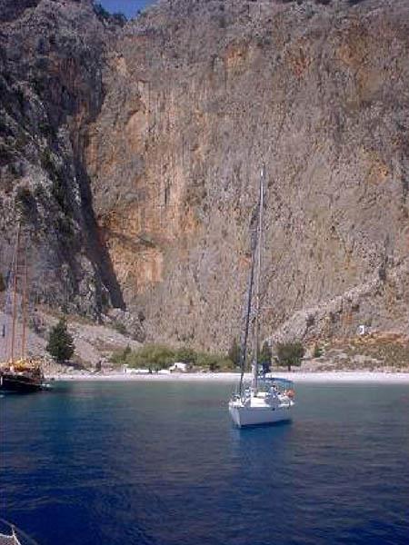
  While its interior is punctuated with small valleys, its coastline alternates between being steep and rocky or sandy and indented with little coves.
  In antiquity it bore the names Aigli and Metapontis. It took its present name from the nymph Syme, who was Poseidon’s wife. After its conquest by 
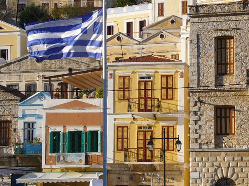
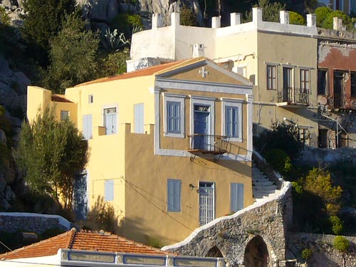
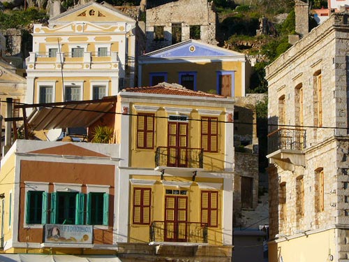
the Knights of St. John in 1373, commerce and shipping flourished until steam replaced sail. The stately mansions in the main town date from this period. which reached its peak in the 19th century.
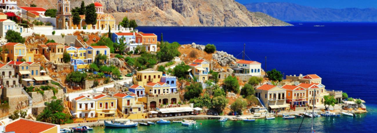
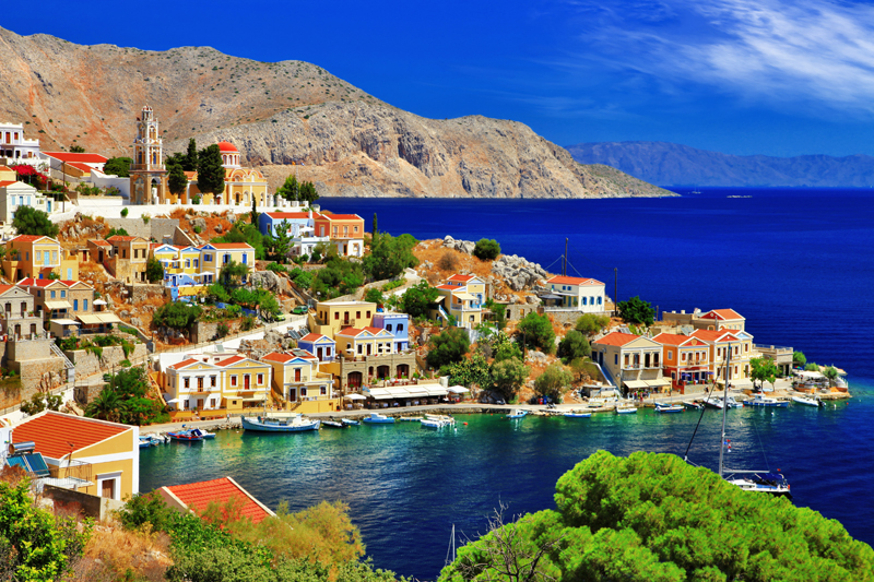
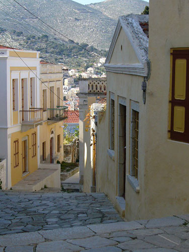
  The capital in the north of the island bears the same name and is divided into the upper and lower town. Ano Symi and Kato Poli. The lower town is also called Yialos. The 
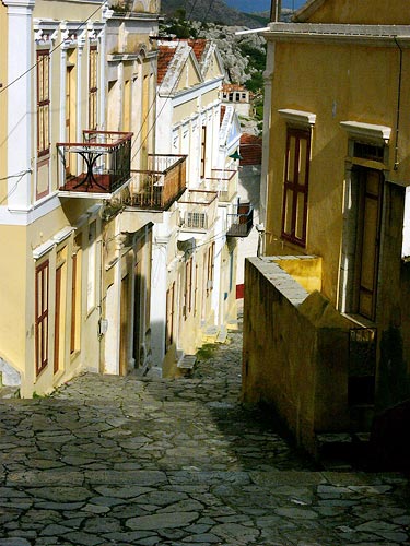
two districts are linked by a lane so steep it has steps It is flanked by charming neoclassical houses. some of them painted in warm pastel colours, with balconies and peaked, red tile roofs. Many of them also are embellished with neoclassical 
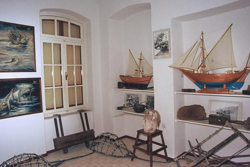
features on the doors and windows Their interiors are decorated with wood carvings, the locals having been adept at the craft for generations The highest point in Ano Symi is capped by the usual castle of the Knights of St John, whose emblem can be seen above the main portal.
  The traditional village of Emborios is Symi’s second port. The ancient town of Metapontis was situated close 
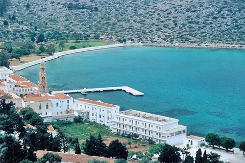
by. One of the island’s most famous landmarks is the monastery of the Archangel Michael Panormitis on the southwest coast. Built in the early 18th century. it overlooks the bay bearing its name in a setting combining mountain and sea It contains marvellous Byzantine frescoes and an intricately carved iconostasis.
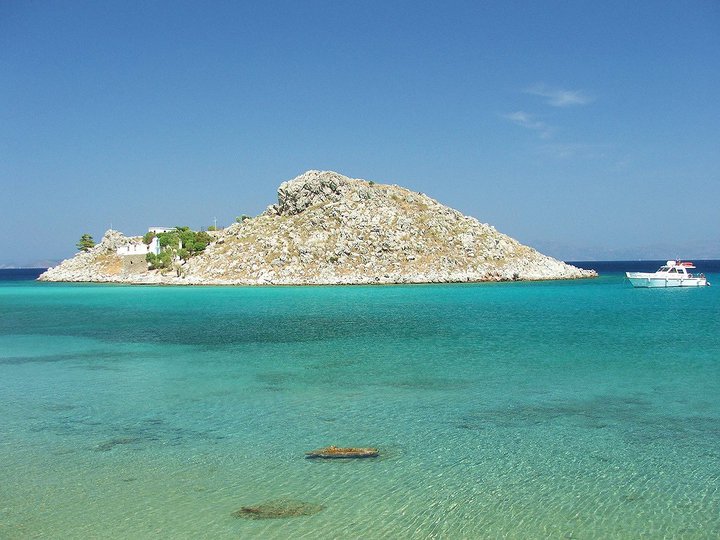
  There is no lack of wonderful beaches on Symi. You’ll find good swimming at Yialos, Pedio, Emborios, Marathounda, Nanou as well as on the nearby islets of Agia Marina and Nimos.
http://www.ando.gr/eot/eng/islands/symi.htm (2 img.) Greek
Dodekanissos Development Enterprise WebPage
Distances: 
  15 Nautical miles South (S) RODOS, Island, DODEKANISSOS, GREECE
Search the above location for: 
  Travel and travel-related companies and organizations:
  45 companies/organizations found
  Accommodation:
  22 hotels found
  Areas and places of interest within the above area:
  30 areas and places of interest found
  Domestic sea schedules:
  Domestic sea schedules for the above location  
   Information of the location:
If you want to see them individually choose one from the list below or click here to see them all (24) members only
     Homeric world (6)
     Mythology (1)
     History (3)
     Biographies (2)
     Information about the place (6)
     Photo Album (1)
     Economy (2)
     Various locations (1)
     Sights (1)
  Total area information:
  56 information found
Photo Album 
Agia Marina, Symi
Architecture of Symi
Buildings of Symi
Church
Results:  4 from 42 More photos...


Destinations
Travel Directory
Accommodation
Beginning with
Destinations |  Accommodation | Companies |  Ferry Schedules | Home