The community of Pano and
Kato Selia is built on the slope of a hill and surrounded by greenery. It
boasts interesting examples of folk architecture, like the older village
of Souri, with its neoclassical church of Agios Ioannis Theologos.
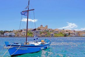
The coast with the steep cliffs and the wide variety of self-growing
plants near Likotinara is an area of interest and is included with the surrounding
area in the European Community Directive, Natura 2000. Kefalas
and the nearby communities of Selia and Xerosterni
surround a big formation (Dolinis), Roupakia
or Orpakia, an area rich in woody plants, old agricultural facilities (roads,
stone farm houses, wells and other facilities), flora and fauna.
Through the environmental educational programmes this area of natural beauty
will develop and prosper.
Map & Distances
Altitude:
318 meters
Longitude:
24o 14' 24.78" E
Latitude:
35o 23' 41.96" N
Hotels, local businesses, destinations & directions
If you want to find additional information on the greater and/or surrounding areas select one of the titles below and click "more"
We could't find news articles relevant to this location/area.
Latest Travel & Tourism News from GTP Headlines
Cruise Passenger Arrivals to Corfu Up 79% in Early 2025
Data released this week by the Corfu Port Authority (CPA) shows a strong start to the 2025 cruise season, with increases in passenger traffic, cruise ship arrivals, and tourism revenue....