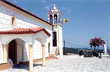
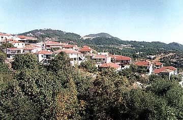
The village, so called Kourkouli, is a traditional mountainous colony.
It is situated at the 3rd km over the axis of the central road of Chalkida-Limni
and the foot of the mountain, so called "Dry
Mountain", in beautiful fully green with pine trees areas, on inclined plane
and altimeter of 400 meters.
It is of panoramic views, when one looks at the horizon of Aegean
Sea but also Evoic Bay.
The village was built by the residents of the colony, so called Skoulari,
which was situated at a distance of about 2 kilometers from the today's village
to the area of Drymona. Its residents
were forced to move because of brigands' and corsairs' invasions. The residents,
first, gave the village the name "Neo Skoulari". The Turks, however, changed its
name to "Kourkouli" meaning "pursued people". So, this name prevailed and has
been kept even until today.
This text is cited May 2003 from the Municipality
of Elymnies tourist pamphlet.
Photo gallery
Map & Distances
Distances:
81.0 Kilometers South-southeast (SSE) the prefectural capital CHALKIDA
Town, EVIA
,
GREECE
Altitude:
420 meters
Longitude:
23o 20' 27.76" E
Latitude:
38o 49' 59.94" N
Hotels, local businesses, destinations & directions
The Hellenic Hoteliers Federation recently underscored the detrimental impact of excessive taxation on Greek hotels amidst intense international competition....
Aria Hotels: Διακρίθηκαν με τέσσερα βραβεία στα Tourism Awards 2024
Τα Aria Hotels, η οικογενειακή αλυσίδα boutique ξενοδοχείων και ανεξάρτητων κατοικιών, διακρίθηκαν με τέσσερα βραβεία, τρία gold και ένα silver, στα φετινά Tourism Awards....