http://www.gtp.gr
May 24, 2013 Language selection
Map Search | Hierarchical Search | Special Search

Destinations Guide

You are here GREECE ARGOLIS ARGOS

ARGOS (ARS), Town, ARGOLIS

URL for linking to this page: http://www.gtp.gr/ArgosTown

Geographical Data

Type of location: Listed traditional settlement, Town hall, Province capital, Municipal district, Modern monuments, Archaeological site, Acropolis, Ancient theatre, Ancient city, Byzantine castle/fortress
Postal Code: 21200
Tel +30 27510
Altitude: 42 meters
Longitude: 22o 43' 48.28" E
Latitude: 37o 38' 10.99" N

Map

Population Census

Year Population
1981 20955
1991 21901

Geographical Boundaries

  ARGOS (Town, Town hall) belongs to ARGOS (Municipality (Kapodistrias plan))
ARGOS (Municipality (Kapodistrias plan)) belongs to ARGOS - MYKINES (Municipality (Kallikratis plan))
ARGOS - MYKINES (Municipality (Kallikratis plan)) belongs to ARGOLIS (Prefecture)
ARGOLIS (Prefecture) belongs to PELOPONISSOS (Region)
PELOPONISSOS (Region) belongs to GREECE (Country)
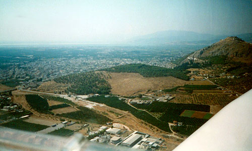
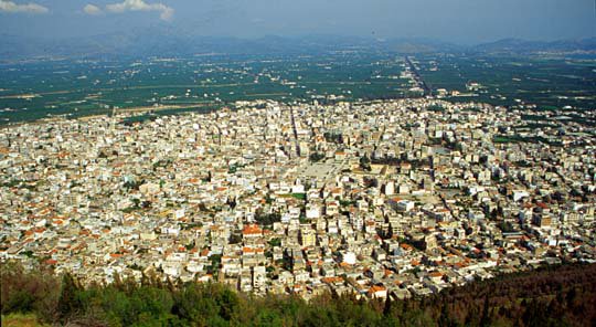
  On the one hand the geographic mark of the city, placed within the boundaries of Argolis fertile plain, close to road axes that link North Peloponnese to Aegean and Mediterranean 
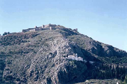
Sea under the defensive stand of its high hills (Larissa 279m, Aspida 80m) on the other, underlie the main reasons that Argos was inhabited continually.
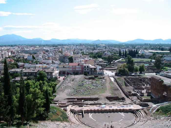
  Argos is the most important agricultural, industrial and export center of the wider Argolis region, due to systematic cultivation and industries of processing, packaging and distribution of citrus products as well as those of building material, marble, distillery and winery, processing and standardization of olive oil, pump manufacturing and package machinery etc.
  Argos, commercial center on the region from ancient times, continues to be the area’s trade center even today. Its inhabitants surpass the 30.000 people and that makes Argos the most dense of Argolis Prefecture.
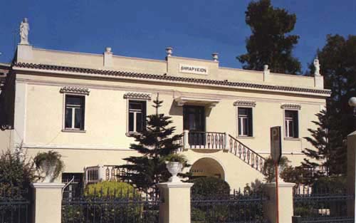
(Text: Nikos Petropoulos)
This text (extract) is cited March 2004 from the Municipality of Argos tourist pamphlet.
Distances: 
  137 Kilometers Northeast (NE) the capital of the country: ATHENS, Town, GREECE
12 Kilometers Southeast (SE) the prefectural capital NAFPLIO, Town, ARGOLIS, GREECE
8,2 Kilometers East (E) TIRYNS, Mycenean palace, ARGOLIS, GREECE
52,1 Kilometers East (E) the municipality seat EPIDAVROS, Small town, ARGOLIS, GREECE
Located: 
  South (S) on the banks of: CHARADROS, Tributary, ARGOS - MYKINES, GREECE
Located in the same area of: 
  ARGOS, Ancient city, ARGOLIS, GREECE
Ancient sites within Municipal's District: 
  LARISSA, Acropolis, ARGOS, GREECE
TIMENION, Ancient port, ARGOS, GREECE
Search the above location for: 
  Travel and travel-related companies and organizations:
  38 companies/organizations found
  Accommodation:
  5 hotels found
  Areas and places of interest within the above area:
  21 areas and places of interest found
  Domestic sea schedules:
  Domestic sea schedules for the above location  
   Information of the location:
If you want to see them individually choose one from the list below or click here to see them all (11) members only
     Associative equation (1)
     History (1)
     Biographies (1)
     Religious figures biography (2)
     Hellenism (1)
     Useful Information (1)
     Local governments (1)
     Professional associations: (1)
     Selected tourism enterprises (1)
  Total area information:
  537 information found
Photo Album 
ARGOS Ancient theater
Argos ancient theater, built in the 4th century BC, it held 15,000 spectators on the seats hewn from the rock; there were marble places for honored persons
Argos, Archaeological museum, fragment of a 7th cent. krater, depicting the blindness of Cyclops Polyphemus by Odysseus
Argos, Argolis
Results:  4 from 8 More photos...


Destinations
Travel Directory
Accommodation
Beginning with
Destinations |  Accommodation | Companies |  Ferry Schedules | Home