With the Greek islands climbing to the top of the world’s holiday destinations, competition is stiff for any major metropolitan area. Besides, the summer is traditionally associated with a mass exodus from cities towards the countryside. Nevertheless, Athens has come a long way and is no longer a mere transit lounge en route to other destinations in the country and has developed into a metropolis of exceptional variety with its own unique and heterogeneous character. In fact, the Greek capital has much more to offer beyond some of western civilization’s most important monuments, an impressive array of museums and beaches a mere hours’ drive away from the city center. Even those averse to the idea of spending even a single day of their summer holidays in a city will find comfort in the fact that Athens is a hop away from the Saronic Gulf islands and countless other destinations in Peloponissos, Evia and, close by, the pristine slopes and plateaus of Mt. Parnitha.
The flip side of the crisis that hit the country was a surge of experimentation as the city sought novel ways to escape or remedy its grim predicament, softened only by a culture of indefatigable alfresco socializing. Though many businesses in the center of Athens have shut or relocated over the past 5 years, a younger generation, along with the newly unemployed, has seen plummeting rents as an opportunity to try out new ideas across a broad spectrum, to the benefit of all. These include pop up shops, eclectic bookstores, spiffy wine bars, stylish restaurants, trendy cafes, boutique hotels, artsy hotels, alternative art venues (the perfect stop-over en route to one of the city’s many open air cinemas) and, more recently, even art and architecture-oriented walking tours and innovative city guide services. The sense of a city on the go has created an atmosphere of sparkling energy that lasts well into the small hours, a midsummer mayhem especially around the neighbourhoods of Psyri, Monastiraki, Gazi, Thissio and radical Exarchia, to name a few - though neighbourhoods like Chalandri farther up north, Pagrati and Mets, both very near the Panathenaic Stadium, which hosted the first modern Olympics in 1896, have also come into their own.
The city’s three main hubs of activity are the center, broadly defined as the area around Syntagma and Omonia squares and what is known as the historical triangle, Kifissia, a leafy and posh northern suburb, and the coast of Faliro that stretches out to Poseidon’s temple at Sounio via the beaches of Vouliagmeni, Glyfada, Kavouri, Varkiza and, in the opposite direction, towards the ultra-busy port of Piraeus. Though the city center is at its emptiest in mid-August, some of the clubs and bars have decamped to their summer venues on the coast, which in parts has a generous promenade with a direct view of the Saronic Gulf and the islands of Salamina, Aegina, Agistri and, on a clear day, Poros and Hydra.
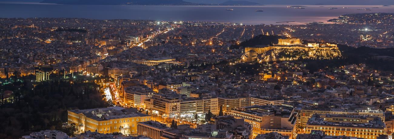
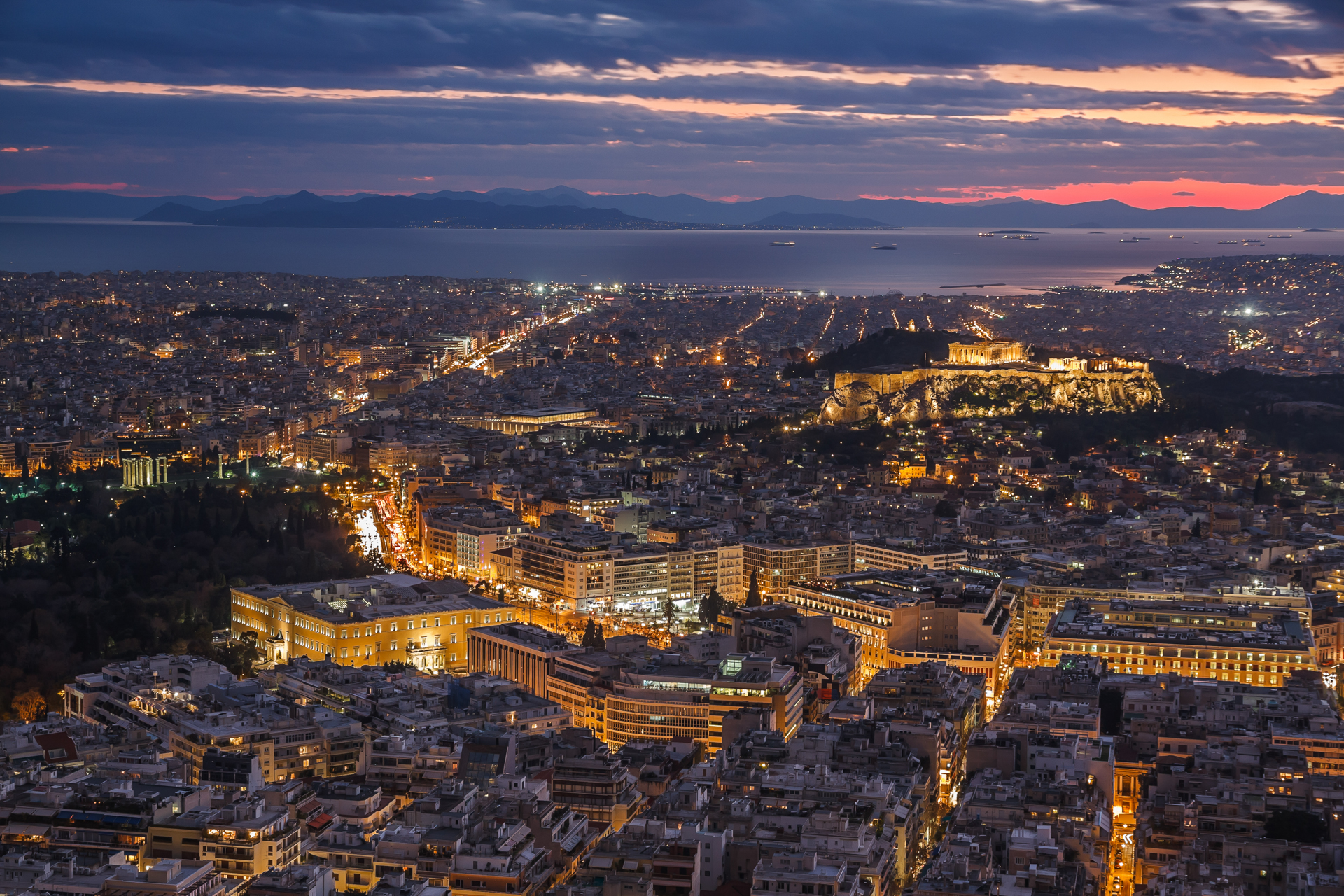
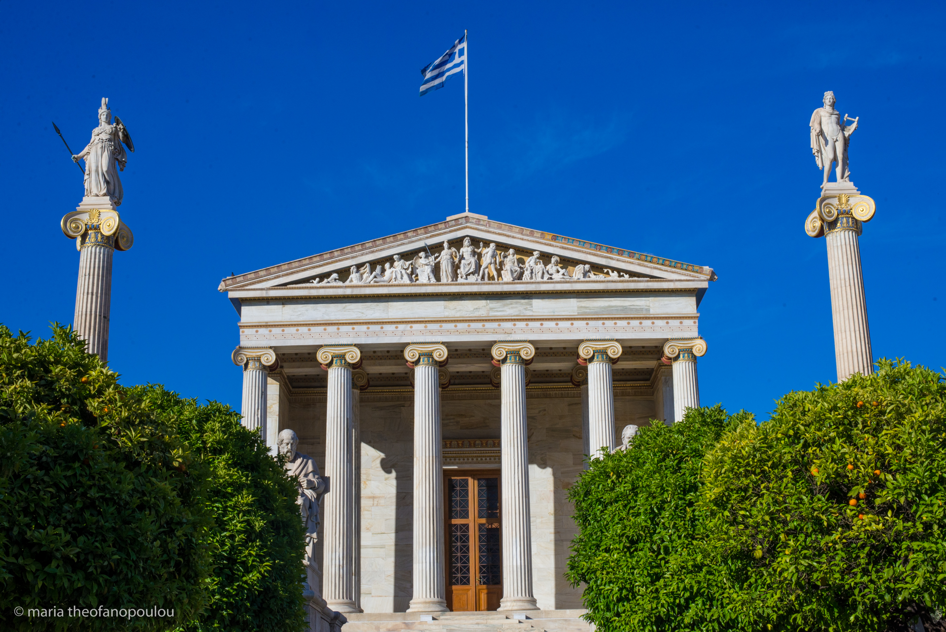
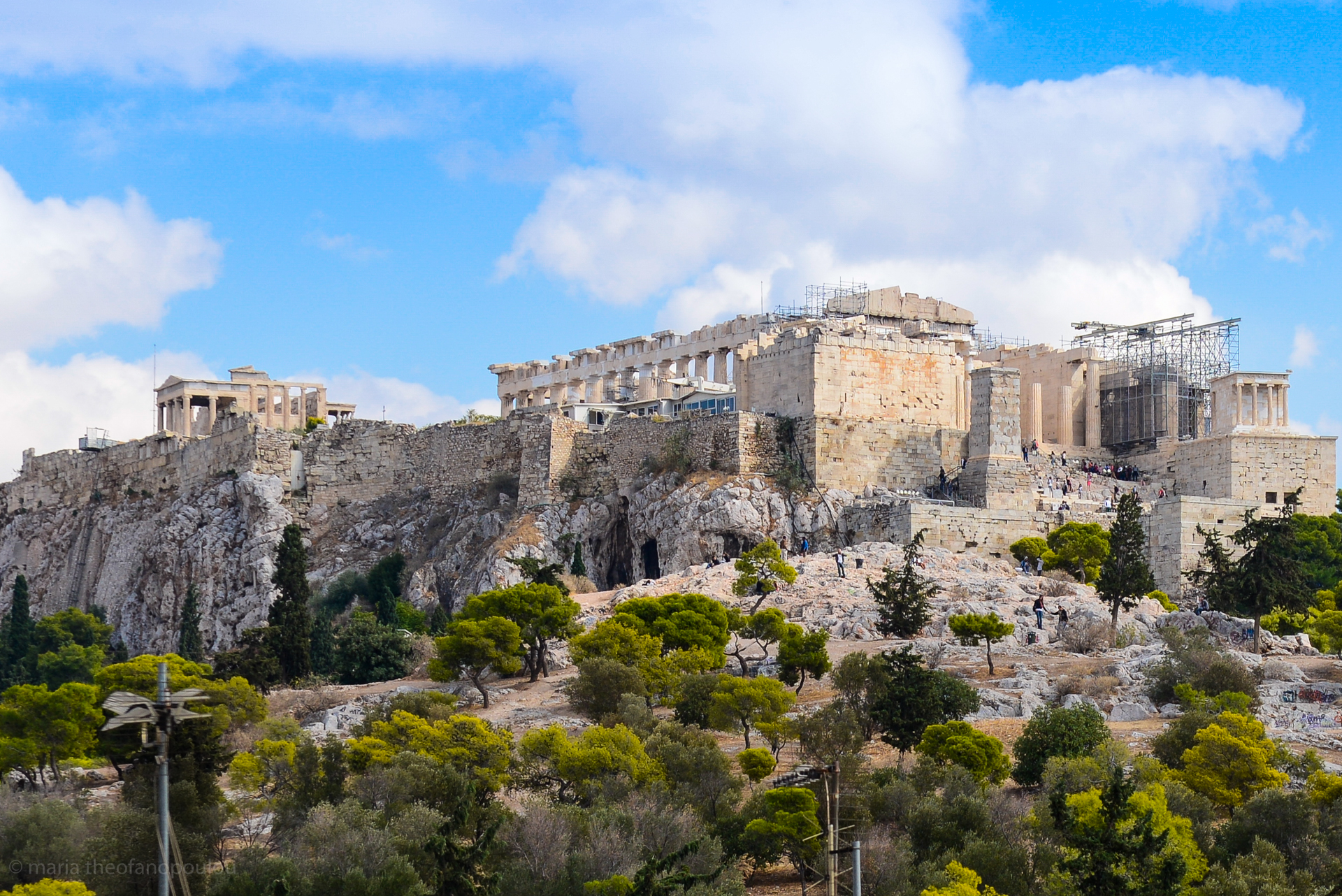
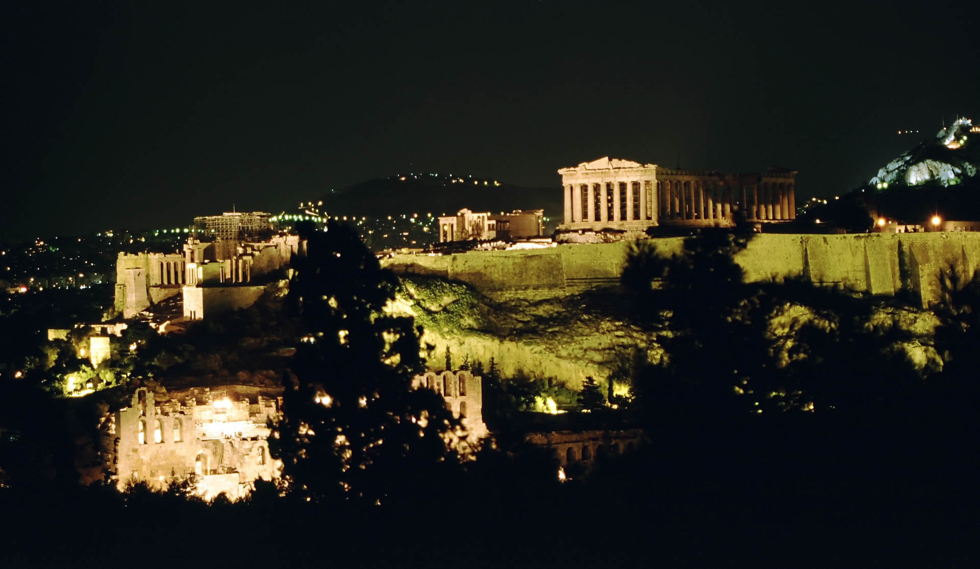
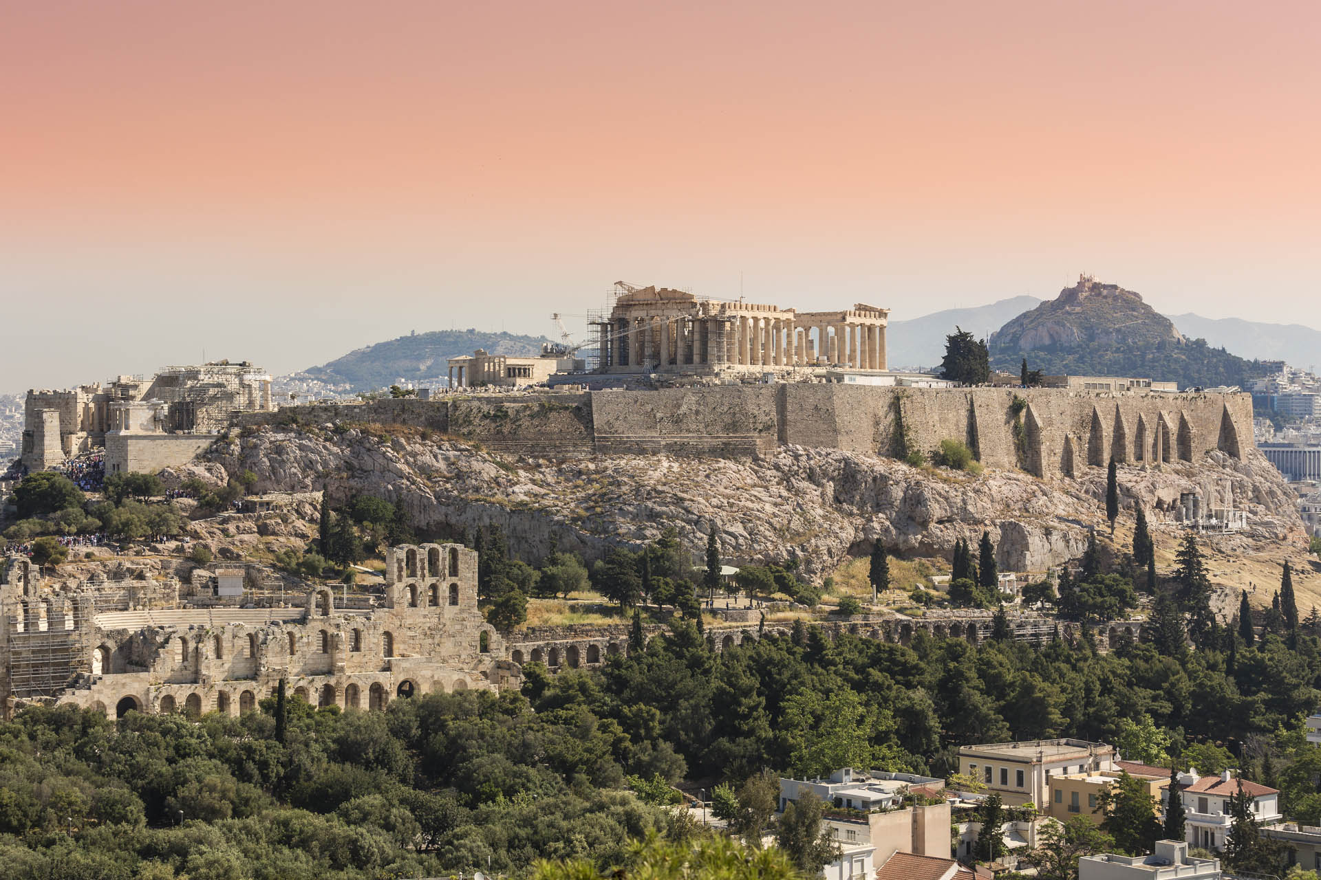
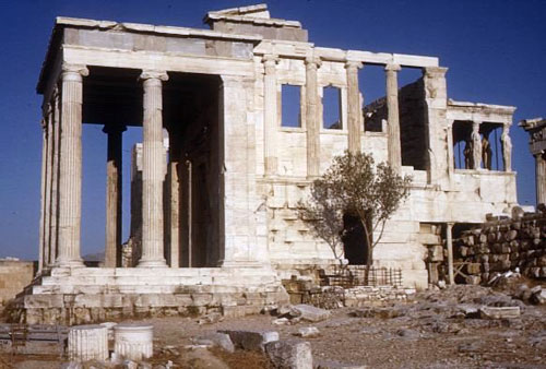
There is probably no other landmark associated so inescapably with Athens than the Parthenon, its outline atop the Acropolis almost like an island amidst a sea of cement: construction spiraled out of control in the Greek capital for many decades, especially after a building spree in the 50s that, among other things, gave priority to cars over pedestrians – though this seems to be changing. But from a different perspective and perhaps by that token, the city is a repository of architectural styles that range from the dignified neoclassical buildings of the center (e.g. the Academy of Athens, the Archaeological Museum), the unpresuming houses at Anafiotika on the slope of the Acropolis, the surviving gems of inter-war architecture in the heart of the city (e.g., in Kypseli and in some sections of the ethnically diverse Patission area) and, of course, the ancient monuments of the Ancient Agora, the Roman Agora, Kerameikos, among many others.
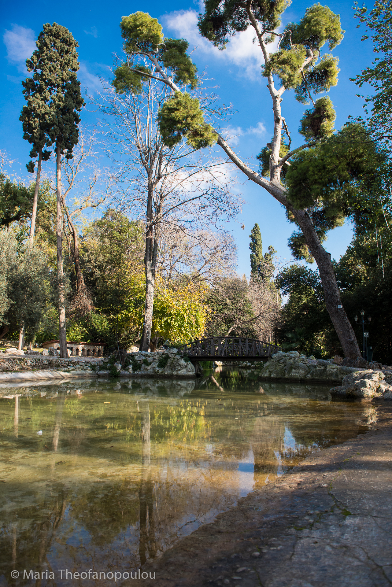
Though a number of initiatives have sought to remedy the city’s lack of green spaces, the center has its own exquisite oasis in the form of the National Gardens, perfect for strolling, reading or for moments of Zen-like respite. With entrances from Syntagma, the up market neighbourhood of Kolonaki and the stately and almost palatial Herod Atticus Street, the gardens’ southwestern exit opens up to the temple of Olympian Zeus and thereon to the old-world neighbourhood of Plaka (another with similar appeal is Kessariani, a couple of kilometers away in the opposite direction). From there, the spacious pedestrian walk of Dionysiou Areopagitou leads directly to the bustling neighbourhood of Thissio and Pnyka, which over the past years has hosted from picnics to tai-chi. Lykavitos, a hill in central Athens that is equally a landmark, is perfect for finding one’s bearings and offers a panoramic view of the entire city stretching out in every direction of the Athens basin.
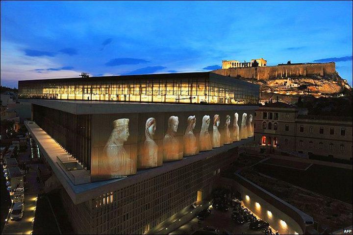
Besides the striking new Acropolis museum in the neighbourhood of Makrygianni (designed by renown architect Bernard Tschumi) that houses thousands of artifacts from the Acropolis and has seen more than 4 million visitors since 2009, Athens boasts many superb museums and contemporary art galleries including the National Archaeological Museum, the Benaki Museum, the Museum of Cycladic Art and the National Gallery. There are also some exciting projects in the works, including a new building for the National Museum of Contemporary Art and the Stavros Niarchos Foundation Cultural Center, an immensely exciting project (designed by acclaimed architect Renzo Piano) at the Faliron delta, that includes the construction of the new facilities of the National Library of Greece, the Greek National Opera and the Stavros Niarchos Park. Close by and towards Piraeus are the picturesque marinas of Mikrolimano, Kastella and Zea among many other places worth visiting along the winding coastal road that eventually leads the main port of Piraeus.
Do not fret if cities are generally not your thing: Athens is a perfect launch pad for day trips and excursions, which may include the Saronic Gulf islands, Cape Heraion near the spa town of Loutraki, where there is a tiny but magical cove next the remnants of an ancient temple of Hera, the ancient theater of Epidaurus on Peloponissos, Trikala Korinthias perched atop Mt. Ziria, Vouliagmeni Lake to the south of Athens and near the beach by the same name, Schinias, a beach several kilometers long on the eastern coast of Attica. It is a local windsurfing paradise (there are also kite surfing strongholds further south) that comes with some beach furniture and bars but also sections of clear beachfront dotted with pine trees. Avlaki, Chamolia near the temple of Artemis in Vravrona and Daskalio, are to the south along the same coast, towards Lavrio and eventually Sounio. The island of Evia to the northeast of Athens is also well within reach, as is stunning Delphi on Mt. Parnassos, one of the country’s top ski resorts northwest of Athens.
Recommended
Archeological and Historical Sites
- Acropolis and the area surrounding the hill, including the Ancient Theater of Dionysus and the Odeon of Herod Atticus (along with the ancient theater of Epidaurus, a main venue for the Greek Festival) on one side of Dionysiou Areopagitou street and near the Acropolis Museum at the lively neighbourhood of Makrygianni. Nearby are also Hadrian’s Arch and the temple of Olympian Zeus.
- Athens Historical Center: includes many of the city’s top-tier antiquities besides the Acropolis, including Arios Pagos, Kerameikos, the Ancient and Roman Agora, the Attalos Stoa, Pnyka, Filopappou Hill, the temple of Hephestus but also the neighbourhoods of Plaka, Monastiraki and Psyri, a true mosaic of history and architecture that spans the centuries.
- Panathenaic Stadium
- Plato’s Academy
Museum and Cultural Centers
Contemporary Art Galleries and Spaces
Around town and further
Excursions