Listed 90 sub titles with search on: Archaeological sites Ancient towns for wider area of: "GREECE Country EUROPE" .
AGII DEKA (Village) HERAKLIO
Tel: +30 28920 31144
Gortyna was first inhabited at the end of the Neolithic period (3000 BC)
and by the Late Minoan period (1600-1100 BC) it became a flourishing settlement.
Remains of the Archaic period (7th century BC) were located in the area of the Acropolis,
while the large inscription, the Gortyn Law Code, dated to the 5th century BC, attests
the prosperity of the city, which continued throughout the historical times. However
Gortyna reached its peak during the Roman era (1st - 5th centuries AD), as an ally of
Rome and the capital of the Roman provinces of Crete and
Cyrene.
The city remained an important center of Crete in the following Early Byzantine
period and, according to tradition, it was the first Cretan city which espoused Christianity.
Gortyna became the seat of the first bishop of Crete, Apostle Titus, to whom was dedicated
a monumental temple. The conquest of Crete by the Arabs put an end to the history of the
ancient Gortyna, which was destroyed in 824 AD.
The first archaeological research on the site was conducted in 1884 by the
Italian archaeologist F. Halbherr. Since then, excavations have been carried out
by the Italian Archaeological School and the local Archaeological Service.
The most important monuments of the site are:
- The Odeion.
It is a typical Roman theatre of the 1st century AD with two entrances on the north side and an almost semicircular
orchestra. The north wall of the formerly raised skene (stage) had four niches for statues. Only three rows of the cavea
benches are preserved.
- The Gortyna Law Code.
The inscription with the Code is to be seen in the north round wall of the Odeion, sheltered in a small structure. It is a
complete code of law, based on Minoan tradition, which survives in the Doric city of the historical times. Dated to 450 BC.
- Isieion.
The sanctuary of the Egyptian Divinities (1st-2nd centuries AD) is a rectangular area dedicated to the cult of many gods,
such as Isis, Serapis-Zeus and Anubis-Hermes. It had an underground cistern. The cult statues of the gods stood on an oblong
podium with crepis.
- Temple of Apollo Pythios.
It was built in the Archaic period (7th century BC) and originally was a rectangular house with a treasury. In the following,
Hellenistic and Roman periods (4th century BC-2nd century AD) several additions were made to the building, including the prodomos,
the colonnades, and a conch which sheltered the statue of Pythios Apollo.
- The Praetorium was the seat
and residence of the proconsul of Crete. It is divided into two parts: the administrative section, in which the central building is the basilica,
and the residential section. The preserved ruins are dated to the 2nd century AD and seem to have been repaired in the 4th century AD.
- The northeastern cistern and the Nymphaeum. They lie immediately to the north of the Praetorium. The first cistern
was a rectangular, open-air structure with conches on all sides, where the statues of Nymphs were placed. It was converted into a vaulted
cistern in the 7th century AD.
- The Acropolis on the hill of Aghios Ioannes. Large sections of a polygonal fortification wall are preserved with towers at the
corners (10th-6th centuries BC). Within the enclosed area there was an Archaic temple, on the ruins of which an Early Christian basilica was
later erected.
- The Church of St. Titus.
It is a cross - shaped three - aisled basilica with cupola; the northern and the southern arm of the cross end up in conchs. The church was
built with rectangular hewn stones and is dated in the 7th century AD. It was destroyed by the Arabs in 824 AD and rebuilt after the recapture
of Crete by the Byzantines during the 10th century.
- Triconch church founded probably over the tomb of the Ten Cretan Martyrs. The narthex communicates through a tribelon
with the central rectangular part of the church. The mosaic floor and the remaining capitals are exquisite. The church is dated in the 5th century AD.
AKROTIRI (Village) SANTORINI
Akrotiri's most significant contribution to our knowledge of the prehistoric
Aegean and Europe in general is its monumental graphic art. The wall-paintings
of Thera constitute the earliest examples of large-scale painting in Greece and
enrich inestimably the history of European art. Their technique is not that of
fresco, for which reason it is not correct to use this term. It seems that the
artist began painting when the plaster was still quite fresh on the walls. He
did not, however, take care to maintain this wet condition. So the wall gradually
dried and the painting was finally made on an entirely dry surface. This is why
the colour often flakes if the modern technician does not manage to fix it with
chemicals. Wherever the painting was made on a wet surface the colour has seeped
in and does not flake.
The plaster on the wall destined to be painted was rubbed whilst
still wet, so that its surface became smooth for the artist's paint brush. This
smoothing seems to have been effected using special sea pebbles. Hundreds of these
pebbles with one or two flat surfaces from the rubbing have been found amidst
the ruins of Akrotiri. The colours which the prehistoric Theran artists used were
red, black, yellow, blue and cream. The latter was usually used as a background.
With these colours the artist painted diverse surfaces both in shape and dimensions.
One of the principal characteristics of the art of Akrotiri is that
the artist had complete command of the space in which he moved unhesitatingly.
He infallibly selected a subject suitable for filling the surface offered by the
arrangement of the area. Door and window jambs, small surfaces of wall between
two such openings, zones which are of necessity created for the opening of cupboards
or windows and finally large expanses of wall, always bear the composition best
suited to their shape and size. A representation of a pithos plant pot with lily
adorned the jambs of the window in the West House. Again in the West House, a
door jamb was apparently decorated by the so-called "Young Priestess." The narrow
surface between the window and the NE corner of Room 5 in the same house was occupied
by the famous Fisherman while another similar painting was depicted in a corresponding
position diagonally opposite. Such a surface--between the two doors--was covered
by the wall-painting of the Boxing Children in the upper story of Room B1. In
Room 5 of the West House the narrow strip of wall under the windows was painted
as an imitation marble dado whilst the zone high above the windows was decorated
with the Frieze of Miniatures. The Frieze with the Monkeys from Xeste 3 must have
been a similar case. But the artists of Akrotiri were not afraid to paint whole
blank walls. The grand composition with the Monkeys was discovered in Room B6,
while three of the four walls of Room 2 were completely covered with the wall-painting
of the Lilies. From the homonymous house came the wall-paintings of the Ladies.
Finally, from Xeste 3 comes an enormous composition of Women Gathering Crocuses.
Even though the character of the wall-paintings from Thera is Minoan,
there is an apparent independence of the artist from the conventions of Cretan
art. Freedom in conception, freedom in design, freedom in composition, freedom
in movement are the characteristics of the Theran wall-paintings. Men, animals,
plants are rendered with such conviction that it borders on naturalism. Purely
decorative subjects rival the pictorial scenes in variety and perfection. These
too were employed to cover all kinds of surfaces. Rosettes, often combined with
rhomboid motifs were also painted on large surfaces, as is the case in Xeste 3.
The ivy branch is an ideal motif for framing the Antelopes from Room B1. The "starry
sky" harmoniously covers the ladies from the Room of the Ladies. In Room 5 of
the West House the "marble" dado underneath the windows is a well-chosen architectural
element. The pithoi plant pots on the jambs of the window and the "cabins" on
the walls of Room 4, again in the West House, are examples of the inventive imagination
of the artists.
Even greater and more impressive is the diversity exhibited by the
narrative scenes. Such is the artist's predilection for variety that he even makes
the landscape narrative through the insertion of some animals. The rocky terrain
with lilies is fixed in time by the presence of the swallows flirting and flying
in daring formations. There must have been some reason why the Monkeys in Room
B6 scrambled hastily upon the rocks. The Landscape with the River and Subtropical
Vegetation from Room 5 of the West House is further enlivened by the presence
of wild or mythical beasts. A wild duck flies to the left, while on the right
bank of the river, almost in flying gallop, a goat runs to the right. Both seem
to have rushed startled from a cluster of palm trees. From the other, the left
bank of the river, a griffin flies to the right in a flying gallop, while a wild
cat stalks the unsuspecting wild ducks sitting on the river's edge. All this movement,
all this activity indicates the artist's intention not merely to paint a landscape
but a wild landscape, far away, yet full of life. The same ruggedness of nature
is to be seen in the landscape above the left city in the Miniature of the Fleet.
In the wood three terrified deer flee the predatory claws of the lion which pursues
them.
In the narrow Frieze from Xeste 3 the narrative is even more vivid.
In a landscape, again rocky, full of crocuses, swallows fly to their nests bearing
food for their chicks who await with open beaks. Blue monkeys complete the scene.
These monkeys are not inert; one of them has drawn his sword and holds the scabbard
in his left hand. Another monkey clasps a harp and is perhaps the musician of
the company.
More narrative, of course, are the scenes in which humans participate.
The two Fishermen from the West House proudly display their catch, holding the
bunches of fish. The so-called Young Priestess from the same house wears a long,
heavy, perhaps woolen, chiton and holds a brazier with glowing charcoal while
sprinkling it, more than likely with incense. Perhaps she passed from room to
room censing it or perfuming the air of the house. This is why she is depicted
on a door jamb. [p. 35]
More animated is the movement displayed by the Boxing Children from
Room B1. Each wears a glove on the right hand and the children are portrayed in
a momentary phase of the game. One has already thrust his gloved hand in an attempt
to strike his opponent. He in turn avoids the blow by shielding with his bare
hand and prepares to strike his own blow with the other.
In the wall-painting of the Ladies the scene is not quite so clear
since many of the pieces are missing. Certain, however, is the movement of one
woman of a somewhat advanced age who stoops slightly to the right and offers both
her hands in an attitude which is not comprehensible. Another figure stood in
front of the bare-breasted one; unfortunately only a part of her skirt is preserved.
A third one, with her breasts covered, is illustrated in an opposite movement
towards the left. She also presents her hands but does not stoop like the first.
All these figures are drawn beneath an arch which delimits the upper surface of
the wall and is filled with stars.
The Miniatures from Room 5 of the West House are narrative too. Unfortunately
we have only fragments from the frieze of the north wall; and yet in these pieces
one can not only observe the technical dexterity of the artist but also his conception
of space and the third dimension. In one group of these pieces we have scenes
which are enacted at three different levels. On the first level, that nearest
the spectator, a rocky seashore is shown and in the sea are three naked men, apparently
drowned. At least so their unnatural attitude would suggest. Also in the water
are three rectangular shields, perhaps one from each drowned man. Only sections
of three ships are shown in the pieces which have survived: the stern of one and
the prow of the other two One prow, however, is in a strange position, reinforcing
the view that the whole scene illustrates a shipwreck, the victims of which were
the three drowned warriors. On the second plane of the painting there are warriors
who, clutching their oblong shields, long spears and wearing the characteristic
Mycenaean helmet of boar's tusks, march towards the right. The tasselled end of
their scabbard projects beyond the back of their shield. On the third plane, high
up, various scenes are taking place. Two shepherds are trying to gather their
different coloured sheep and goats into the pen which is depicted as an elliptical
fence. Two trees at the entrance to the fold ensured shade for the flock from
the summer heat whilst their trunks serve as sturdy gate-posts. Perhaps it is
midday and the shepherds are gathering the flocks into the pen to water them.
For, next to it, on the left of the entrance is a well whose presence is marked
by two upright water pitchers on top of its mouth. Some men are conversing in
front of the well while two women who have already filled their pitchers walk
away: one has balanced the jug on her head and treads lightly with arms outstretched
to keep her balance. The second, [p. 36] who comes from close by steadies the
pitcher with her hands while trying to set it on her head. The scene is not very
different from what happens today in many mountain villages where the well or
water tap is the common meeting place for the villagers. "When you go for water
my Malamo, I loiter at the tap . . ." says a folk song which aptly fits this scene
at Akrotiri.
The best preserved piece from the miniatures from the West House
is the Frieze with the Fleet. Large sailing boats are depicted sailing from one
harbour on the left to another one on the right. Much discussion has taken place
concerning this scene with opinions which differ considerably. Some maintain that
these two ports are in the Aegean where the fleet is traveling. For others, one
city is in the Aegean and the other is in Libya. Some, indeed, even identify specific
Minoan cities in this miniature painting. Regardless, however, of the opinions
of each scholar, there are certain elements which are difficult to refute. First
of all, the representation is narrative, irrespective of whether it portrays a
specific event or not. It states clearly that the ships depart from one city on
the left and arrive at the harbour of the other on the right. The architecture
in both towns resembles that we find in the excavation: multi-storeyed buildings
built of ashlar blocks and at different levels. The Minoan character of the town
on the right is further emphasized by the "horns of consecration" which crown
one of the buildings. These elements, however, are not sufficient to support the
view that specific towns are illustrated. For even if the artist wanted to draw
imaginary places he would incorporate elements with which he was familiar. The
scene, however, has a festive flavour. This is evidenced by the bunting on the
large boat, the "Admiral's" and confirmed by the numerous dolphins which frolic
along the route of the craft. The inhabitants of the left township bid farewell
to the fleet either from the roofs of their houses, or down at the shore, or escorting
it in their little boats. At the end of the voyage the population came out to
welcome the fleet. Here too there are people on the roofs, at the water's edge
and in boats which leave the harbour to meet the fleet.
Certain other elements indicate some uniformity among the sailing
ships of this wall-painting. Firstly it would appear that the passengers on board
are warriors. They have hung their helmets on the pronged pole intended to hold
the lowered mast and lateen yards of the sails. On these same prongs the warriors
have placed their spears too. The captain is also a warrior who sits in his cabin
astern. His helmet hangs high up while his spear projects a long way behind. With
the warriors on board the boats acquire a somewhat martial aspect. Perhaps the
wild beasts which are depicted, sometimes carved on the stern and sometimes painted
on the bows of the ships, are also aimed at expressing this character. The relatively
small sailing boat, the only one depicted with sails unfurled, has a swift-flying
bird painted on its sides. Did the artist perhaps wish to show through the bird
that the ship is a fast-sailing one? [the messenger boat of the fleet?] It is,
anyway, the only boat with two paddles at the stern end, essential for controlling
the movements of a fast boat. Each paddle is operated by a paddler.
All the above elements [the single direction of the fleet, the martial
[p. 38] character of the ships, the messenger vessel] bolster the opinion that
the boats comprise a specific unity, in which case the whole scene may perhaps
refer to a particular event. However, in addition to its narrative character this
wall-painting is also a rich source of unique information. For, apart from information
concerning the architecture, the fauna and flora and the people's apparel, we
have for the first time information concerning the art of ship-building in the
prehistoric Aegean, as well as the manner in which the various parts of the boat
operated [raised masts, sails, paddles, oars, cabins, etc.] Also we gain, indirectly,
an idea of the dimensions of the ship. This is the first time we have representations
of prehistoric ships in a scale which permits the rendering of such details. A
most significant piece of information of historical importance is the armoury
depicted on the boats. Not so much the shields and spears as the helmets, make
us wonder whether the warriors who were using them were not Mycenaeans. Boar's
tusk helmets are usually counted among the accessories of the Mycenaean armoury.
If, however, the warriors in the miniatures of Thera are Mycenaeans then certainly
many of our views on the prehistory of the Aegean around the middle of the 2nd
millennium B.C. will have to be revised. The fact that Mycenaean warriors could
come, even in paintings, so close to Crete means that even in the 16th century
B.C. Crete had begun to lose some of her power and sovereignty in the Eastern
Mediterranean.
The realism which characterizes the wall-paintings of Santorini,
in addition to the diverse information it provides, also verifies that the artists--for
many artists worked at Akrotiri--did not paint abstractly. They depicted specific
personal experiences. Perhaps they themselves had travelled to other lands. Thus
it was not difficult for them to paint convincingly not only the immediate environment
but also exotic animals such as the antelopes. monkeys, lions, wild cats, deer
etc. [p. 39]
External Relations
Even though we have no tangible indications of the external relations
of Akrotiri we are able to infer these. The prosperity which the ruins reveal,
the large luxurious buildings, could not be attributed to the sources of wealth
on the island. The wealth, therefore, must have been derived from elsewhere.
The first, nearest and most important place with which Akrotiri had
close connections was Crete. This is evidenced both by the imported Minoan products
[pottery, stone vessels etc.] and the Minoan character of the art. Perhaps a section
of the population, albeit small, which lived at Akrotiri was Cretan. There are
also indications [mainly through the pottery] of communications between Thera
and Mainland Greece.
Two rhytons of ostrich-egg shells and faience bear witness to relations
with Egypt, even if these were indirect. Further evidence of these contacts are
the wall-paintings showing monkeys. The species of monkey portrayed at Akrotiri,
Cercopithecus, is indigenous to Ethiopia and has diffused throughout the Mediterranean
via Egypt. The Syrian amphora, which was probably not brought empty, is further
evidence of relations with the Eastern Mediterranean.
Of course, we cannot as yet demonstrate that the Therans themselves
journeyed to these far-off lands. However, the miniature "fresco" of the fleet
obliges us not to dismiss this possibility. [p. 56]
The island of Santorini casts a magic spell on those who visit it
whatever their interests or preferences may be. The specialised geologist will
find in the walls of the caldera a unique stratigraphical museum of volcanic provenance.
The vulcanologist and the curious find interest in the dormant volcano. The archaeologist,
the archaeophile and art lovers in general cannot but admire the archaeological
wealth of the island which spans virtaully the entire cultural history of the
Aegean . . . .
Geography and Geology
Santorini is located in the southern part of the Aegan and is the
southernmost island of the Cyclades. Its surface area is 73 sq. km. and its population,
distributed among thirteen vilages, just exceeds six thousand souls. . . . [p.
9]
Historical Outline
Even though some scholars have considered certain sherds from vases
as being Neolithic, it remains a fact that not a single certain sign has been
observed so far which confirms human presence on the island prior to the Bronze
Age. The earliest pottery found in the deepest levels of the quarries does not
seem to be older than the middle of the 3rd millennium B.C., that is belonging
to the second phase of the Early Cycladic civilization [c. 3200-2000 B.C.].
The Catastrophe and the Myth of Atlantis
This happy society of Akrotiri as we know it from its monuments had
an unhappy end. In about 1500 B.C. a terrific eruption of the volcano buried the
whole island beneath a very thick mantle of pumice and pozzuolana. The stratigraphical
observations made in the excavations give us the following picture concerning
the successive phases folloeed by the eruptive process.
Minor earth tremors first surprised the island and warned the residents
to abandon their homes. On leaving they took their valuable with them. This is
why neither victims nor precious possessions have been found in the ruins. More
serious earthquakes followed which caused considerable damage to many buildings.
Then ensued a fairly long period of quiescence during which the people plucked
up courage and returned to the settlement which, meanwhile, had suffered quite
considerable damage. Different teams set to work, some clearing away the ruins
from the streets, others demolishing shaky walls and others repairing and rebuilding
the town. It was during this phase of operations that the actual eruption commenced.
Again, however, the inhabitants had time to evacuate and were not interred within
their city. Fine pumice, about the size of rice grains, fell and created a thin
layer [2-3 cm.] over the entire island. Even though calm prevailed once again
for a considerable period, sufficient time for this layer of pumice to undergo
oxidation, the inhabitants did not return. Perhaps they had left their island
for good. A second paroxysm of the volcano brought forth more pumice, coarser
[4-5 cm. Diam.] which covered the city. This layer reaches a thickness of 50 cm.
in the area of the excavation. The next paroxysm produced a greater quantity of
pumice and of bigger size. The depth of this layer varies from 1-6 metres depending
on the distance from the volcanic crater which is estimated to have been about
10 km. north of Akrotiri. But it was the final paroxysm which was the most devastating.
The eruption was such that immense quantities of material exploded from the crater
of the volcano in the form of droplets. These solidified in the atmosphere and
fell like dust on the island creating a mantle which nowadays exceeds 30 metres
in thickness in places. Together with this dust, huge boulders of basalt were
hurled forth. Some of these boulder-bombs reached as far as Akrotiri and damaged
many houses. We find them today inside the ruins, witnesses of the destruction
they wrought. The enormous quantities of material vomited forth from the bowels
of the earth created a vast hollow. All that remained of the earth's crust collapsed
into this void forming a huge caldera whose extent exceeds 83 sq. km. Into this
void surged the sea transforming what was left of the island into islets, the
present-day Santorini, Therasia and Aspronisi. The consequences of the eruption
must have been terrific, not only for Thera but also for the whole of the Aegean
and for Crete. [p. 60] [
Doumas, Christos, Santorini, A Guide to the Island and its Archaeological
Treasures. Athens: Ekdotike Athenon S.A. 1995. [Christos Doumas is Professor of
Archaeology at the University of Athens, Director of Excavations at Akrotiri.]

Replacement of the shelter - conservation, arrangement and enhancement of the
archaeological site at Akrotiri Thera
Archaeologist - Director of the excavation: Prof. Chr. Doumas, Architect: N. Fintikakis
WebPages of Heliotopos hotel & convetion cente

AMFIPOLIS (Ancient city) SERRES

APOLLONIA (Ancient city) GAZI
The most significant archeological site up to now is situated at Souda's cape in Agia Pelagia. At this beautiful bay, excavations brought to light parts from private houses and public buildings of the Hellenistic town that was identified with ancient Apollonia
This extract is cited Oct 2002 from the Municipality of Gazi URL below, which contains image.
APTERA (Ancient city) SOUDA
Tel: +30 28210 44418, 94487, 90334
Aptera was founded in the Geometric period, although the city is mentioned
in the Linear B tablets found at Knossos
(A-pa-ta-wa). It reached a peak in the Hellenistic period, with intense commercial
and political activity. In the Roman period, the town had a more rural character.
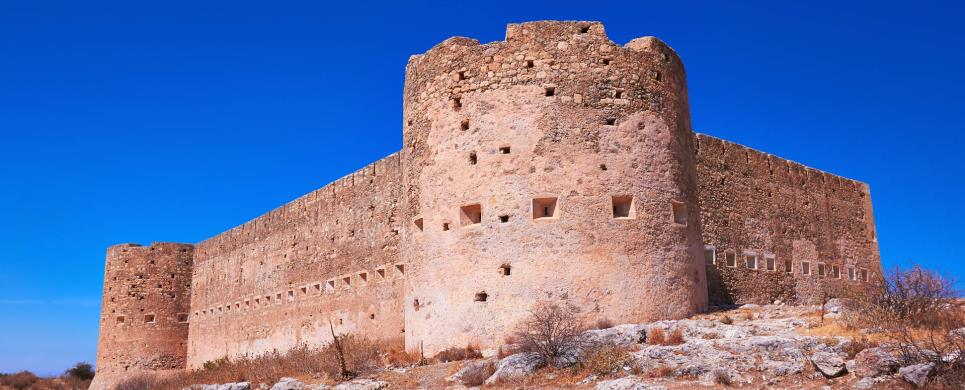
It was destroyed by an earthquake in the 7th century AD and much later, in the
12th century, the Monastery of Hagios Ioannes Theologos (St. John the Baptist) was founded at the site.
The most important monuments of the site are:
- The Roman cisterns
- Bipartite temple, known as the "bipartite sanctuary", dated to the 5th-4th century BC
- Graves of the Geometric-Roman periods
- The fortification walls, preserved to a length of almost 4 kilometres. The main phase of construction belongs to the 4th century BC.
- The Roman bouleuterion
- The Late Byzantine monastery of Hagios Ioannes Theologos (St. John the Baptist)
- The Turkish fortress built in 1866-1869
AXOS (Ancient city) KOULOUKONA
The village of Oaxos, one of the most important cities of ancient Crete, was situated in the area of the modern village of Axos, and flourished from Late Minoan and Geometric up until Roman and consecutive times. Archaeological pick-axes have brought to light many parts of the ancient city including the temple of Aphrodite, the prytaneum, tombs and a variety of archaeological relics. The wall of the acropolis, remains of which can still be seen today on the summit of the hill, must have been of particular grandeur. In 1899, the Italian Archaeological School started excavations, which uncovered a variety of findings such as Minoan potsherds, stone vessels, inscriptions and many figurines of a naked female body, which is believed to portray the goddess of Fertility. Furthermore, remains of buildings dating back to the Classical Period were found, on top of which new constructions had been built, mainly Byzantine churches.
During the latter it accommodated the seat of the Episcopate and boasted a large number of churches. At the place of Livada, north east of the village, remains of archaic times have been found, a fact, which indicates the dimensions of ancient Axos. Another detail implying the importance of Axos is the fact that it had various kinds of currency. Approximately 40 different coins have been recognised, most of which display the head of Apollo or of Zeus, the gods, who were worshipped in ancient Oaxos.
This text is cited Oct 2003 from the Tourism Promotion Committee of Rethymno Prefecture URL below, which contains image.
CHERRONISSOS (Ancient city) CHERSONISSOS
The Romans were the first invaders of Hersonisos and during their
occupation built a large aqueduct as well as an amphitheatre, a harbour and a
fountain. The surviving Roman fountain has mosaics depicting fishermen and it
is near the east end of the harbour. Remains of the Roman mole of the harbour,
one of the best in Crete at this time, are still visible. The Roman quay is on
the eastern part of the harbour, partially submerged. On the northeast side of
the peninsula cuts in the rock are thought to be Roman fish tanks. In Kastri,
on the east side of the peninsula above the church of Agia Paraskevi, was a solidly-built
Roman fort.
This text is cited Feb 2003 from the Crete TOURnet URL below, which contains images.

DIKTINA (Ancient sanctuary) KOLYMBARI
Vritomartis is probably a continuation of Minoan religious beliefs,
and is identified with the goddess Artemis in the Greek pantheon of gods and goddesses.
Diktinna was the most important sanctuary of Vritomartis and a reason for conflict
regarding its control between the powerful cities of Kydonia in Chania and Polirinia
in Kastelli. Vritomartis was worshipped here during the Greek and the Roman era.
The Greek sanctuary has not been identified yet, but the Roman one was visible
from a great distance at sea and many pieces of marble and Roman building remains
were found in its location. Later, in the ninth century the monastery of Agios
Georgios was built here but it was abandoned because of continuous pirate attacks.
Today very little remains to be seen of the Roman site or the monastery. However,
there is a protected bay, a pebble beach, and the boat trip from Kolimbari is
very pleasant.
This text is cited Oct 2002 from the Crete TOURnet URL below, which contains images.
EANI (Ancient city) KOZANI
Aiane, situated south of present-day Kozane,
was the capital of the kingdom of Elimeia
in Upper Macedonia. Extensive ruins of a city inhabited from prehistoric times
to the 1st century BC were discovered and are under excavation on a hill in the
region.
The city was built on the free
system of town-planning, on successive stepped terraces, and had large portico
structures possibly for public use, a circular cistern and other installations
for water supply, as well as numerous private houses. Most buildings were split
on several levels due to the slope of the terrain.
Round the hill there were extensive cemeteries and clusters of graves
dating from the late Bronze Age to the end of the Hellenistic period. In the cemetery
of the Archaic and Classical periods, chamber tombs and cist
graves were found as well as a 'heroon', which must have belonged to members
of the highest social class of the kingdom of Elimeia.
The wealth of grave goods in the tombs, and other finds in the city
area attest the existence of commercial and cultural relations with the rest of
Greece and the flourishing of metal, figurine and pottery workshops. The discovery
of Aiane, already a structured city in Classical times, refutes theories of cultural
isolation of Upper Macedonia at this early period.
By kind permission of:Ekdotike Athenon
This text is cited Nov 2003 from the Macedonian Heritage URL below, which contains image.
EGES (Ancient city) IMATHIA
Vergina is a small village located approximately 12 km northeast of
Veria. It comprises one of
the most significant archaeological sites in Greece. Excavations within the archaeological
site of Vergina began by the French archaeologist L. Heuzey in the 19th century,
however, the Greek archaeologist Manolis Andronikos began systematically excavating
the Tombs of the cemetery during the 50s and 60s. In 1977, he reached a significantly
unique discovery: The Great Tumulus of the Great Tumuli. This discovery confirmed
that this area constituted Aigai, that is, the first capital of Macedonia.
Aigai was renowned for their huge wealth of royal tombs, which were found within
the city's vast necropolis (i.e. cemetery). A section of the findings from the
tombs can be found within Thessaloniki's
Archaeological Museum.
Three Macedonian tombs and one box shaped tomb are comprised within
the Great Tumulus of the Great Tumuli. One of these tombs belonged to King Philip
II of Macedonia (336 B.C.). The appearance of two sarcophaguses made from solid
gold on the tomb's exterior, which contained purple colored bones or bones wrapped
in purple tissue and gold as well as a diadema (i.e. crown) and two ivory portraits,
which depicted Philip II and Alexander, convinced archaeologists that the tomb
belonged to Philip. The two other Macedonian tombs must have belonged to individuals
of high social standing. This is evident from their monumental form, the wealth
of the ex-votoes as well as the quality of the scenes drawn in the tomb's interior.
The box shaped tomb may have possibly belonged to Alexander IV (310 B.C.). Funeral
gifts were not found inside the tomb, since the tomb had been subject to sacrilege.
The surfaces of the sides however, were decorated with wealthy wall paintings.
The northwest side of Vergina contains a series of other royal tombs. Two Macedonian
tombs are comprised, that is, the Roman Tomb which exhibits an Ionic Order (dated
back to the 3rd century B.C.) and the Tomb of Evridiki (340 B.C.). One may distinguish,
within the funeral chambers' interior, marble doors and a marble throne, even
though it is relatively dark. Also, there are three box shaped tombs dated back
to the 5th and 4th century B.C. as well as four graves that are dated to the period
following the Late Archaic Period.
On the northeast side of Vergina, there is an extensive tumuli cemetery,
the renowned necropolis of the early Iron Age (dated 10th - 7th century B.C.),
which is comprised of 300 dirt tumuli. According to evidence from Greek times,
in order for the inhabitants in the area to bury their dead, they used many of
the tombs. This was either done by using simple graves or tombs built from limestone.
According to Plutarch, this cemetery was looted by Galatians during the 3rd century
B.C. The same constructed complex contained within: the Palace which was built
during the Hellenistic period under the reign of Antigone Gonata (278 - 290 B.C.)
and expanded at the end of the 3rd century or beginning of the 2nd century B.C.
It consisted of a huge peristyle court surrounded by a Doric colonnade and pillars
as well as a circular shrine (Domes) that was dedicated to Hercules Patroos. The
floor was paved in decorated by slabs or mosaics within a few of its rooms. Today,
only the foundations have been preserved. The high ground that is located on the
south side of the settlement upon a steep palace hill remains from the Acropolis
walls that have been found. This high ground extended east of the city and included
several sections of the Acropolis and its interior.
This text is cited May 2003 from the Hellenic Ministry of Foreign Affairs URL below.
EGILA (Ancient city) ANTIKYTHIRA
The island's, ancient walled city, the "kastro" or stronghold
of ancient Aigila, lies in the north of the island above the above the bay of
Xeropotamos, once the city’s harbor. Its walls, which date from the Hellenistic
period, have survived in good condition. The city’s ruins cover about 75 acres,
and it probably had about 800-1000 inhabitants. Much of the fortification has
been preserved: in places, the walls stand as much as six meters tall. In the
harbour of Xeropotamos there is a neosoikos - an inclined space or slipway where
the warships from the pirate city were stored. It is carved out of the rock and
in exceptionally good condition; it is one of the few in Greece that have ever
been found preserved in their entirety. The ongoing excavation of the stronghold
has discovered that the fortifications were first built towards the end of the
fourth century BC or the begining of the third century BC. Important repairs were
made during the middle of the third century BC, after an expedition of invaders
from Rhodes devastated the city. It appears that from the begining the castle
was under the control of Falasarna, a well-known city of pirates in Western Crete,
which used it as an obeservatory and isolated outpost. The island's luck changed
between 69 and 67 BC, when the Romans the decided to embark on "an expedition
against piracy" and after the first century BC it seems to have been abandoned.
Throughout the city, archaeologists have found clear evidence of a long history
of war. The majority of the archaeological objects found are residues of war,
such as stone projectiles from small catapaults, arrowheads, and innumerable lead
sling-shots in the shape of almonds. The walls are marked by numerous and extensive
repairs, and in some places the repairs were clearly hasty and improvised.
This text is cited June 2005 from the Community of Antikythira URL below

EGIRA (Ancient city) ACHAIA
Ancient Aigeira (in the province of Achaia) lies on the north coast of the Peloponnese
- roughly opposite Delphi - at the opening of a valley which leads directly into
the Corinthian gulf; together with Pellene, it represents the easternmost city
of the ancient region of Achaia.
Excavated finds revealing human activity and dating to the advanced
late neolithic period have been found on the acropolis hill, which lies 416 m.
above sea level; while excavated remains, in the same location, of a late Mycenaean
settlement of the early 12th century B.C. constitute the beginning of a continuous
settlement. The remains of a mansion and abundant finds point to a settlement
structure, which developed during the period of foreign migrations and can be
situated in the late Mycenaean koine.
In the following period, perhaps already after the 10th century B.C.,
an early Greek sanctuary was erected on the acropolis, a sanctuary which was continually
rebuilt and which continued to be used into the 4th century B.C. A wide spectrum
of votive objects, as well as architectural evidence such as foundation walls
and painted roof tiles, attests to the development of this sacred centre as the
nucleus of the city of Aigeira, a city which, at least in the early period, is
to be connected with the "Hyperesia" of Homeric tradition.
For an evaluation of Aigeira in its prime, that is, at its greatest
extent measuring ca. half a square kilometer and surrounded by a circuit wall,
the excavation results from the theatre terrace in the north, beneath the acropolis
hill, are particularly instructive.
In the course of a thorough new foundation in the hellenistic period,
at about 280 B.C., a monumental, public, sacred civic centre was achieved through
the construction of a theatre and adjacent small temple; this area was continually
rebuilt up until the early Imperial period with further temples and a cult building
dedicated to Tyche. A period of usage prior to that of the theatre-complex is
not to be ruled out for an additional sanctuary to the north, from which foundations
of two further temples are preserved.
In addition to the preserved architectural elements, the sculptural
finds of the 2nd c. B.C., amongst them an over-lifesize head of Zeus by the sculptor
Eukleides, and a draped female conforming to the figure of Tyche, as well as the
mosaic floors of the small temples, attest to the high quality of the fittings
of this space and its buildings.
It is therefore not surprising that even in the 2nd c. A.D. this ensemble
attracted the attention of the travel writer Pausanias, whose short description
absolutely corresponds to the excavated finds.
Two additional public spaces, which currently cannot adequately be
classified, nevertheless at least provide evidence for the complex urban articulation
of the city. Corresponding to this is an extensive infrastructure, which above
all has to do with structures for the provision of water. An aqueduct system which
can be traced for a number of kilometres and which, coming from the south, was
carried over wide stretches through rock tunnels, guaranteed the city's water
supply. This system was continually rebuilt and remained in use from the pre-hellenistic
up until the post-antique period.
Complementing the public and sacred centre, remains of a domestic
building were cut into a terrace directly to the north-west of the acropolis.
An andron, decorated with pebble mosaics and fitted with 11 klinai, attests to
the representative pretension of this building, whose foundation date can provisionally
be placed in the 4th c. B.C. and which in any event predates the construction
of the complex of buildings at the theatre. In spite of sporadic evidence, the
situation of Aigeira for the Roman Imperial period and late antiquity is at the
moment not adequately known.
Research at Aigeira
The discovery of the site and the earliest archaeological investigations date
back to Otto Walter, who, with excavations at the theatre terrace in 1916 and
1925, initiated archaeological research at Aigeira which would have an impact
on the future. As the unstable political situation in Greece only allowed two
short seasons, the research presence of the Austrian Archaeological Institute
(?AI) at Aigeira was in this fashion founded.
The excavation campaigns, from 1972 to 2001 carried out under the
auspices of the central OAI in Wien and since 2002 conducted by the Athens Branch,
have brought to light fundamental evidence concerning the historical development
of this Greek settlement from the late Bronze Age up to the most recent past,
and the appraisal of its material culture.
W. Alzinger led the greatest part of the field research (from 1972-1988),
with systematic surface excavations on the acropolis and on the theatre terrace,
turning aside briefly for excavation in the plain of Palati north of the city.
Besides numerous individual studies on material such as sculpture, ceramic finds,
coins, and the like, as well as the study of the theatre by S. Gogos, a comprehensive
presentation of the historical development of Aigeira has resulted from these
investigations. The remains from the prehistoric and Bronze Age periods found
on the acropolis are currently the focus of intensive research by E. Alram-Stern
(OAW, Myceneaen Commission) and S. Deger-Jalkotzy (OAW, Mycenaean Commission).
Analysis of the ceramic finds from the Greek historical period from the acropolis
excavations is being carried out by G. Schwarz (IKA Graz). Preliminary research
for the final publication of the building elements and the remains from the so-called
Tycheion is the work of T. Hagn (IKA Vienna).
Between the years 1990-1997, A. Bammer pursued a comprehensive urban
survey, and investigated numerous areas of the city via intensive survey, measuring,
and cleaning. These studies incorporate the re-addressing of questions concerning
the water supply, the orientation of numerous extensive public areas, the photographing
of architectural remains from the Byzantine period, and the study of the modern
remains of the so-called "Houses of the Raisin Pickers". A surface excavation
in the plain of Zaoussis led to the partial exposure of the foundations of two
temples north of the theatre terrace.
The most recent excavations by G. Ladstatter (from 1998) continue
the study of the water supply of Aigeira, in connection with hydrogeological studies,
and concentrate on the excavation of the domestic buildings in the plain of Solon
to the north-west of the acropolis.
A selection of objects from the excavations is presented in the Archaeological
Museum at Aigion, while the head of Zeus is displayed in the National Museum at
Athens. The impressive ruins of the theatre with its connected temples, two of
which are protected by a modern shelter, provide an architectural impression of
the hellenistic building ensemble.
Georg Ladstatter. Feb 2004
This text cited Aug 2004 from the Austrian Archaeological Institute's URL http://www.oeai.at/eng/ausland/aigeira.html
which contains 4 images.
ELEA (Ancient city) THESPROTIA
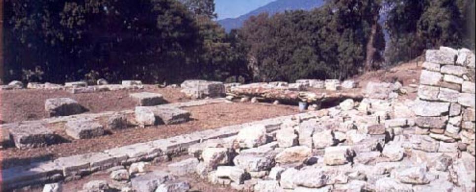
Elea (today's Veliani-Chrysavgi) It identifies with the ruins of an ancient settlement south of Paramythia, east of Chrysavgi. It is about the most important settlement of Eleatida, that is the region between the Necromance and Paramythia, where the tribe of the Eleatean Thesprotoi lived. Fore some decades after its foundation (mid 4 century BC), it was the capital city of Thesprotia and the seat of the "Koino of Thesprotoi" (the Common of the Thesproteans). Its name is confirmed by ancient tradition, inscriptions of the 4 century BC and the coins of the Eleateans (360-340 BC). It is situated on a uphill plane, of an area of 105.000 m, at the top of a mountain of Korila, at an altitude of 460-525m. Its population inside the walls of the settlement totaled 3.000 people. The construction of the walls and the gate at the NE/E side, is monumental. The thickness of its wall is over 4,5m and its height is over 6m, even today. The settlement is crossed from NE to SW by a central arterial road which possibly ended up at the two main gates, the eastern and the south-western. On the left and on the right, there are rectangular buildings.
The construction of the walls and the gate at the NE/E side, is monumental. The thickness of its wall is over 4,5m and its height is over 6m, even today. The settlement is crossed from NE to SW by a central arterial road which possibly ended up at the two main gates, the eastern and the south-western. On the left and on the right, there are rectangular buildings. On the south of the main artery, in a wider rectangular area, framed by the excavated arcade, the theater and some other buildings, were used as a political market place. At the theater, a few seats and the ruins of the walls of the stage survive in place. The large diameter of the hollow was 45-50m, its height 8-9m and it had a capacity of 3/4.000 spectators. The excavations in Elea, which started in 1985, have revealed a an arcade of the Hellenistic era, west of the theater, semi-underground storage areas, a small temple and a very big public building.
This text is cited Jan 2003 from the Thesprotia Prefecture Tourism Promotional Committee URL below, which contains images.


ELEFTHERNA (Ancient city) ARKADI
The village of Eleftherna is 24km southeast from Rethimnon on a road
right at Viran Episkopi (14km) of the Rethimnon - Iraklion highway. Route: Rethimnon
- Viran Episkopi - Skouloufia - Eleftherna. Eleftherna is one of the most important
ancient locations in Crete and one of the largest sites, occupying a large area
across two hills. Inhabited from Minoan times, it reached its peak and flourished
during the Greek and Roman through to the Byzantine periods. Remains from all
those eras can be seen in the area. Recently archaeologists discovered traces
of human sacrifice dating from the late eighth century B.C. In the Archaeological
Museum of Rethimnon there is a display of articles from the excavation.
Monuments:
Roman Remains:
Several sites from all the eras are currently been excavated by the University
of Crete. Greek carved stone cisterns
and Roman aqueducts are in the area, as are Byzantine churches of the early Christian
period. To find the cisterns walk from Ancient Eleftherna towards the acropolis.
After you pass the large Roman
tower at the entrance of the acropolis, look for a path on the left side of
the acropolis going directly down. After a few metres of descent you are on a
path that goes around the acropolis. Take the path backwards and you will see
two sets of very large cisterns cut deep into the rock and supported by hewn rock
pillars.
Hellenistic Remains:
An incredible bridge
from the Hellenistic era has survived and is still in a good state of preservation
in the valley. It is triangular and is made of large stones. It is still usable
and you have to walk over it before you descend to observe it.
First Byzantine Period
Church: For the Byzantine church take the path forward, going by the path
that brought you down from the acropolis and after a while you will see a gate
higher up. Climb through the gate and you will soon see the remainders
of a church of the first Byzantine period. A cemetery of the Early Iron Age has
also been excavated and has been invaluable in the formation of theories about
the burial practices of the era.
This extract is cited Nov 2002 from the Crete TOURnet URL below, which contains images.
Excavations in the area of Eleftherna were started 16 years ago, in 1985, when the Department of Archaeology and History of Art of the University of Crete started research on the ancient city and subsequently brought it to light, of which philological texts had already given mention.
As early as 1929, H. Payne, the director of the British Archaeological School, had also carried out minor research in the area. Remains were discovered in the wider area of the two contemporary and neighbouring villages of Eleftherna and Ancient Eleftherna, which are situated in the northern foothills of Psiloritis, at a distance of 24 and 29 kilometres respectively from the town of Rethymno. More specifically, the most important findings have been discovered at three places on a hill, which is situated between two converging streams: at the place of Orthi Petra on the west side of the hill (excavation section III), at the place of Pyrgi on the summit of the hill (excavation section II) and at the place of Katsivelos on the north side of the hill (excavation section I). Further important findings have been discovered in the area of Nisi, near the modern village of "Eleftherna", which mainly include remains of a settlement of the Hellenistic Period. At the place of Orthi Petra, Professor N. Stampolidis, archaeologist and leader of the excavating team, brought to light a necropolis dating back to the Geometric and Ancient Period, as well as Hellenistic and Roman buildings and streets, which had been built on top of earlier constructions. At the place of Pyrgi, on the summit of the hill, where the centre of the ancient city is believed to have been, the archaeologist Professor Ath. Kalpaxis has discovered parts of buildings of the Roman and Early Christian Period.
On the east side of the hill, in the area of the modern village of "Ancient Eleftherna", the archaeologist, Professor P. Themelis, discovered a part of the settlement showing all the chronological stages from Pre-historical to Early Christian times. Among others, Hellenistic supporting walls, Roman buildings and baths have been discovered as well as an early Christian basilica with three aisles, boasting a narthex and a superb mosaic displaying geometric and floral motifs.
This text is cited Feb 2003 from the Tourism Promotion Committee of Rethymno Prefecture URL below, which contains images.
ELYROS (Ancient city) ANATOLIKO SELINO
The site of the ancient Greek city of Elyros is 500 metres above this
village on the Kefala hill, above the road to Sougia, and is presently unexcavated.
Elyros was one of the most important Greek cities in western Crete. It was an
industrial and commercial city which had factories for weaponry production. Sougia
and Lissos were its harbours. Elyros was also important during Roman and Byzantine
times. A Roman statue, the Philosopher of Elyros was excavated here and is now
in the Archaeological Museum of Chania. It was the seat of an Archbishop and the
remains of the bishopric church, a sixth century basilica, can still be seen in
the centre of the old city. A larger, modern church marks the site of Elyros on
a small hill, just after the bypass of the branch to Rodovani. Very little is
to be seen at the site itself. However, you have a superb view of the valleys
below that belonged to Elyros as far as Sougia. The Elyrians could see their boats
in Sougia from their city. The highest peaks of the Lefka Ori are visible to the
east. The olive trees and the villages situated among them dominate the north
view.
This text is cited Oct 2002 from the Crete TOURnet URL below, which contains images.
ETIS (Ancient city) SITIA
Tel: +30 28430 23917
On a small headland called Trypetos, 3km to the east of modern
Seteia lies a city of the Hellenistic period (middle of 4th - middle of 1st century BC), most probably
identified with the ancient city of Eteia. A Hellenistic dockyard has been uncovered
at the east coast of the headland. It is known that in 1960 the owners of the
land created plots for cultivation using digging machines which caused severe
damage to the buried antiquities. Since 1987 a systematic excavation has been
conducted by the Ephorate of Antiquities, under the direction of N. Papadakis.
The dockyard lies at the south edge of the east side of the headland
called "Karavopetra" or "Trypetos". It is unroofed, hewn out of the rock and is
rectangular in shape (30m. long, 5.50 m. wide, and 5 m. high). The floor is slightly
inclined towards the sea (15-30 degrees) and does not continue under the sea level,
but this is due to the geological changes that have taken place in the past centuries.
The ship which would be sheltered under this structure during winter time, must
have been of a medium size. Carvings on the surface of the rock indicate the existence
of a wooden "bolt" for the fastening of the ship. Other parts of the building,
such as floor, saddle roof and towing machines were made of wood and have not
been preserved.
The Hellenistic city covers the whole of the headland and was built
on terraces, following the terrain. The south side was protected by a massive
wall, which separates the main area of the headland from the mainland. The wall
is built of cobblestones and its width reaches 1,8 m. on the uncovered sections.
Along the inner side are rooms and other structures, parts of houses and military
installations. The most important room seems to be a hall measuring 7,5 x 5 m.,
at the centre of which lies a rectangular hearth, formed by the surface of the
bedrock, enclosed by poros slabs smoothed outside. Behind the south side of the
hearth there is a small poros bench with an oblong cutting in the middle, which
contained the lower part of a poros plug, undoubtedly part of a relief or statuette
relating to cult practice at the hearth. A U-shaped built bench surrounding the
hearth was attached to the wall; it was probably used as a seat by the inhabitants.
Also uncovered were a storeroom, a cistern lined with hydraulic stucco, and stone
paved streets, one of which separates two neighbourhoods. Among the most important
finds is a series of coins cut by this city, which had its own mint.
FALASARNA (Ancient city) CHANIA
The ancient city of Falasarna is being excavated. The excavations
have exposed some of the walls and buildings of the city. The geographical shift
(rise) of Crete has put the ancient harbour on dry land. Falasarna was a commercial
naval power during the Hellenistic period and also the harbour of Polirinia. An
interesting throne, carved out of rock, is on the dirt track as you enter the
ancient city. The acropolis of the city was on the peninsula in front, on top
of the hill. The fortification walls around the hill are still visible. The harbour
was just below the fortifications, on the south side of the peninsula. There are
no signs of the harbour now, since it is above ground. There were two towers,
one on the north and one on the south side of the harbour dating from the fourth
century B.C. A second channel allowed an exit from the harbour on the bay at the
north side of the acropolis, 100 metres further on. It is assumed that this was
a pirate stronghold at one time.
This text is cited Oct 2002 from the Crete TOURnet URL below, which contains images.
FANE (Ancient city) CHIOS
The excavations carried out in the locality of Kato Fana, by the English Archeological School in collaboration with Koutouriotis, revealed an important center of adoration that had been active since the 9th century BC. During the Byzantine Age, however, this place was transformed into a center of Christian devotion and so, today, there is the church of Agios Theodoros.
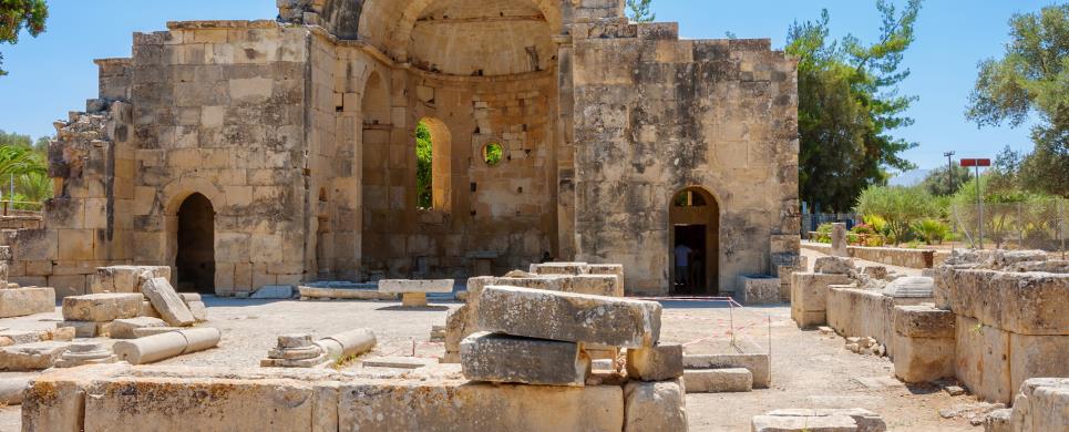
GORTYS (Ancient city) HERAKLIO
Tel: +30 28920 31144
Gortyna was first inhabited at the end of the Neolithic period (3000 BC)
and by the Late Minoan period (1600-1100 BC) it became a flourishing settlement.
Remains of the Archaic period (7th century BC) were located in the area of the Acropolis,
while the large inscription, the Gortyn Law Code, dated to the 5th century BC, attests
the prosperity of the city, which continued throughout the historical times. However
Gortyna reached its peak during the Roman era (1st - 5th centuries AD), as an ally of
Rome and the capital of the Roman provinces of Crete and
Cyrene.
The city remained an important center of Crete in the following Early Byzantine
period and, according to tradition, it was the first Cretan city which espoused Christianity.
Gortyna became the seat of the first bishop of Crete, Apostle Titus, to whom was dedicated
a monumental temple. The conquest of Crete by the Arabs put an end to the history of the
ancient Gortyna, which was destroyed in 824 AD.
The first archaeological research on the site was conducted in 1884 by the
Italian archaeologist F. Halbherr. Since then, excavations have been carried out
by the Italian Archaeological School and the local Archaeological Service.
The most important monuments of the site are:
- The Odeion.
It is a typical Roman theatre of the 1st century AD with two entrances on the north side and an almost semicircular
orchestra. The north wall of the formerly raised skene (stage) had four niches for statues. Only three rows of the cavea
benches are preserved.
- The Gortyna Law Code.
The inscription with the Code is to be seen in the north round wall of the Odeion, sheltered in a small structure. It is a
complete code of law, based on Minoan tradition, which survives in the Doric city of the historical times. Dated to 450 BC.
- Isieion.
The sanctuary of the Egyptian Divinities (1st-2nd centuries AD) is a rectangular area dedicated to the cult of many gods,
such as Isis, Serapis-Zeus and Anubis-Hermes. It had an underground cistern. The cult statues of the gods stood on an oblong
podium with crepis.
- Temple of Apollo Pythios.
It was built in the Archaic period (7th century BC) and originally was a rectangular house with a treasury. In the following,
Hellenistic and Roman periods (4th century BC-2nd century AD) several additions were made to the building, including the prodomos,
the colonnades, and a conch which sheltered the statue of Pythios Apollo.
- The Praetorium was the seat
and residence of the proconsul of Crete. It is divided into two parts: the administrative section, in which the central building is the basilica,
and the residential section. The preserved ruins are dated to the 2nd century AD and seem to have been repaired in the 4th century AD.
- The northeastern cistern and the Nymphaeum. They lie immediately to the north of the Praetorium. The first cistern
was a rectangular, open-air structure with conches on all sides, where the statues of Nymphs were placed. It was converted into a vaulted
cistern in the 7th century AD.
- The Acropolis on the hill of Aghios Ioannes. Large sections of a polygonal fortification wall are preserved with towers at the
corners (10th-6th centuries BC). Within the enclosed area there was an Archaic temple, on the ruins of which an Early Christian basilica was
later erected.
- The Church of St. Titus.
It is a cross - shaped three - aisled basilica with cupola; the northern and the southern arm of the cross end up in conchs. The church was
built with rectangular hewn stones and is dated in the 7th century AD. It was destroyed by the Arabs in 824 AD and rebuilt after the recapture
of Crete by the Byzantines during the 10th century.
- Triconch church founded probably over the tomb of the Ten Cretan Martyrs. The narthex communicates through a tribelon
with the central rectangular part of the church. The mosaic floor and the remaining capitals are exquisite. The church is dated in the 5th century AD.
Travellers located the city of ancient Elis in the 19th century and indeed
prepared topographical plans. The first systematic excavations were conducted
by the Austrian Archaeological Institute between 1911 and 1914, under the direction
of Otto Walter. Since 1960 excavations have been continued intermittently by
the Archaeological Society at Athens. Rescue excavations carried out by the
VIIth Ephorate of Prehistoric and Classical Antiquities, between 1965 and 1970,
when the irrigation channel of the Peneius dam was being constructed, uncovered
part of the ancient city.
The following buildings were revealed or located and subsequently identified
on the basis of Pausanias' descriptions: Gymnasium, which has not been excavated
but seems to have had the same dimensions as that of Olympia (approx. 200m long);
Baths, to the west of the agora; Temenos of Achilles; Hellanodikaion; 'Southward'
Stoa; 'Corcyraian' Stoa, which was the south border of the agora; various small
sanctuaries; a square building with internal peristyle cort where the sixteen
Eleian women wove the peplos of Hera; a section of the peribolos (enclosure)
of the temenos of Aphrodite; another peribolos of the sanctuary, a small temple
and precincts, among them one of Hades; and finally the theatre to the north
of the agora.
The theatre was built in the 4th century BC and remodelled in Hellenistic and
Roman times. The stoneskin with the proscenium and the paraskenia are among the
oldest in ancient Greece. The audience did not sit in seats but on the hill slope,
just as they did in the stadium of Olympia. Six stone stairways gave access to
the cavea and divided it into seven cunei. An elaborate drainage network safeguarded
the theatre from the danger of flooding. The theatre ceased to function in late
Roman times, when the city in general went into decline, and a cemetary with clusters
of cist and tile-roofed graves was created here.
The Elis Archaeological Collection
Founded in 1981, the Collection includes finds brought to light
in the excavations in Elis. These date from the Early Helladic period to the Roman
Age. Vases, statues, sculptures, funerary stelai, teracotta adn stone architectural
members, figurines, bronze vessels, weapons, coins and other minor objects are
exhibited.
Of particular interest are the broze theatre 'tickets', inscribed with the designation
FA(ΛΕΙΩΝ), meaning 'of the Faleioi', i.e. Eleians, which were found in
large number and date from the late 4th century BC, as well as the teracotta face
masks and the female figurines, which are excellent examples of Eleian coroplastic
art.
Outstanding are the two sections of mosaic floors displayed in the atrium of the
Archaeological Collection. They come from a large villa of the 3rd century AD,
built to the southwest of the agora of Elis. The representations are in circular
arrangement: on one the relate to the Nine Muses and on the other to the Labours
of Herakles.
Xeni Arapoyanni, ed.
Translation by: Alexandra Doumas
Cited Sep 2002, from the Municipality of Amaliada information pamphlet

KATOCHI (Small town) IERA POLIS MESSOLONGIOU
On the west of the village, there is a rocky hill with oak trees, where the remains of the ancient city of Oiniades are situated.
KOMMOS (Beach) HERAKLIO
This is the site of on-going archaeological excavations of a Minoan
settlement on a very beautiful sandy beach east of Matala. Kommos was a Minoan
harbour from the early time of Minoan civilization. It was probably the major
port of entry in the Mesara Plain, and monumental buildings near the shore and
paved roads towards Mesara suggest a customs house. Remains from the Greek era
have also been found in Kommos. A temple built here in the tenth century B.C.
is one of the oldest known in Greece. Remainders of later temples dating from
the fourth to the first century B.C. are now visible.
This text is cited Feb 2003 from the Crete TOURnet URL below, which contains images.
KYDONIA (Ancient city) CHANIA
Tel: +30 28210 44418
Fax: +30 28210 94487
(Archeological research in the region of Kasteli Hania). Excavations, begun in 1964 and continuing up to the present time in collaboration with the Swedish Archeological School, have rendered invaluable evidence concerning the city. This shows Kasteli as an archaic centre of life and civilisation. Sections of two roads, one square and four houses have been unearthed in an area of 550 m2 and at a depth of 2m. Within the excavated area can be seen storage rooms, living quarters, a two-flight staircase, corridors, a kitchen with a cooking site, and a loom, as proven by several weaving weights found there. Equally important are the fragments of clay tablets in linear A scripture, seals made of clay and the unique seal known as “Master impression” depicting a multi-storeyed building complex in a rocky coastal landscape crowned with horns. A male figure, in a domineering pose, stands at the top.
This text is cited Oct 2003 from the Municipality of Chania URL below, which contains images.
LEVIN (Ancient city) GORTYNA
Tel: +30 2810 226470, 226092, 224630, 288484
Fax: +30 2810 241515, 288484
LOUSSES (Ancient city) KALAVRYTA
Ancient Lousoi (province of Achaia, Peloponnese), is located on the slopes of
the high valley of Sudena near Kalavrita at an alitude of ca. 1200 m. above sea
level, and in antiquity belonged to the region of Arcadia.
After the discovery of the sanctuary of Artemis Hemera in Lousoi by
W. Dorpfeld and A. Wilhelm in 1897, the sister-institute of the Austrian Archaeological
Institute (OAI) in Athens carried out the first excavations in three campaigns
during 1898 and 1899, under the direction of W. Reichel and A. Wilhelm.
In the sanctuary which extended over two terraced areas, the foundations
of numerous structures were nearly completely exposed, structures which exemplify
the necessary infrastructure of a small rural sanctuary of the 3rd century B.C.
The central building of the sanctuary, the temple of Artemis, was located on the
southern terrace, the higher one; its noteworthy groundplan consists of a central
naos and colonnades connected at the sides. Constructions on the slightly lower
northern terrace accompanied the road to the sanctuary, and according to the interpretation
of the excavators included a fountain house, a "propylon" (gateway) and a "bouleuterion"
(council building). The rapid publication of the architectural elements, as well
as the finds, which include votives connected to the cult of Artemis represents
even today the primary focus of research at the sanctuary.
As part of the excavations, which were renewed in 1980 under the direction
of V. Mitsopoulos-Leon and which continue to date, a survey of the architectural
remains of the extensive settlement area visible in the region has been undertaken
(F. Glaser). To this end, systematic field research has concentrated on excavations
in the sanctuary of Artemis and on the uncovering of domestic housing in the region
of Phournoi, as well as on the measurement of the remains of public structures
in the area called "stadion".
In the sanctuary, the finds recovered from undisturbed stratigraphic
layers reveal the early phase of the cult of Artemis. From the analysis of the
broad spectrum of votive gifts such as bronze jewellery, small figural bronzes
and terracottas, lead and bone votives (V. Mitsopoulos-Leon, Ch. Schauer), pyxides
for the cult and miniature vessels (Ch. Schauer), it is clear that, for the late
geometric and archaic periods, this sanctuary played a leading transregional role,
when seen against the back of similar sacral places. The discovery of the so-called
East Building expands the picture of the architectural layout of the temple terrace,
and points to a possible predecessor of the 4th c. B.C. The complete clearing
of the temple foundations and the search for architectural elements enable to
a great extent the reconstruction and classification of this building from the
turn of the 4th-3rd century B.C. or slightly afterwards. The structure, which
consists of a marble architectural order at the front and in the cella, is divided
into a naos, consisting of pronaos, cella and adyton, and into lateral colonnades
at the sides, comprising a unique solution for a sacred building (G. Ladstatter).
With the excavated remains of two houses from the area of Phournoi,
extending over two terraces, the hellenistic domestic culture of Lousoi can be
clarified. Neither the eastern peristyle house, which probably represents an adaptation
of one or more earlier structures, nor the simpler house to the west, embody canonical
groundplans. Furthermore, the room inventories, with their klinai, bath tubs,
and hearths, indicate a relatively elevated standard of living. The troughs for
wine production located near the domestic area, the evidence for the working of
bones and of ceramic production, as well as storage rooms, point to predominantly
agrarian resources as the economic basis of the people of Lousoi. From a rebuilding,
incorporating numerous stretches of walls, which occurred after the houses were
destroyed all at once probably in the 1st cent. A.D., it can be seen that the
area continued to be used until the late Imperial period.
The preliminary results of a survey in the region called "stadion"
point to a monumental public building in this area. The foundations of a two-aisled
stoa, further traces of walls arranged in a rectangular ground plan, as well as
massive worked ashlar blocks suggest that the remains of a hellenistic civic square
should be identified here.
From this research, beginning with the development of the sanctuary
in the late 8th century B.C., followed by a hellenistic civic settlement covering
an extensive built up area and with the outgoing use of the site in the late Roman
period, important stages of the historical development of the settlement of Lousoi
can be recognised.
The foundations of the Artemis sanctuary and the groundplans of the
houses are visible high above the valley in an impressive location. Until the
construction of a museum at the site, the most important finds are kept in the
Ephorate in Patras.
Veronika Mitsopoulos-Leon Feb 2004
This text cited Aug 2004 from the Austrian Archaeological Institute's URL http://www.oeai.at/eng/ausland/lousoi.html
which contains 3 images and bibliography.
LYKTOS (Ancient city) KASTELI
Lyttos was one of most ancient and powerful cities of the Greek (Doric)
era. Its territory was from the north to the south of Crete, extending to the
Lassithi Plateau. Its harbour was Hersonisos. Lyttos was one of the most aggressive
city states of the Hellenic era and it was continually at war with Knossos and
Gortyn. In 220 B.C. it expedited against Ierapytna, the strong city state in the
site of today's Ierapetra, leaving the city with little protection. The Knosseans
found the opportunity to occupy and destroy the city completely. The city was
later rebuilt, however, and put up strong resistance to the Romans. Today few
remains can yet be seen from recently-begun excavations of the site. However,
the site has a commanding view of the valley below and the mountains of Lassithi
making it worthwhile to visit. In Roman times the city flourished again. Today
a part of the formidable Roman wall that enclosed the city is visible. Many statues
were found here.
This extract is cited Feb 2003 from the Crete TOURnet URL below, which contains images.

MALIA (Small town) HERAKLIO
Tel: +30 28970 31597
Human presence at Malia
during the Neolithic period (6000-3000 BC) is attested only by potsherds, but
habitation was continuous from the middle of the 3rd millennium BC until the
end of Prehistory. Houses of a Prepalatial settlement (2500-2000 BC) have been
found under the palace, while graves of the same period are located near the sea.
The first palace was built in around 2000-1900 BC. The already existing significant
settlement of which are preserved parts around the palace, was then converted
into a palatial centre-city. The palace was destroyed in around 1700 BC and
rebuilt in 1650 BC at the same site, following the plan of the older palace,
while a few changes took place 50 years later. The destruction of the new palace
came in c. 1450 BC, along with the destruction of the other Minoan palatial
centres. The site was reoccupied for a short period in the 14th-13th century BC
Remains of a Roman settlement cover an extensive area at the site called "Marmara",
where a basilica of the 6th century is also preserved.
The English admiral Th. Spratt, who travelled in Crete in the middle
of the 19th century, reports the finding of gold sheets at the site "Helleniko
Livadi". In 1915, Joseph Chatzidakis started a trial excavation on the hill called
"Azymo", and brought to light the southern half of the west wing of the palace,
as well as the tombs by the sea, but he stopped the investigation. Finally, the
French School of Archaeology at Athens resumed the excavations, which are continued
until today with intervals, at the palace, the sectors of the town and the cemeteries
on the coast. The results have been published in the series of "Etudes Cretoises"
since 1928, and in the works of H. Van Effenterre and O. Pelon. The finds are
exhibited in the Museum
of Herakleion, and some in the Museum
of Aghios Nikolaos.
The most important buildings of the site are:
The Palace. The largest part of the ruins visible
today belongs to the New Palace period; of the first palace only a section is
preserved, to the NW of the building, while a small oblique structure in the north
court dates to the Post-palatial period. Access to the palace today is through
the west paved court, which is crossed by slightly raised paths, the so-called
"processional ways". Every side of the complex had an entrance, but the main ones
were those in the north and south wings.
The palace is arranged around the central court, which had porticos on
the north and east sides, and an altar at the centre.
The largest and most important part of the palace is the two-storeyed
west wing with cult and official appartments, and extensive magazines. Impressive
is the Loggia, a raised hall opening to the court, and the rooms to the west,
all related with cult practice, the "pillar crypt" with an antechamber, also of religious character,
and between these two, the grand staircase leading to the upper floor. Another broad
flight of steps, possibly used as a theatral area, is located to the SW of
the central court, beside the famous "kernos" of Malia.
The south wing, also two-storeyed, included habitation
rooms and guests' rooms, a small shrine, and the monumental paved south entrance
to the palace that led directly to the central court.
The SW corner of the of the palatial complex is occupied by eight circular
structures used for the storage of grain (silos).
The east wing is almost completely occupied by magazines of liquids,
with low platforms on which stood pithoi (large storage vessels), and a system
of channels and receptacles to collect liquids.
Behind the north stoa of the central court is the "hypostyle hall" and its
antechamber. Above these rooms, on the upper storey, there was a hall of equal
size, interpreted as a ceremonial banquet hall. To the west of these rooms, a
stone paved corridor connects the central court with the north court, which is
surrounded by workshops and storerooms, and with the NW court, also called "court
of the dungeon". To the west of this lie the official rooms of the palace: at
the centre, the reception hall with the typical Minoan polythyra, and behind this,
the sunken lustral basin.
The palace is surrounded by the town, one of the most important Minoan
towns in Crete. To the north of the west court is the agora and the curious "hypostyle
crypt", which has been interpreted as a kind of council chamber, connected with
the prytaneia of historic times.
The most important of the excavated sectors of the town and isolated
houses are sector Z, houses E, Da, and Db; very important is sector M, dated to
the First Palace period, which covers an area of c. 3,000 sq.m. and is actually
the most important settlement of this period in Crete. The unusually extensive
buildings of this neighbourhood included religious, official, and storage rooms,
and workshops, and it seems that in general, it had functions similar to those
of the palace.
The cemetery of the First Palace period is located
to the NE of the palace, near the north coast. The most important of the graves
found is the large burial complex called Chryssolakkos, which yielded the famous
gold bee pendant.
MEGALOPOLIS (Ancient city) ARCADIA
MESSINI (Ancient city) ITHOMI
It had been built by the feet of the mountain of Ithomi in 369 B.C., where the prehistoric Ithomi was, by the Theban general Epaminondas with the help of Epitelis from Argos. It was erected as a shelter for the settlement of refugees from Messinia and Arkadia and in order to create a powerful city to counterbalance the sovereignty of Sparta. The city was protected by a circular symmetrical wall built with huge stones which were 2-2,5 m. wide and 4,5 m. high. Its perimeter extended for 9,024 m. and followed the two slopes of Mount Ithomi which was a place of worship for Ithomata Dia (Zeus). In terms of structure the wall is considered to be one of the best examples of architecture and fortification of the fourth century B.C. with two gates; the eastern, the Lakoniki and the northwestern, the Arkadiki. The Arkadiki Gate had two doors and a big circular yard was included inside while the wall had ramparts and overlooking turrets at intervals as well as embrasures on two different levels.
The centre of the town was in the place of the contemporary village Mavromati while in the Agora, according to what has been Knhwn until 1986 and what comes to light with the excavations on the area of ancient Messini by the professor in the University of Crete, Petros Themelis, was the source of Arsinoe or Kallirroi Krini. In the archaeological site there is the Asklaepeio, holy sanctuaries of Poseidon, Aphrodite and Demeter, statues of the Mother of gods (attributed to the Messinian artist Damofondas), Lafias Artemidos, Elitheias, the Dioskouri, a monument to honor Aristomenis, the Gymnasium and the Sevasteio or Kesharion, a building dedicated( from 14 A.D) to the worship of Roman emperors.
Skeletons of Synedrio, Alexandrianis era and Ierothisiou have been found close to the Agora as well as statues of all the gods and goddesses of ancient Greece and of the founder of the city, general Epaminondas, and ruins of the theatre, the Vouleftirio and the stadium. It was the capital of the federation of messinian cities (338-191 B.C) and reached its heyday during the Achaic and Aetolic confederacy.
This text is cited March 2003 from the Messenia Prefecture Tourism Promotion Commission URL below, which contains image.
From 1987, that professor Petros Themelis began the excavations, till now, there have been found:
Two sanctuaries on the SW slope of mount Ithome.
The N side of the market-place.
The sanctuaries of Demeter and the Dioscouri.
The sanctuary of Artemis Orthia (standing).
The N wing of the Asclepion.
A public bath.
Two rooms of Roman buildings.
Part of the Hierothesion.
The stadium and the gymnasium.
The shrine of Heracles and Hermes with their statues of worship.
The Heroon, a Doric temple in the stadium.
The ancient theatre.
The water-basin Arsinoe, where the village Mavromati takes water from. Behind the water-basin there was found a sanctuary of Acheloous. (source: Publication of the Prefectural government of Messenia).
MYCENAE (Mycenean palace) ARGOLIS
Mycenae was the center of the Mycenaean Civilization during the period
that Greece prospered, that is, the Bronze Age. Mycenae, with all its wild beauty,
is located in the northern section of the Argolic Gulf and has been built at the
top of a fortified hill. This location comprised a transport intersection. Homer
refers to Mycenae as "polychryses" and "efktimenes", meaning well built with multiple
gold. Perseus (son of Zeus and Danae) is said to have built Mycenae in 1500 B.C.
Under the Atreides' Dynasty, Mycenae reached great prosperity. King Atreus was
the leader of the Greeks in their crusade to Troy.
In 468 B.C., the people of Argos destroyed Mycenae and Tiryns.
Since then, the buildings' ruins were covered with dirt. The excavations within
the Mycenaean site began in 1841. H. Schliemann began excavating Grave Circle
A. The work of the Archaeology Service in conjunction with P. Stamatakis, Ch.
Tsountas, J. Papadimitriou, N. Verdelis, G. Mylonas, S. Iakovides as well as the
British School of Archaeology of Athens (A.J. B, Wace, W. Taylor) maintains great
significance.
Mycenae was comprised within a Citadel or an Acropolis during the
period of prosperity, which could be accessed only through the renowned Lion Gate
(it was named after the pictured sculpture) from the Lower City, which was also
encased within the surrounding settlements that were found outside the walls.
The Acropolis Wall was built between 1350 - 1300 B.C. and was comprised of a rectangular
stone cube (Cyclopean Fortification wall). The Palace of Atreides as well as the
framework of a Doric Temple that was built in place of a Mycenaean Palace were
located at the Citadel's peak. The most noteworthy area is the Royal Cemetery,
which was protected by a circular surrounding wall. Schliemann discovered five
shaft graves (1876) and P. Stamatakis uncovered the sixth (1877). On the east
side of the Citadel, remains of many Mycenaean buildings are found, the largest
of which is the House with the columns. This comprises the central section of
the Palace's east aisle, which was surrounded by warehouses, workshops, shops
and the Residences of the Officials. The southeastern side of the hill was constructed
in 1225 B.C., a tunnel of circular inner walls that led to an underground cistern
fed by the Persian Spring (12 meters in depth) that was used for the purpose of
ensuring water in the event of a siege.
There was a series of houses in the Lower City of Mycenae, such as
the House of Shields (Aspidon), the House of an olive-oil trader (13th century),
which was found in 1950 upon which tile was used that illustrated linear graphics
as well as the House of Sphinxes. Today, only their foundations have been preserved.
The famous Tomb of Agamemnon or Treasury of Atreus is found in the Lower City.
It was agreed that it would be referred to as such even though it was constructed
in 1350 B.C. and belongs to a King that followed. A narrow path carved into a
cliff leads to a colonnade and lintel that are formed by two massive blocs. The
arched booth continues, which comprises a circular hall that is shaped like a
beehive. The Tholos is comprised of 33 successive rings built in accordance with
the bearing system, thus resulting in the fact that the peak can only be closed
by one slab. A passage leads to a side hall (ossuary). The tomb walls are covered
by bronze slabs and the entire structure is covered with dirt. To the right of
the Treasury of Atreus is Clytmenestra's Tomb and the Aegisthus in addition to
a fourth tomb, a little older and near the Lion Gate. Additional tombs were uncovered
in 1902 by J. Papadimitriou. Numerous tombs are located on the west side of the
hill with the Treasury of Atreus (Tomb of Spirits, the Hill of Panagia, Epano
Phournos and Kato Phournos).
This text is cited May 2003 from the Hellenic Ministry of Foreign Affairs URL below.
OLYNTHOS (Ancient city) HALKIDIKI
Olynthos, whose pre-Hellenic name means wild fig-tree, was founded
in the 7th century BC in Chalkidike
by the Bottiaioi. The city, built on a hill according to the free
system of town-planning, was destroyed in 479 BC by the Persians, who turned
it over to the Chalkidians.
In 432 BC the king of Macedonia Perdikkas II persuaded the Chalkidian
cities to desert the Athenian
Confederacy and form the Chalkidian
League. The inhabitants of these cities abandoned their homes for security
reasons and settled at Olynthos.
In order to accommodate the Chalkidians, the city was rebuilt on a
hill north of its former site. There, as seat of the Chalkidian League, it prospered.
At the end of the 5th century BC it had 15,000 inhabitants, and in the first half
of the following century it became the foremost city of the Chalkidian Peninsula.
Classical Olynthos was laid out according to the Hippodameian
system and was surrounded by walls. The wide avenues and large well-built
houses,
decorated with mosaic
floors and plastered walls, indicate the prosperity of the city. Olynthos tried
to resist the expansionist
schemes of Philip
II, and as a result was entirely destroyed in 348 BC.
By kind permission of:Ekdotike Athenon
This text is cited Nov 2003 from the Macedonian Heritage URL below, which contains image.
ORCHOMENOS (Ancient city) LEVIDI
ORCHOMENOS (Archaeological site) VIOTIA
The project is under the auspices of the Athens Section of the Deutsches Archaologisches Institut.
PALEROS (Ancient city) ETOLOAKARNANIA
The most important site is the ancient city of Paleros which was situated
in the current position of Κechropoula in the SE of the peninsula. The city is
believed to exist since the Mycenaean period.
Evidence of that are the walls of the city, part of it belongs to
the second millennium B.C.
The construction of the walls varies between trapezium and polygon
system and they belong to different time periods. The oldest part of the walls
belongs to the Mycenaean period. The port of ancient Paleros was situated in the
current position of Pogonia,
in the SE part of the peninsula. Ruins of marine construction have been found
East of the village.
The fortress was constructed in the middle of 5th century; some believe
is identical to the ancient city of Sollion,
colony of the Corinthians. Today, in that location still exist ruins and the views
of historians regarding the fortress of sterna vary, if there was an ancient city
and what was its name. Others place Sollio, others Νiriko, others place in Sterna
another ancient city with great power. For this opinion substantiates the fact
of the position in which the fortress is located, from which one can have control
of a vast area. Sollio was a marine base of Corinthos, was conquered during the
Peloponnesian war by the Athenians and according to Thoukidides ( 430 B.C.) came
under the control of Palerians-Akarnanians.
The strategic interests of the Athenians from 454 B.C. bring many
conflicts in which the Akarnanian cities are involved during 5th century B.C.
Akarnania during the Peloponnesian war is on the side of the Athenians and at
the end of 5th century B.C. gains power.
North of the city of Paleros is situated lake Voulkaria, or lake Μyrtountion
according to Stavronas. Lake probably leftover of the salt lake that occupied
today’s valley of Paleros during Homer’s time. The salt lake according to the
tradition was the saviour of Queen Cleopatra, when during the battle of Aktion
hunted by her seekers passed with her ships the shallow channel of Paleros. Memory
of the passage of Cleopatra queen of Egypt is the preservation of the name of
the ancient passage as "dock of Cleopatra".
After the victory of Romans in 31 A.D., the prints of ancient Paleros
are lost and historically this is explained by the establishment of Nicopolis
after the battle of Aktio.
The founding of Nicopolis in 30 A.D. is an important event for the distribution
of the population and the whole economy of Aitoloakarnania. The surrounding cities
loose a big part of their potential, as a result they became satellites of the
new Metropolis, this way Ακαrnania
became territorioum of this new city.
Under Trian rule whole of Akarnania belonged to the Imperial district
of Epirus, with base
the ancient Nicopoli. Later, Dioklitian, part of which is today’s Aitoloakarnania,
recognizes Nicopoli as base of Old Epirus. Since, Aitoloakarnania is linked with
the fate Byzantine Empire, of which was part. Paleros was among the cities mentioned
in ancient times and during the Roman period.
If we go back in time, in second millennium B.C., we will see that
that the peninsula of Plagia
was an autonomous island. Plagia is situated on the NW tip of Aitoloakarnania
and is separated from Lefkas by a canal that ancient Corinthians built during
600 B.C. with objective to improve transportation between the Ionian
sea and Patraiko gulf.
The channel separated Lefkas
island from Aitoloakarnania. They were connected through a network of swamps and
islets.
The argument of the existence of Plagia as an island is supported
by the fact that the valley of Paleros is below the sea level with sand type of
soil, where there was sea which cut off the peninsula that Plagia is located today
from the rest of Aitoloakarnania with a swamp that extended from the bay of today's
Paleros to the bay of Ag.
Nikolaos of Vonitsa. Leftover of the swamp is the lake
Voulkaria, which is connected today with the sea by a canal.
The view that Plagia was an island in the Homer years generates theories
regarding the existence and actual location of "Homeric" Ithaka in Plagia.
German researcher Doerpfeld, suggests that the Plagia Peninsula belongs to the
geographic arrangement of "Homeric" Ithaka (Homer Odyssey). He equates
the ancient city of Paleros with "Homeric" Nirikos, he believes that
Nirikos was on the hill of St. Georgios where today exists the fort of St. Georgios.
Views of researchers vary on the location of "Homeric" Ithaka
and many theories have been created.
According to German researcher Doerpfeld, the peninsula of Plagia
was initially an island, believed to be the "Homeric country" of Kefallineans,
where the ancient city of Nirikos
existed, it was conquered by Laertis and incorporated with Ithaka, as the Kefallines
became warriors of Odysseus. According to this theory, in the peninsula of Plagia,
which is used today as in ancient times for shepherding, Odysseus could have had
his schools of pigs, sheep, goats and cows. For Voukoulo Filoitio the poet informs
us he lived in the city of Kefallineans. Kegallines lived in the time of Odysseus
across in the mainland, and the herds of Odysseus according to Odysseus (ξ, 100
and υ, 210) were located in the peninsula of the mainland and at the same time
in the region of Kefallines.
PALLANTION (Ancient city) TRIPOLI
PELLA (Ancient city) GIANNITSA
At the beginning of the 4th century BC the capital of the Macedonian
kingdom was transferred to Pella, on the shores of Lake Loudias, which communicated
with the Thermaic Gulf. Easy access across the open plain contributed to the city's
development. Intellectual and artistic personalities from southern Greece flocked
to the Macedonian court in a period of administrative and military reforms.
Under Philip II and Alexander III Pella became a metropolis with an
impressive complex
of palaces and luxurious private
houses. The city was gradually cut off from the sea due to the silting of
the rivers Axios, Haliakmon
and Loudias, and was extended and reorganized by Cassander. Laid out
according to the Hippodameian system, Pella had strong brick walls,
a sophisticated water supply and sewer system, broad paved streets leading to
the port, and a central 'agora' with workshops producing and shops selling pottery,
figurines, metal objects and foodstuffs. At the city's sanctuaries Athena Alkidemos,
Poseidon, Herakles,
Aphrodite, Demeter and other deities were worshipped.
Although the city was pillaged by the Romans, it did not cease to
exist until the 1st century BC, when it was destroyed, probably by an earthquake.
In 30 AD the Roman colony of Pella ('Colonia Pellensis') was founded west of the
city, at the site of present-day Nea
Pella.
POLYRRINIA (Ancient city) CHANIA
Tel: +30 28210 44418
Fax: +30 28210 44418
PRASSIES (Ancient city) LEONIDION
PRESSOS (Ancient city) SITIA
The important ancient city of Pressos was the homeland of the Eteocretans--the
true Cretans. These people withdrew to these three hills, built a city and continued
their Minoan culture when the Dorians invaded. Remains of an older and newer city
were found as well as very important tablets written in the Minoan language using
Greek characters. This may help in the deciphering of the Minoan language. The
site was inhabited continually from Neolithic to Hellenistic times. Pressos dominated
the east side of Crete, and it had two harbours, one on the north coast--Itia,
the site of Sitia--and the other one, Stiles, on the south coast. The excavations
have revealed three acropolises, temples, houses, and tombs, but little remain
to be seen in the site. From the acropolis, where some ruins still remain, one
has a good view of the old harbour of Pressos, Sitia in the distance. Pressos
was in continuous struggle with the powerful cities of Itanos and Ierapytna for
the control of the Temple of Zeus Dicteos in Palaikastro. Although at some point
in time it even shared citizenship with Ierapytna, it was destroyed by Ierapytna
about 155 B.C. and was never rebuilt. The inhabitants of Pressos left for Itia
(Sitia), their harbour on the north coast and established New Pressos there.
This text is cited Feb 2003 from the Crete TOURnet URL below, which contains images.
RIZINIA (Ancient city) AGIA VARVARA
About 1km north of the village Prinias, is the site of the ancient
city Rizinia on top of a hill named Patela. There are no signs to the site but
the hill is easily seen. There is a path to the summit and a caretaker will open
the gate. The site attracts few visitors as the excavations are not extensive,
but there is a spectacular view north to Iraklion, south over the Mesara Plain,
and east to the mountains of Lassithi. The site of Prinias had been in use since
1500 B.C. through the Late Minoan and the Greek Periods. It is believed that Prinias
was also a refuge site for Eteocretans, similar to the one in Karfi. A sanctuary
found at the eastern part of the hill revealed numerous finds associated with
the snake cult, as well as a goddess figurine with raised arms similar to the
one found in Karfi. Two seventh century B.C. temples were also found in the middle
of the plateau. One shows a strong Minoan influence. Its temple was probably dedicated
to Rhea and it had reliefs of the lion goddess. The temple has been reconstructed
in the Iraklion Museum. The other temple is similar to the temple of Apollo in
Driros and has more Greek influence. On the western side of the hill was a castle
dating from the fourth to fifth century B.C. and a cemetery.
This text is cited Feb 2003 from the Crete TOURnet URL below, which contains images.

TERPNI (Small town) SERRES
In the location of Paleokastro in the community of Terpni, excavations
uncovered an incomparable ancient city, the life of which begins in the Classical
Times and continues throughout the late Roman Times. On the top of the hill, a
building complex has been uncovered within an enceinte of the Roman period while
the cemetery of the city prides a Macedonian tomb of the 3rd century BC.
This text (extract) is cited September 2003 from the Prefecture
of Serres tourist pamphlet.
TITANI (Ancient city) THESPROTIA
Titani or Gitani (today’s Goumani) Political center of the Thesproteans and second, in order of seniority, capital of Thesprotia. It is identified with the ruins of Goumani on the SW side of the mountain of Vrysella, at a distance of 1,5 km from the dam of Kalamas. It was fortified with a polygonal wall whose circuit was 2.400m and the surviving height of 2-3m. The walled area comes to 280.000m, while the buildings take up an area of 180.000m, at the relatively level southern section.
On the inside of the walls, the traces of some big roads and, in several cases, the low part of the walls of the buildings are visible. On the west, outside of the walls, there was a theater which had the capacity of 4/5.000 spectators. Its population, during its peak, is estimated to 6.000 people. A part of the walls on the eastern side, were swept away by Kalamas, while wide are the damages inside the settlement by the destructive underground activity of the waters of the river. The excavations began in 1969 at the acropolis, to continue from 1986 forth, in various mainly public buildings, at the settlement and recently, in 1997, at the theater, revealing a section of the center of the hollow, that is, the area where the spectators were seated, which survives in a better condition that the rest of the, in ruins, building.
This text is cited Jan 2003 from the Thesprotia Prefecture Tourism Promotional Committee URL below, which contains image.
YRTAKINA (Ancient city) ANATOLIKO SELINO
The ancient Yrtakina was an important city of western Crete. It is
located on the top of a hill beside Temenia. It had very strong fortifications,
some of which are still visible. A statue of the god Pan was found here. The remainders
of the city are on the top of a hill called Kastri, which is between Temenia and
Papadiana; and it can be seen from Temenia.
This extract is cited Oct 2002 from the Crete TOURnet URL below, which contains image.

Receive our daily Newsletter with all the latest updates on the Greek Travel industry.
Subscribe now!


